Complete Guide for the Scenic Drive in Chiricahua National Monument
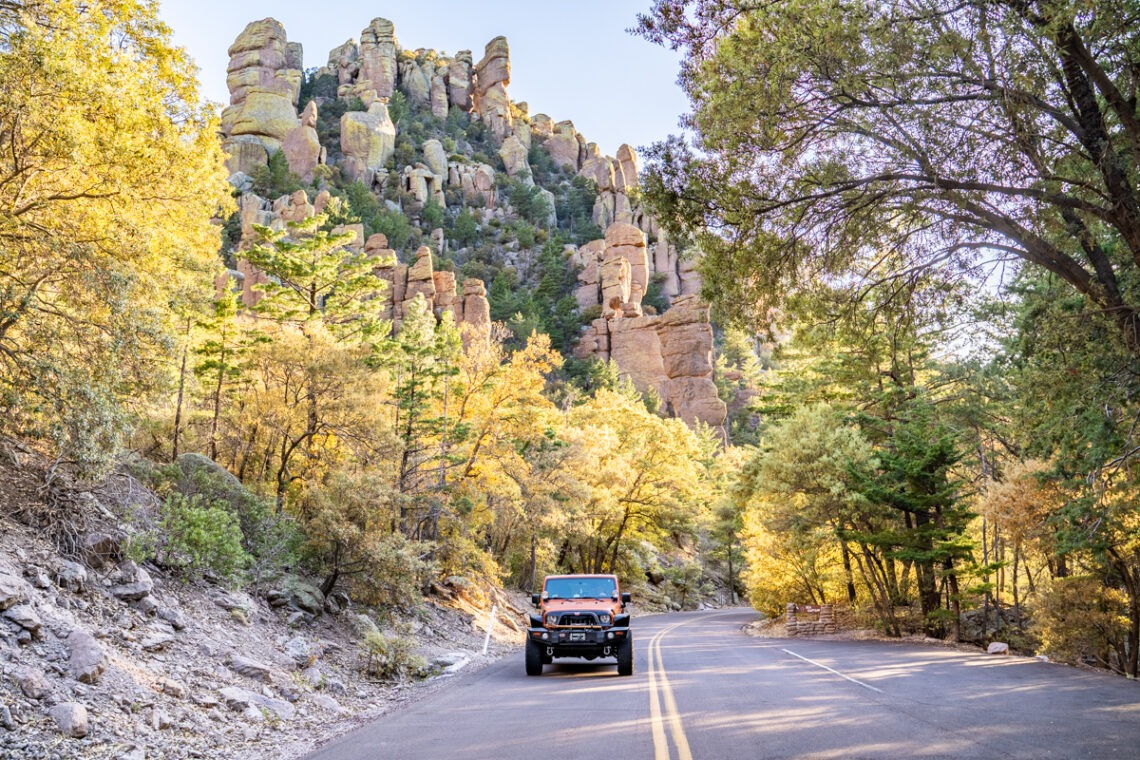
Stretching 12,025 acres in southern Arizona, Chiricahua National Monument is known for impressive pinnacles and balancing rocks. The Apaches called these hoodoos “standing-up” rocks. Some of the most impressive collections of these standing-up rocks can be seen from the 8-mile paved road scenic drive. This scenic drive along Bonita Canyon Road, the only road in Chiricahua National Monument, winds through multiple viewpoints with beautiful views and provides access to 17 miles of day-use hiking trails. In this blog, we will show you all the scenic stops along this road, ranging from the start of the drive to where it ends.
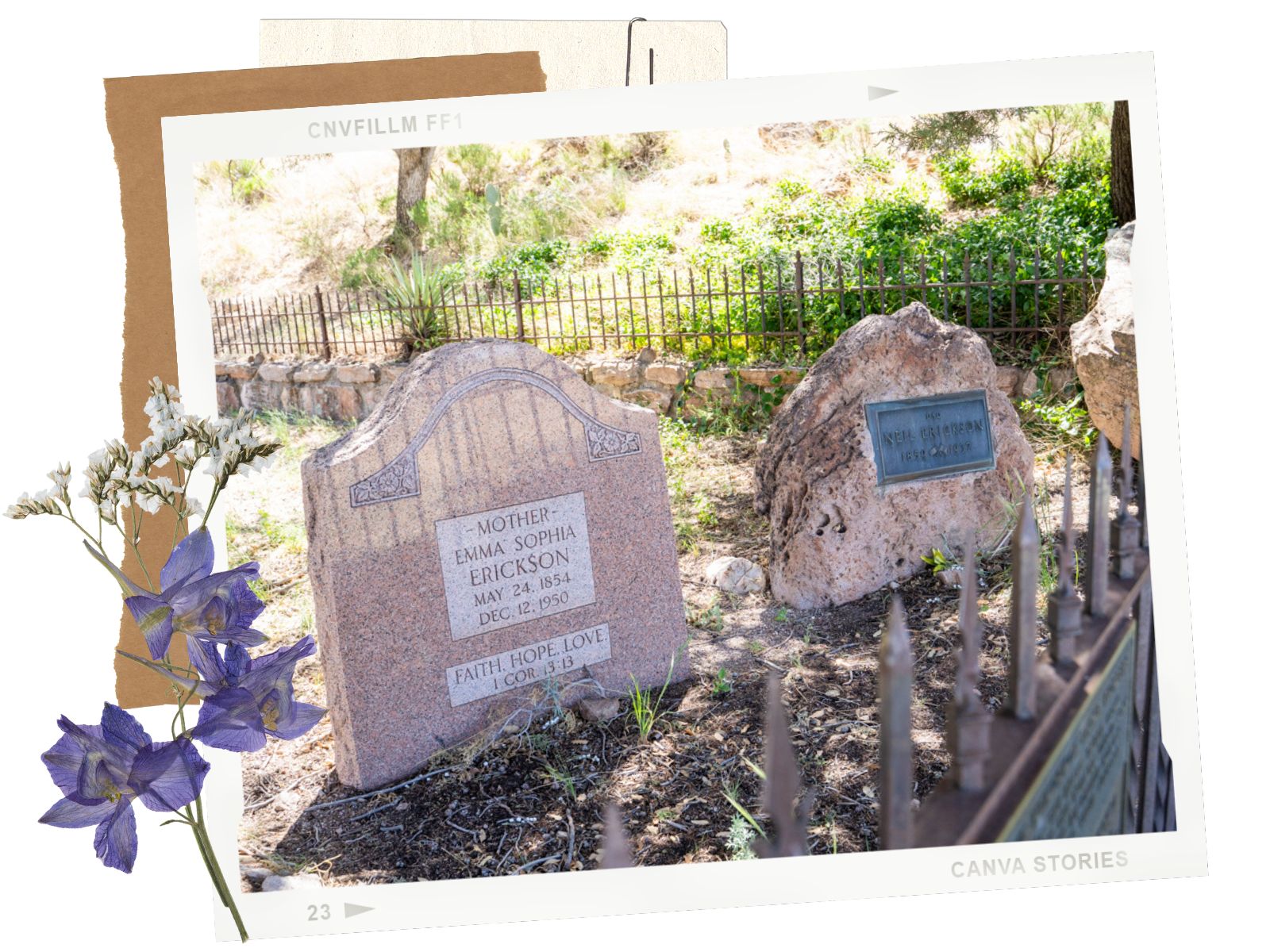
The cemetery is located right after the entrance of the Chiricahua National Monument. This is where the Swedish immigrants Neil, Emma Erickson, and their families are laid to rest. Neil and Emma built their homestead here in 1888. By the 1920s, their daughter, Lillian, and her husband turned the homestead into a guest ranch, where visitors could visit this wonderland of rocks. In 1924, this beautiful area became the Chiricahua National Monument. If you love history, this is an interesting spot to visit the pioneers of Chiricahua.
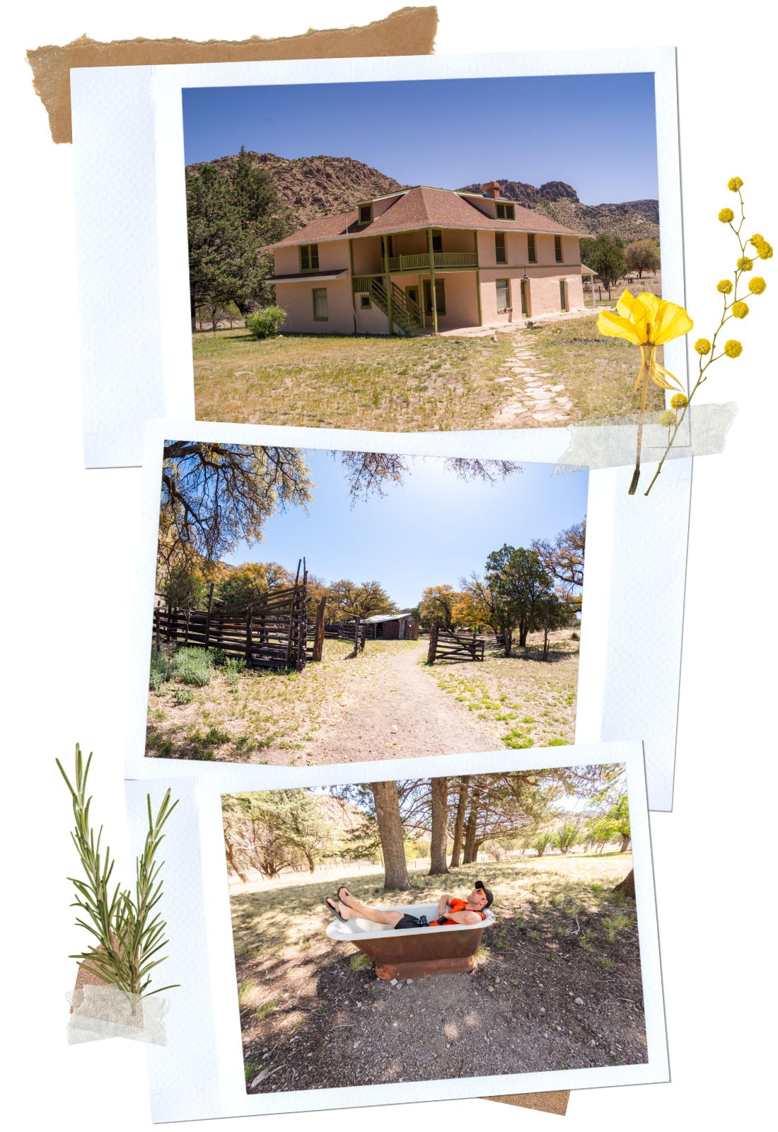
Faraway Ranch
Just down the road from the Erickson Cemetery is the Faraway Ranch, the homestead turned into the guest ranch of the Erickson family. There is a short walk from the parking lot to the ranch. The Faraway Ranch is a really interesting place to visit. It is full of history.
Here, visitors get to wander around the area, checking out old buildings and pieces of equipment. There is a small exhibit that you can go to to learn about the ranch. Usually, the monument offers visiting tours inside the ranch. However, since it is being renovated, no tours are being offered at this time. If you like to hike, there are a couple of easy walking trails starting at the parking lot. The Silver Spur Meadow Trail is about 1.2 miles each way and will take hikers past the Stafford Cabin, to the Campground or the Visitor Center. The Bonita Creek Trail is about 0.5 miles and runs along the creek.
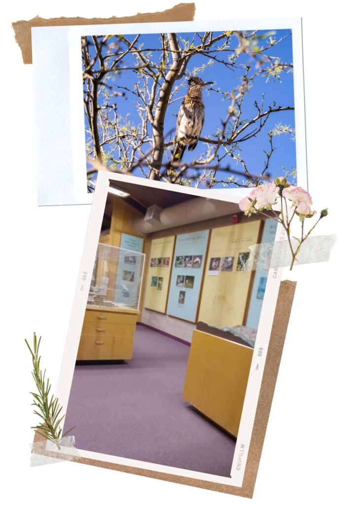
Visitor Center
After the Ranch, the next stop along the scenic drive in Chiricahua NM is the Visitor Center. The Visitor Center has a small exhibit inside where you can learn more about this beautiful Chiricahua National Monument. And if you love birds, there is also a chart where they update daily about different bird sightings. The Visitor Center is also the start of the Lower Rhyolite Canyon Trail. This trail connects to the big network of trails running through Heart of Rocks, Echo Canyon, and more! And if you’re lucky, you can spot deer and coatis hanging out near the Visitor Center. We missed a family of coatis by 30 minutes. Dustin was quite bummed out about it.
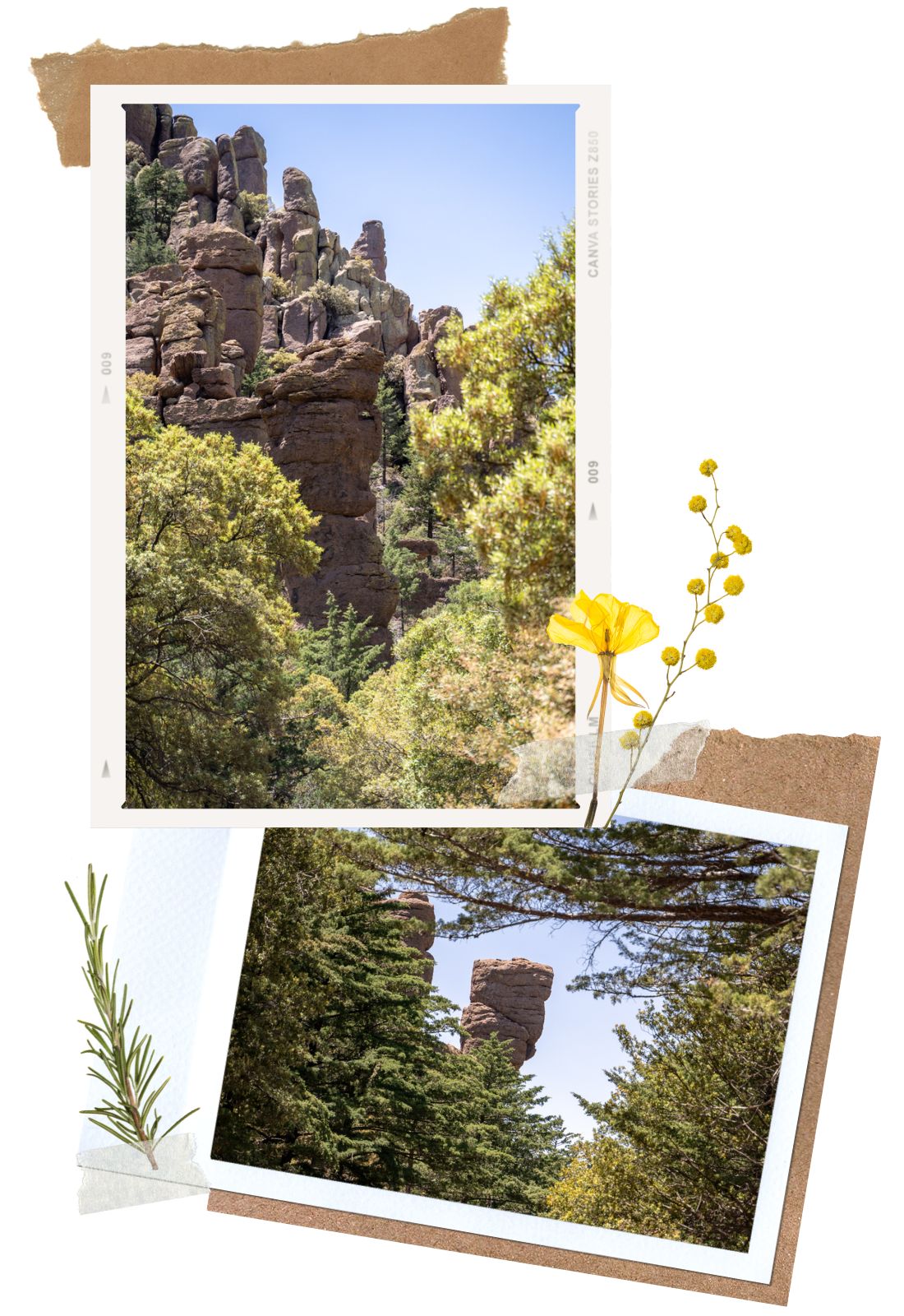
Organ Pipe Formation
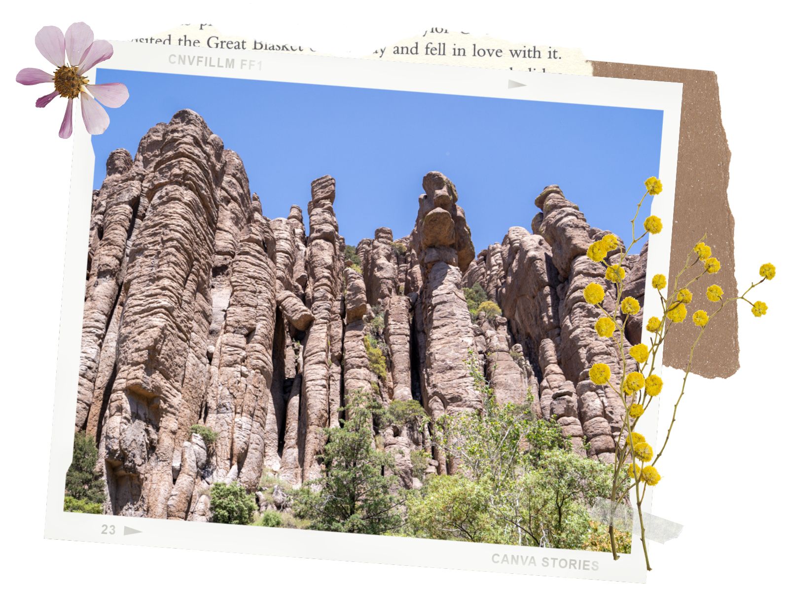
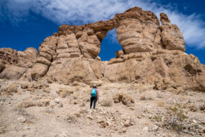
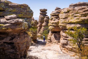
The most impressive geological feature along the scenic drive through Chiricahua National Monument is the Organ Pipe Formation. It’s located on the left-hand side as you leave from the Visitor Center. You won’t miss it. The Organ Pipe formation is a sloping cliff face, weathered into many rocky columns. It resembles a pipe organ, hence the name.
These columns (pipes) are created from layers of volcanic ash called rhyolite. As the ash deposit cooled and contracted, a series of horizontal and vertical cracks called joints, developed. After eons of weathering by ice wedging and water erosion, deep slot-like canyons formed along the major joints. At first, the rocks were angular and block-like. Eventually, these pinnacles were shaped into their current shapes due to wind, chemical weathering, lichen attack, and freezing and thawing during the last thousands of years. It was quite impressive to look upon the Organ Pipe Formation and see the work of Mother Nature.
Sea Captain and China Boy Rock Formations
A bit down the road from the Organ Pipe Formation is a rock formation called Sea Captain. From the pull-out spot, look back toward the Visitor Center. Mr. Sea Captain rock formation blends in with his surroundings so it’s hard to spot him. However, if you look at the line drawing on the sign, you can see him, wearing his captain hat nice and proud! Not too far from Sea Captain is another rock formation called China Boy. There isn’t a sign for this one, but it’s also on the same side (right side) as Sea Captain. We’re not sure why it’s called China Boy as it doesn’t resemble anything, but you can see for yourself.
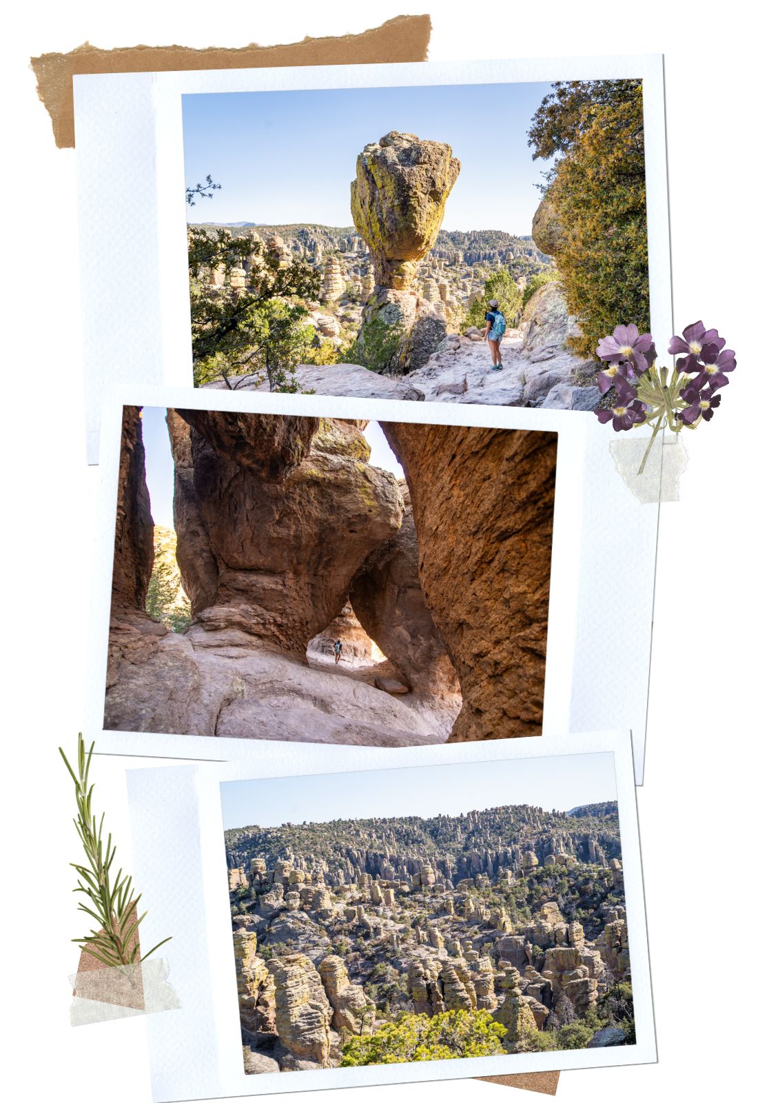
Echo Canyon
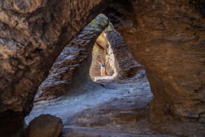
After leaving China Boy and Sea Captain, the road climbs up a hill where you can see Cochise Mountain to the left. The next stop here is Echo Canyon. Echo Canyon is the start of multiple trails inside Chiricahua National Monument including Inspiration Point, Heart of Rocks, Echo Canyon Grottoes, and our favorite, the Big Loop. If you’re looking for an easy yet impressive hike, check out Echo Canyon Grottoes. If you’re up for a harder hike, the Big Loop is a must!
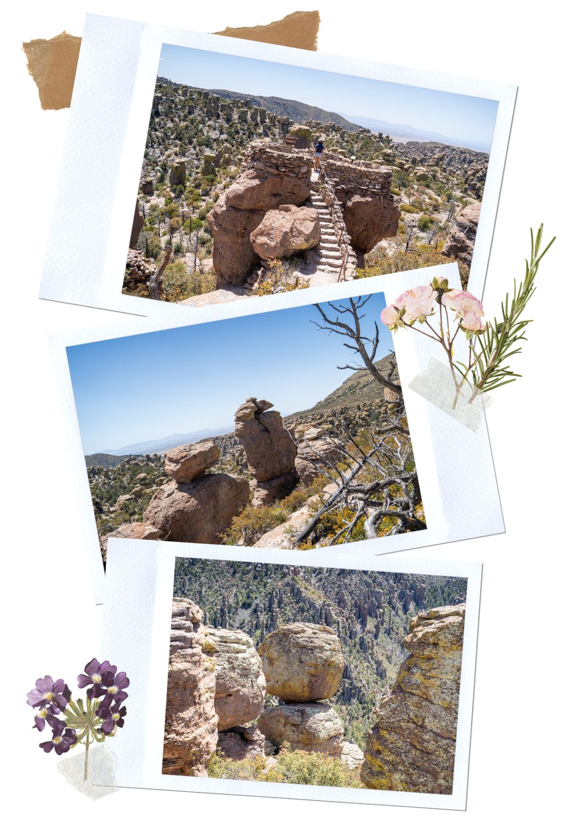
Massai Point Overlook and Exhibits
Massai Point Overlook is the last stop on this scenic drive through Chiricahua National Monument. It is also where Bonita Canyon Road ends. This overlook offers dramatic views of the rock formations. If you just want a casual walk, take the half-mile nature trail to an exhibit building where you can learn about the natural history of the park. The first section of this trail is paved and wheelchair accessible.
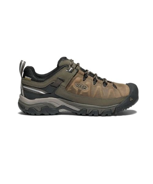
If you’re up from some hiking, there are trails here that connect to the bigger network of trails in the park. Most of the beautiful rock formations in Chiricahua National Monument can only be seen if you hike in. However, Maasai Point Overlook is the only place in the monument where you can immerse yourself in between the rocks without much effort. If you decide to explore the rugged paths, make sure to wear good shoes and watch your steps. The trails can be slippery and rocky.
Happy Adventuring. Don’t forget to check out the related posts below for more inspiration on your upcoming adventures. While you’re at it, go follow us on Instagram and subscribe to our Youtube channel! We’ll love you forever!
These are the gear that we personally use and find them helpful for this particular adventure. Don’t forget to check out our Recommended Gear section as well.
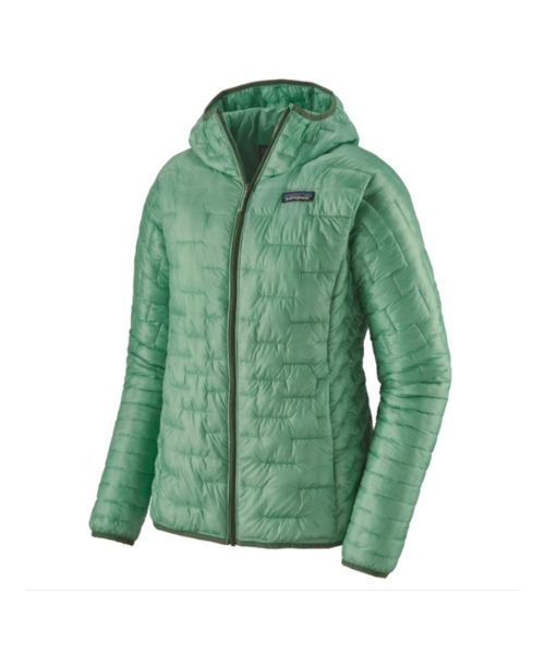
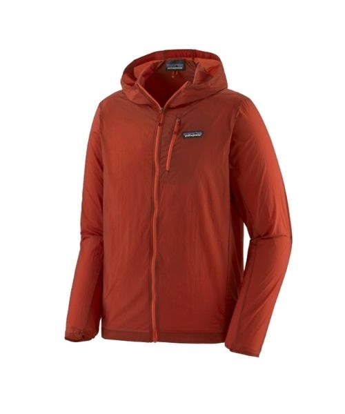
Sedona can get very cold in the winters and springs. We love our packable Patagonia Puff Jackets! You can get Vy’s version here, and Dustin’s version here.