
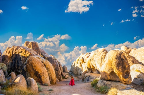
When we were renting our cross-country skiing equipment in Bryce Canyon, Lynette, the staff at the rental counter told us that one of her favorite hiking trails is the Panorama Loop Trail at Kodachrome Basin State Park in Utah. Knowing that we were going to visit the park the next day, she insisted that we give that trail a try. With that glowing endorsement, we decided to hike the Panorama Loop Trail after our favorite Angels Palace Trail. We could see why Lynette loves this trail. It is well-mark, has multiple trail options so you can pretty much choose your own adventures and it takes you to many interesting and fun stops along the way. Keep in mind, this is a mixed-use trail so you might run into bikers and horses along the way.
Note: Please make sure to respect this beautiful place and the surrounding areas. Always practice LEAVE NO TRACE. This means no loud music, no graffiti, no taking artifacts or fossilized items, and pack out what you pack in! Please help us protect this place for generations to come!
Stats
Where
Panorama Loop Trail trailhead:
37.522537, -111.991992
Parking
Paved parking lot across from the trailhead.
Restroom
There are restrooms at the Oasis group campground and Basin campground.
Fee
There is a fee to enter the Kodachrome Basin State Park. For day-use, it is $10 per vehicle (max. 8 people per vehicle). This might change.
Important Things
Kodachrome Basin State Park opens from 6am – 10pm.
Distance
Short loop: 4.3 miles R.T
Full loop: 5.8 mi R.T
Elevation Gain
392 ft
Level
Moderate.
Time:
2-6 hours
Pet-friendly
You can bring your pet, but they have to be on leashed.
Ideal Time
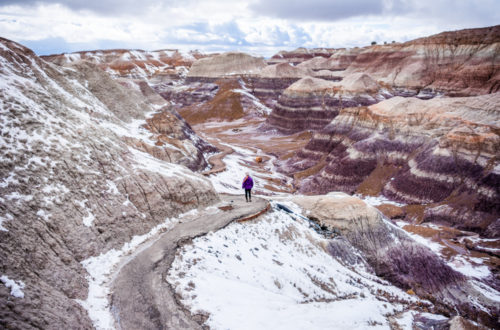
Springs and Falls are the best time to visit. Winter can be very beautiful but the snow might make the condition challenging. Go early in the morning. In the winter, the snow melts as the sun rises so the trail becomes very muddy.
Weather
Video
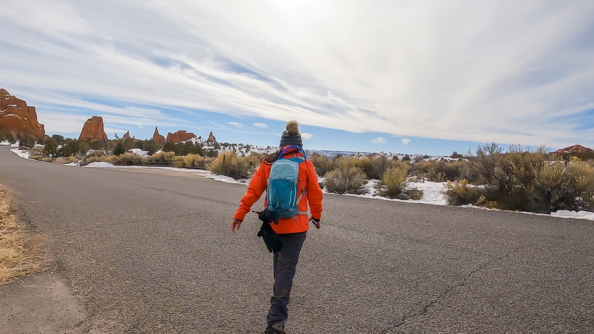
Getting There
The Panorama Loop Trail is located inside the Kodachrome Basin State Park, located near Cannonville, UT. You should be able to map your way there easily. Once you get to the visitor center, it is about 0.6 miles to the trailhead for Panorama Loop Trail. The trailhead is located on the left-hand side while the parking lot is on the right-hand side. The Panorama Loop Trail shares the same parking area as the Grand Parade Trail. There are signs on the road marking the trails.
The Adventure
The Start of the Trail
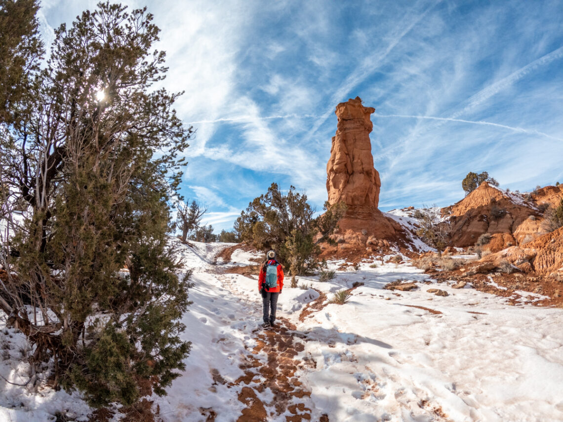
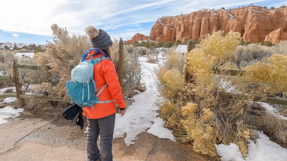
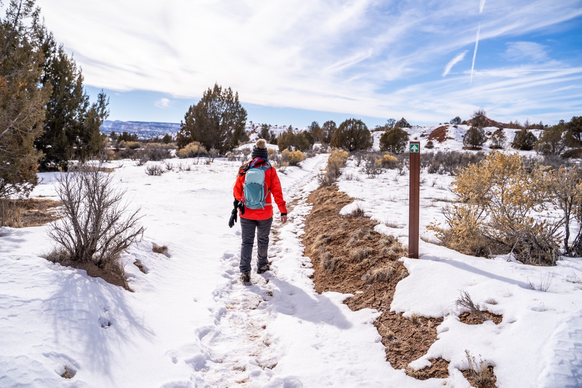
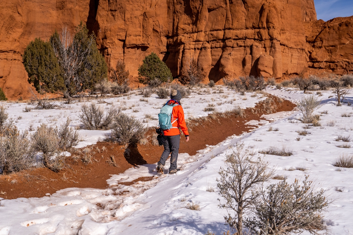
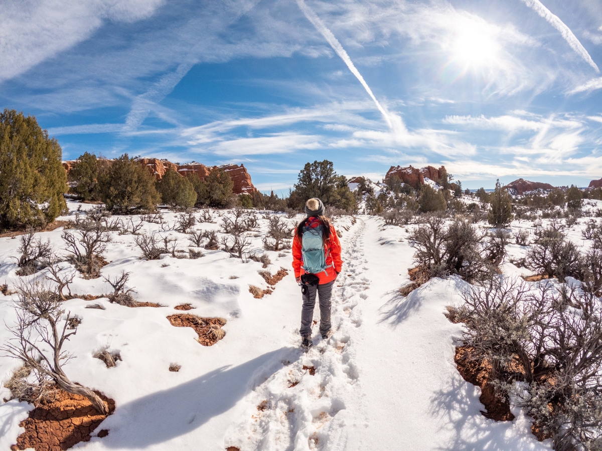
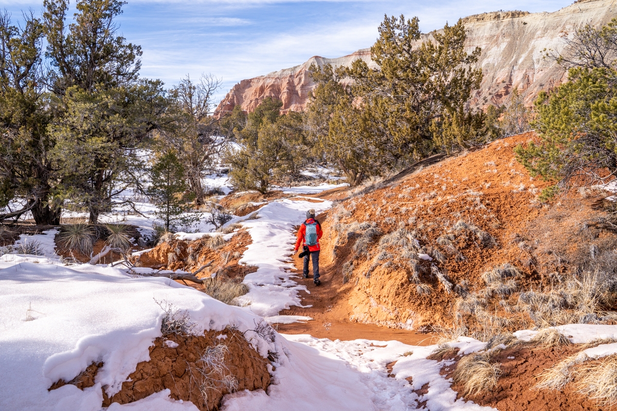
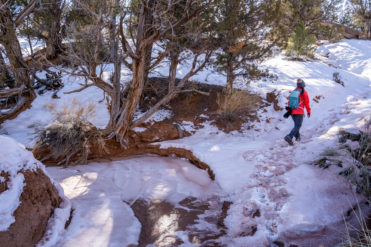
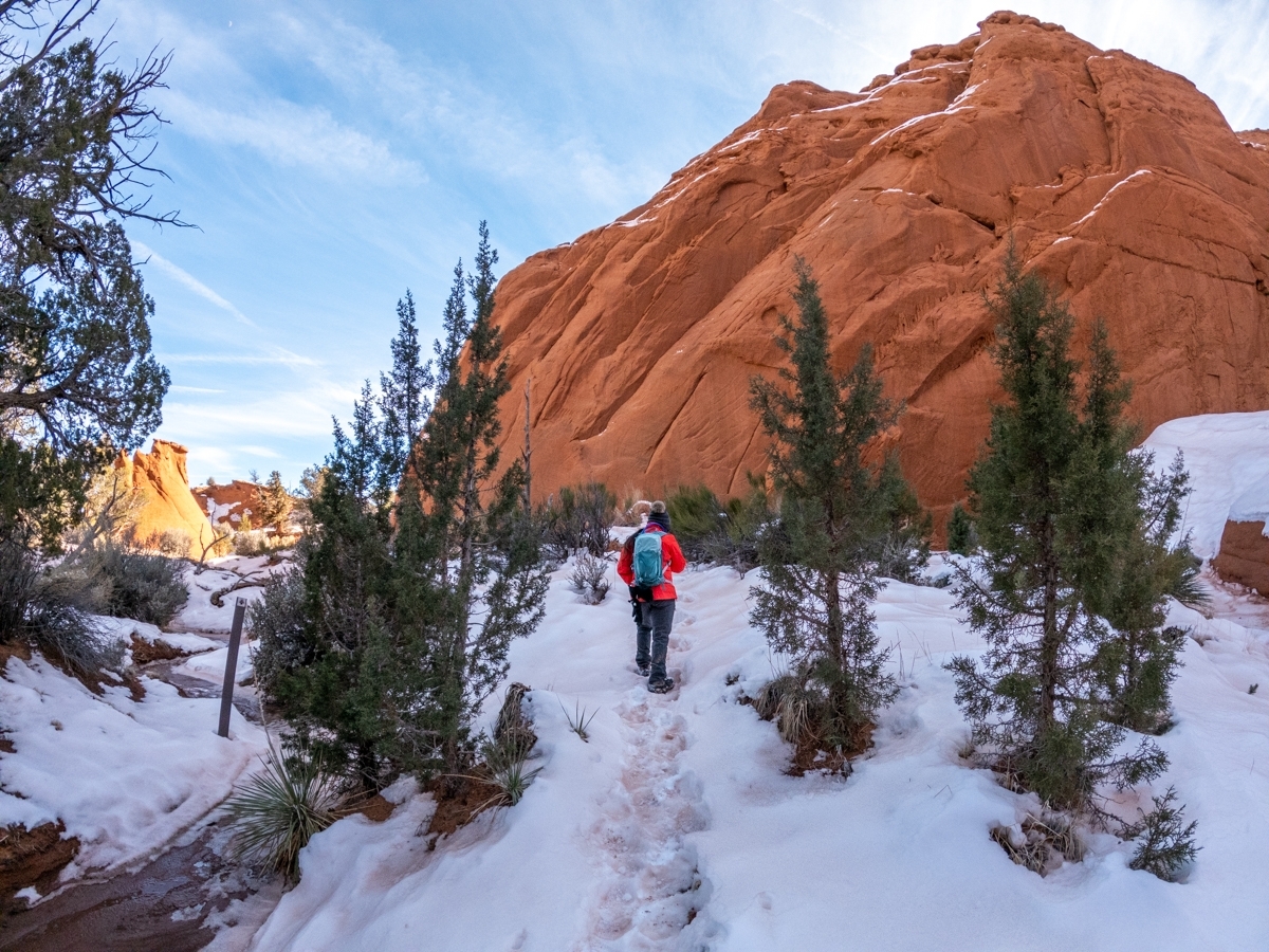
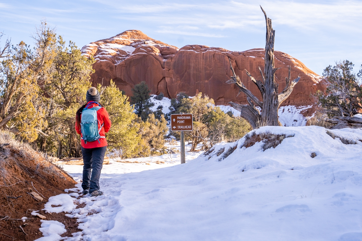
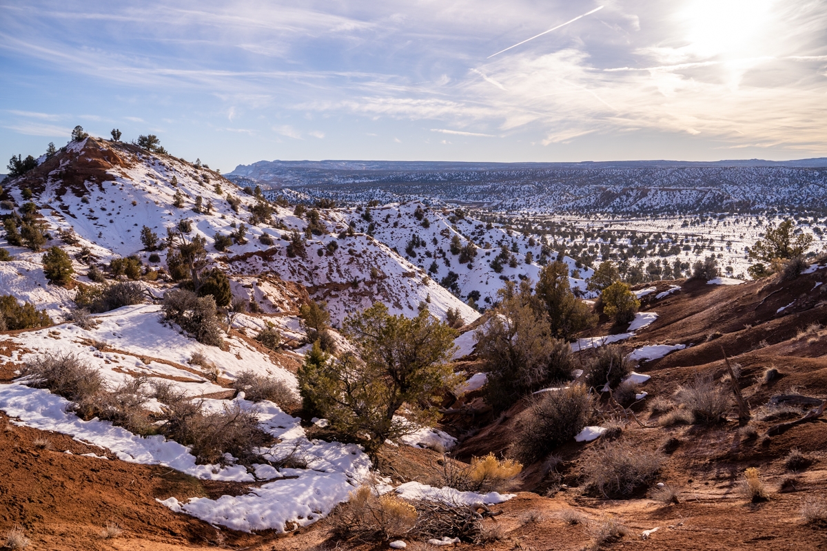
After finishing hiking the beautiful Angels Palace Trail, we headed toward the parking lot for the Panorama Trail. Once parked, both of us crossed over the road to start our hike. Because we hiked this trail later in the day in the winter, it was very muddy. The snow melted as the sun came up so the red clay trail was all soaked in. It made the hike a lot more difficult as we kept sinking in the heavy mud.
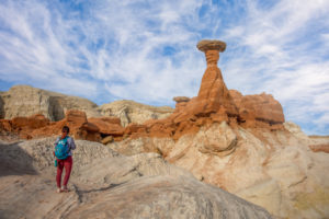
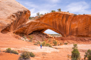
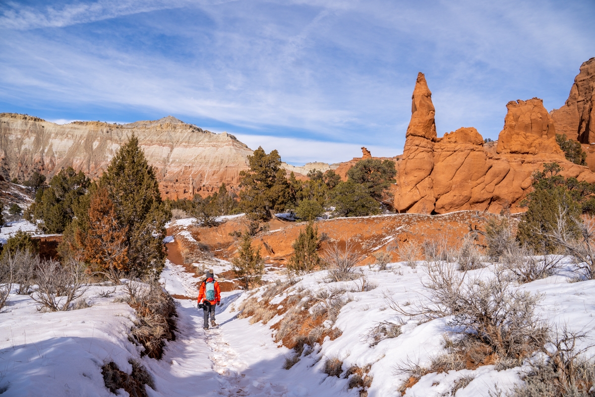
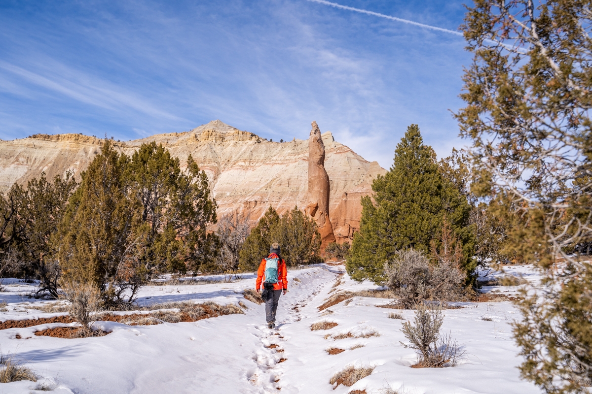
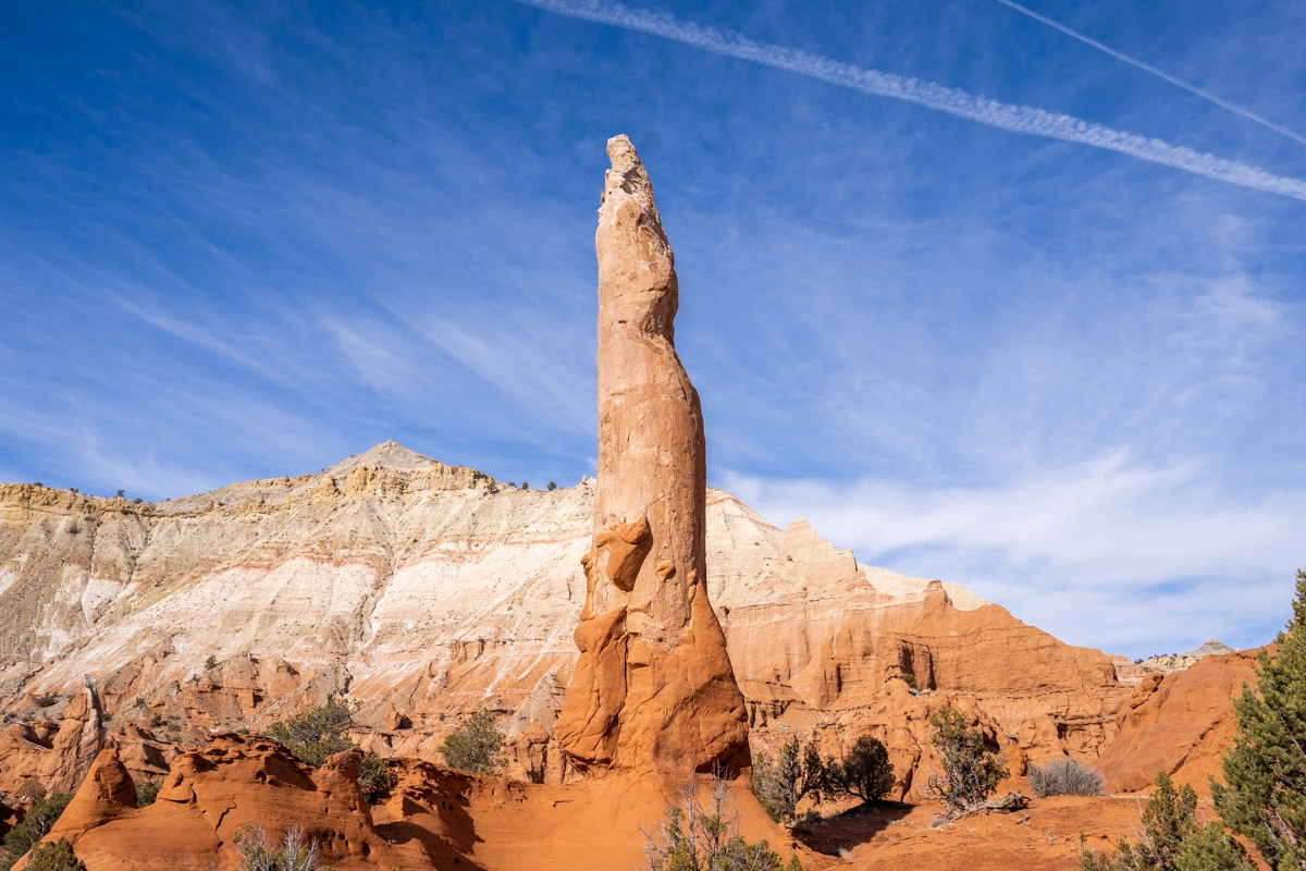
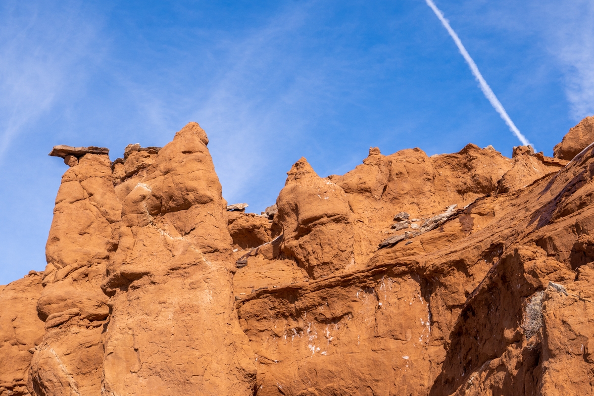
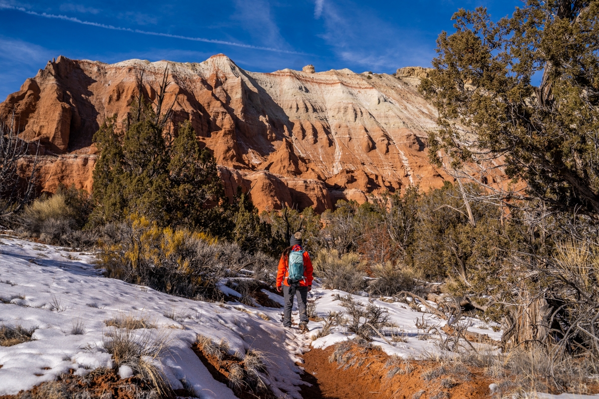
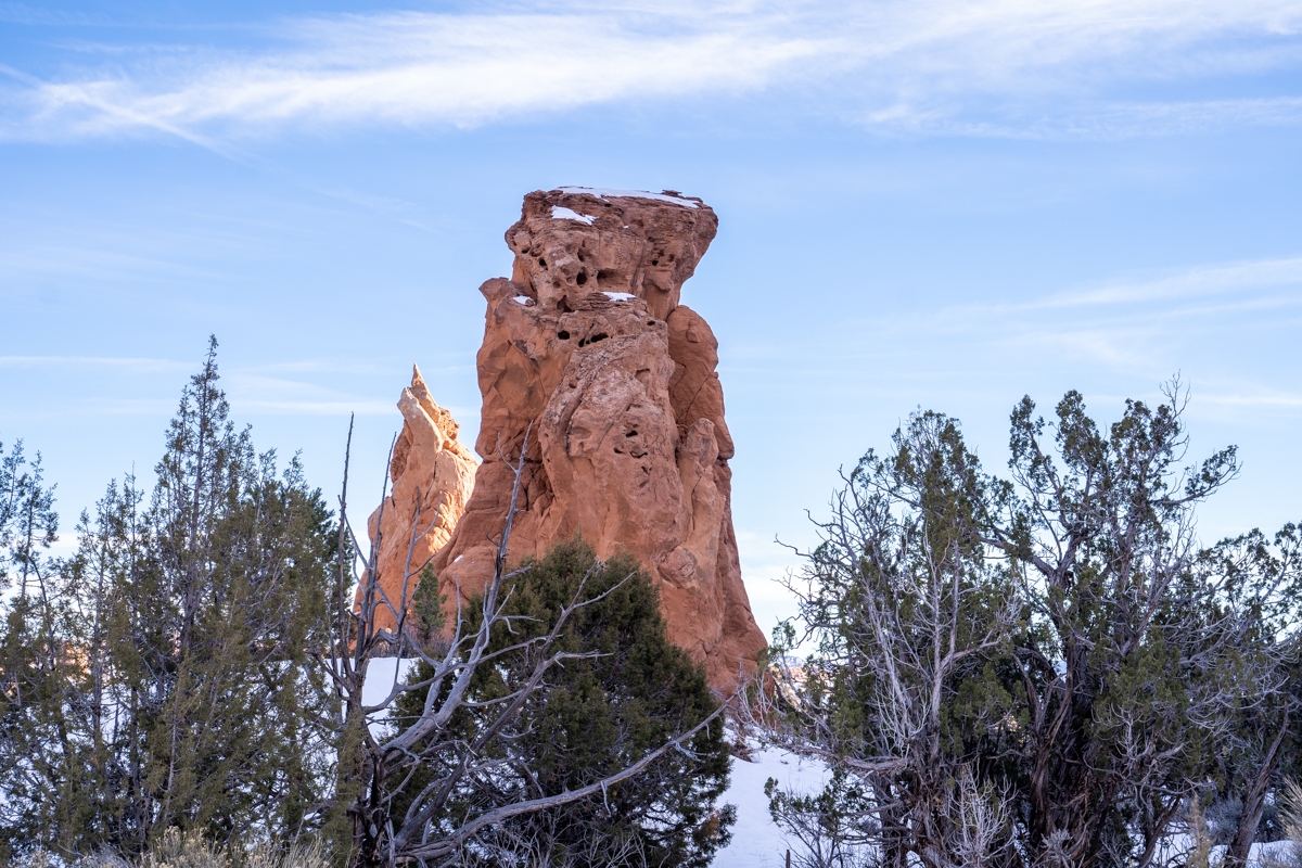
The Panorama Trail crosses over a small wash and then passes through a sandy bench. It then heads directly toward a sandstone bluff. There are many exciting spires and rock formations that you could see along the trail as well. Soon after, you’ll pass through a gate. There is a big spire located immediately right after this gate. This spire is known as the Fred Flintstone Spire. Once we leave Fred Flinstone, the trail starts to climb up a small hill.
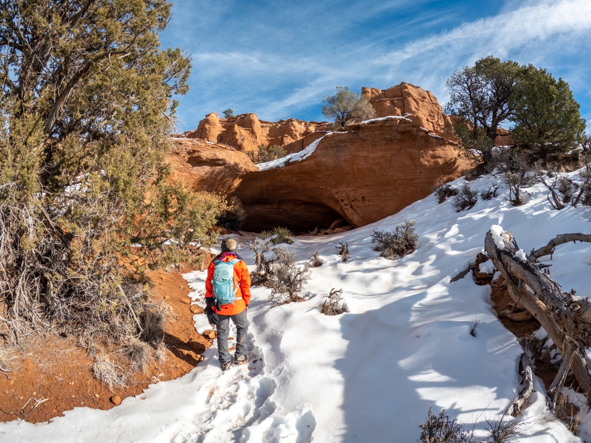
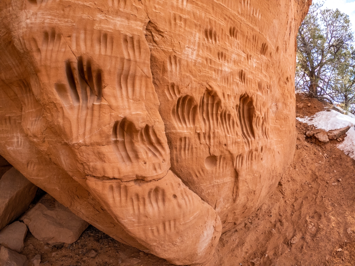
Indian Cave
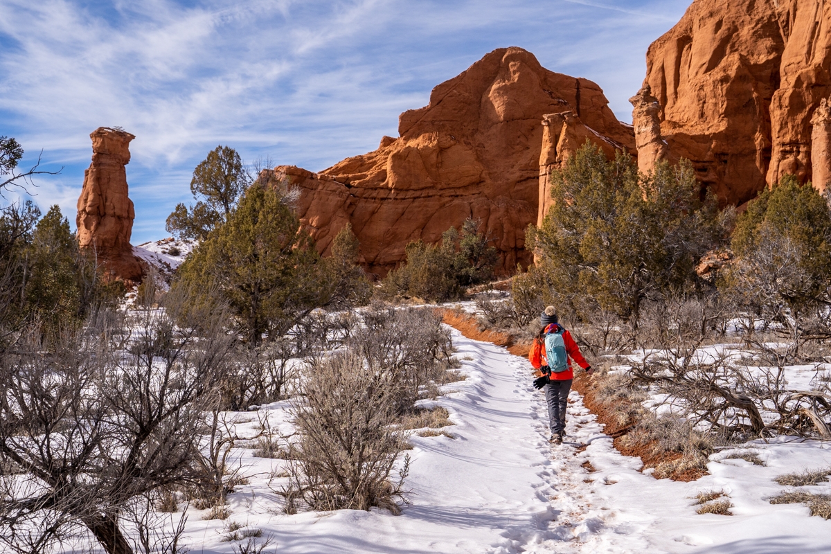
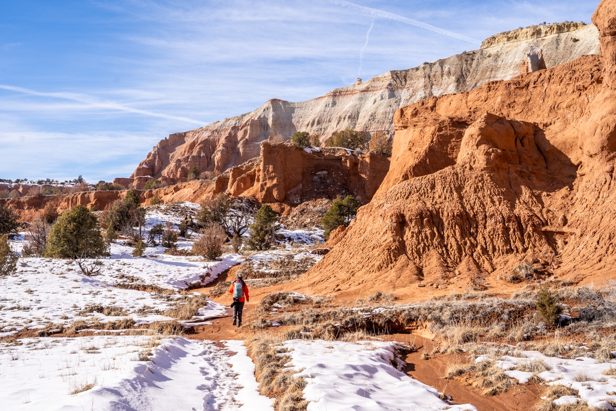
After about 0.3 miles, we came to a fork in the road. This is a loop so going in either direction is fine. We decided to go right first (counter-clockwise) because it is closer to most of the main stops (Indian Cave, Ballerina Spire, and Hat Shop). We were surprised to see how well-marked the Panorama Trail is. There are not only navigational arrows but signages for labeling the direction as well. The trail meanders along the base of the sandstone cliffs and soon takes us to our first stop, the Indian Cave.
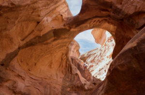
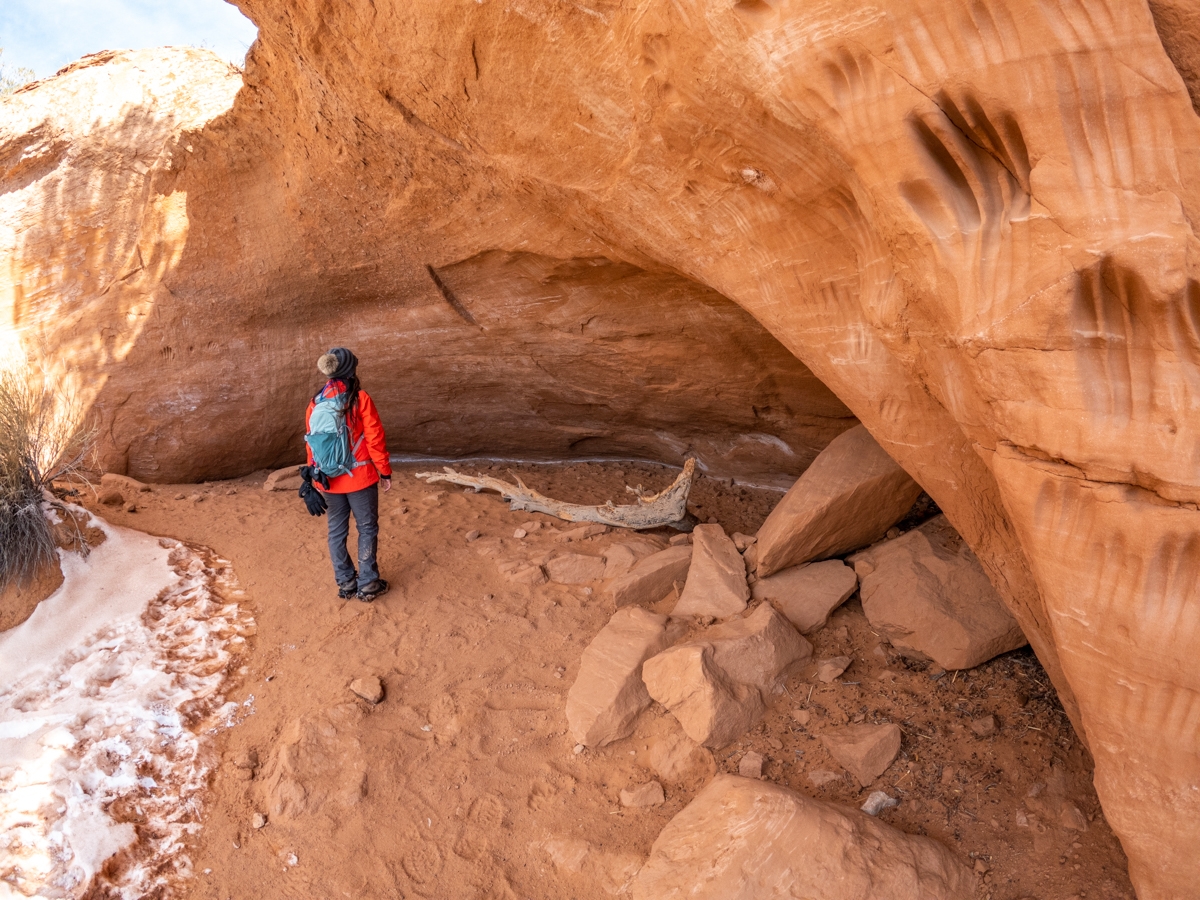
The Indian Cave is just a small cave. However, it was interesting because there are a bunch of what look like handprint impressions worn into the rock on the side of the cave as well as on its ceiling. They are of different sizes and thicknesses. Some of our research suggests that it was created by the Paleo-Indians. However, it is not sure if that is accurate or for what reason. These handprints remain as one of Kodachrome’s many mysteries.
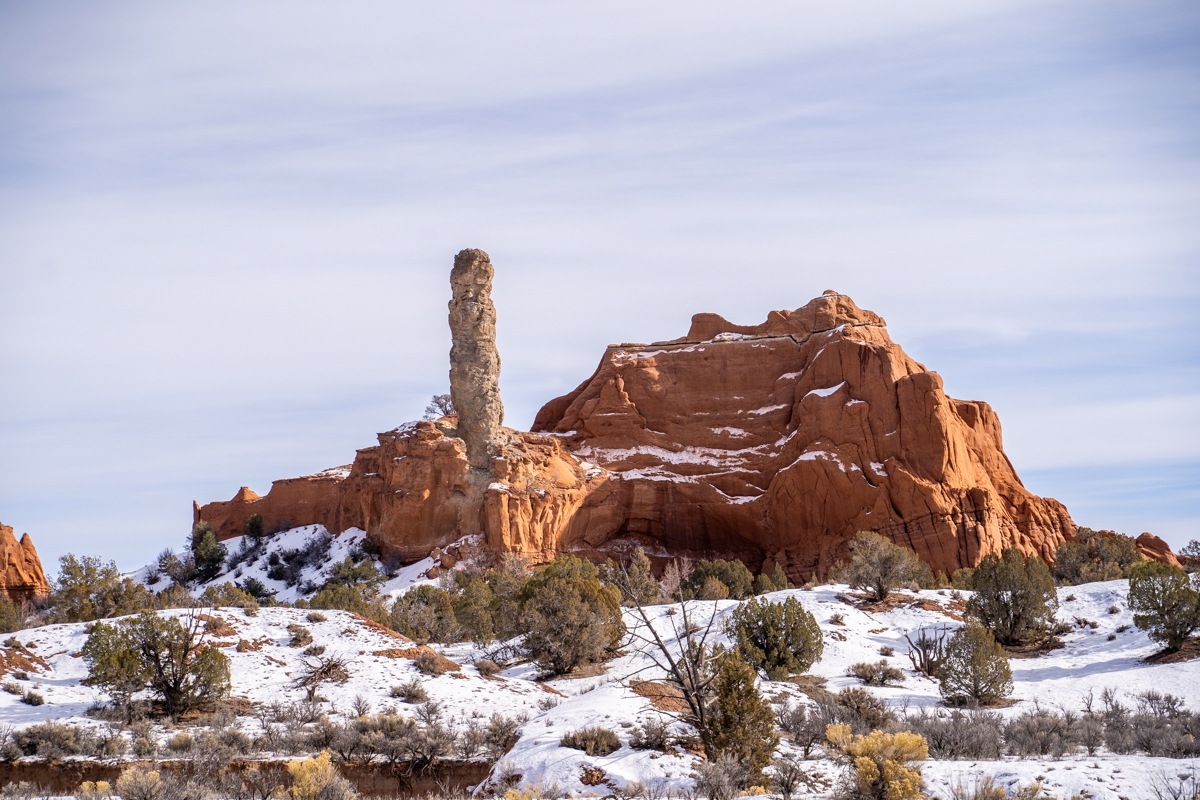
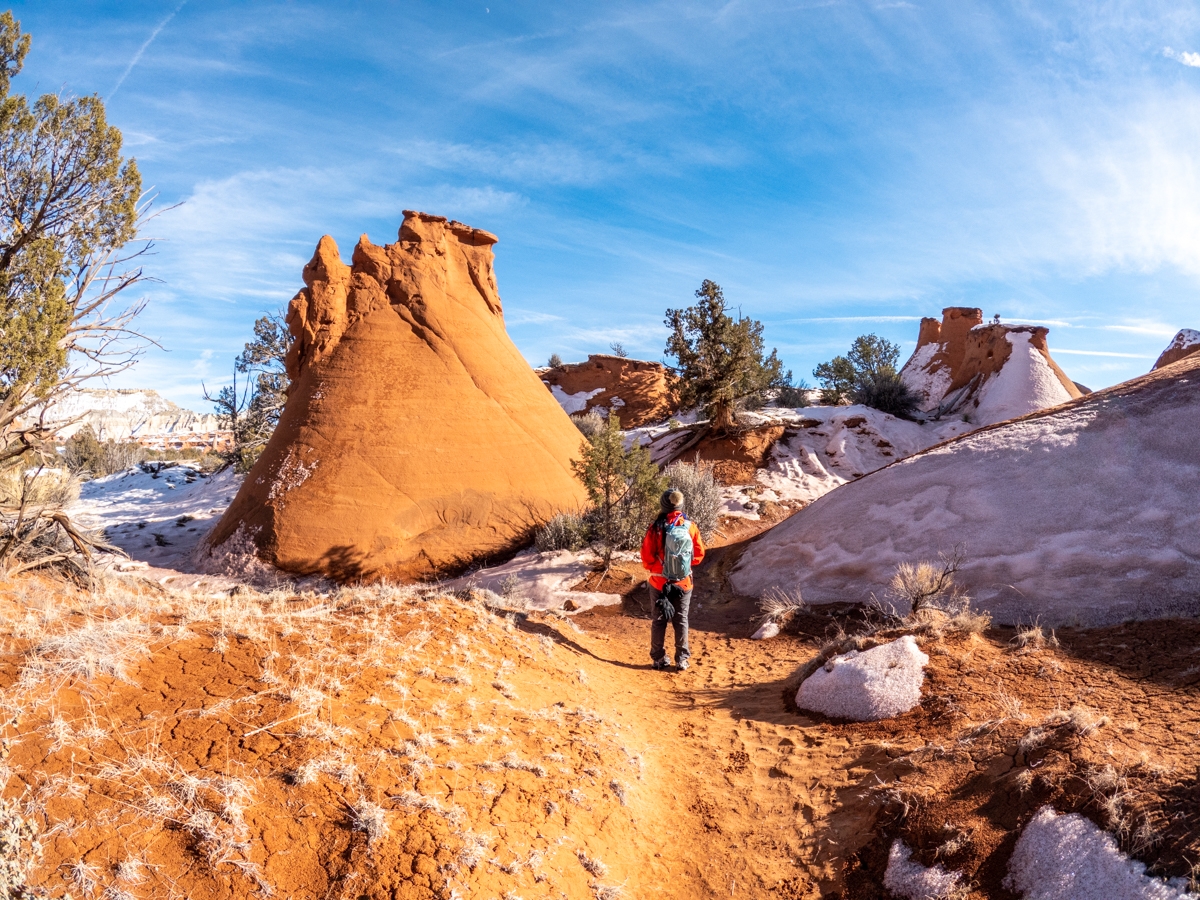
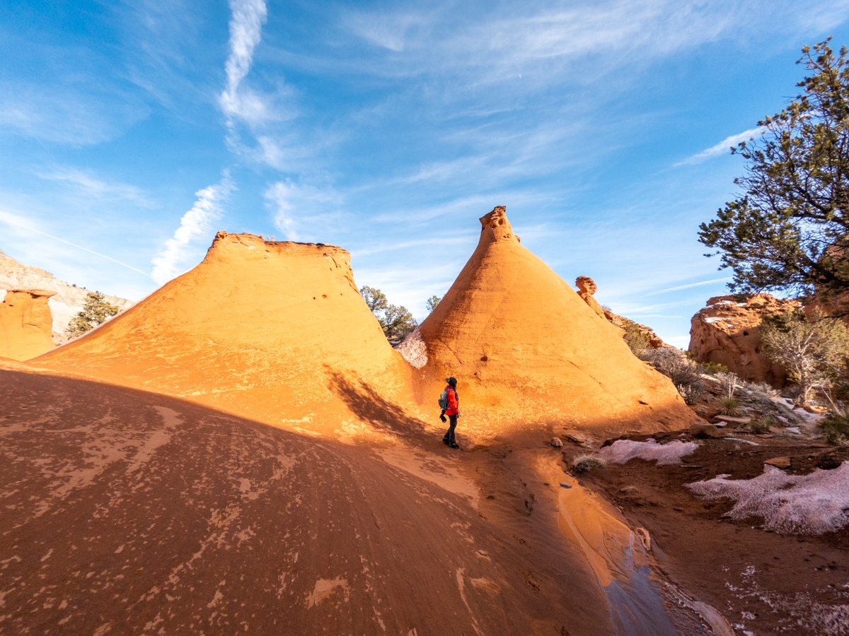
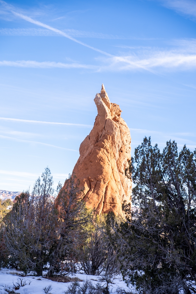
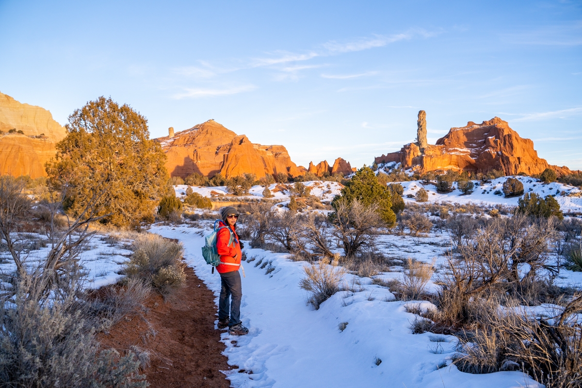
Ballerina Spire and the Hat Shop
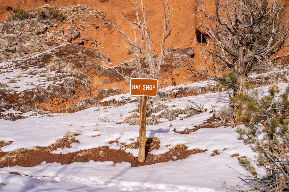
About 0.2 miles from the Indian Cave, we arrived at the Ballerina Spire. This spire is one of the more dramatic spires in the Kodachrome Basin State Park. It reminds us of a ballerina’s foot when it’s en pointe. After leaving the Ballerina Spire, we followed the trail to cross over a drainage. Then, we came to our third stop, the Hat Shop. Apparently, it was named for the number of small sandstone spires topped by erosion-resistant sandstone slabs. It looks like their spires are wearing a hat. Unfortunately, most of these “hats” had fallen off so it didn’t look as impressive.
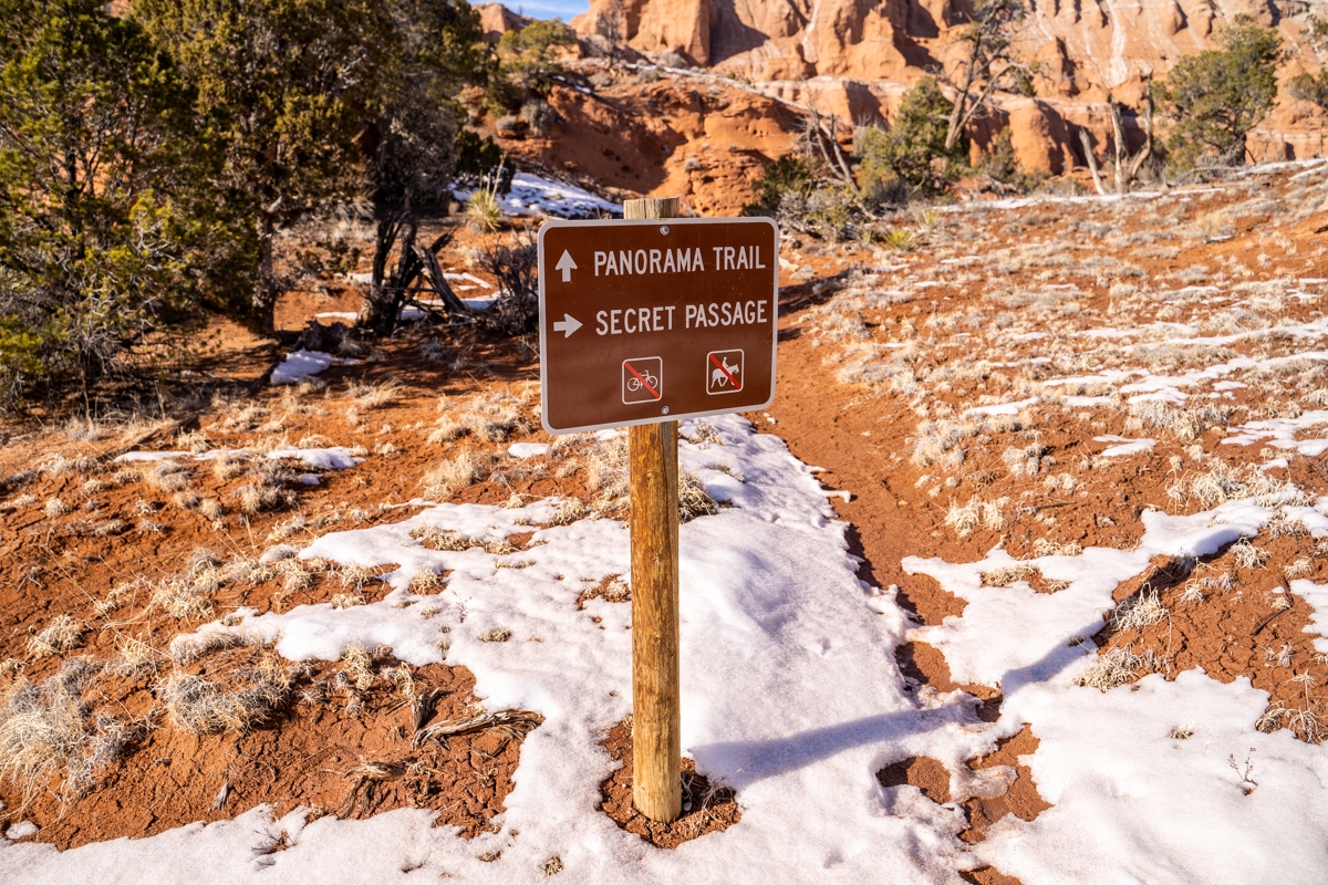
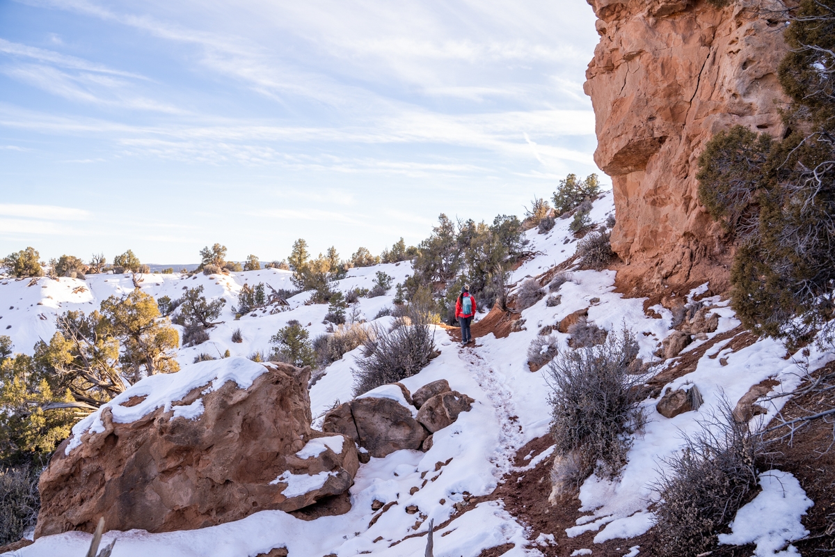
Secret Passage
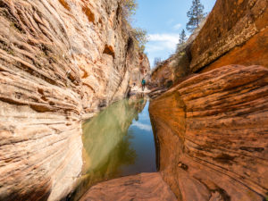
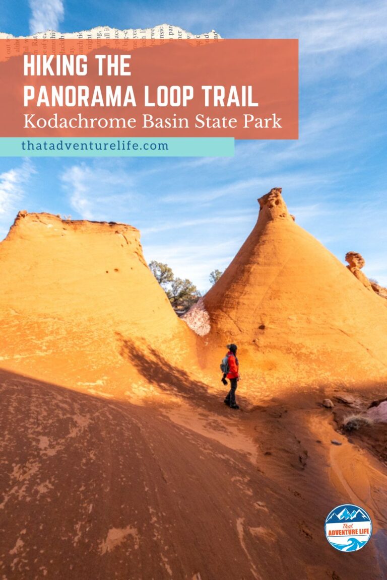
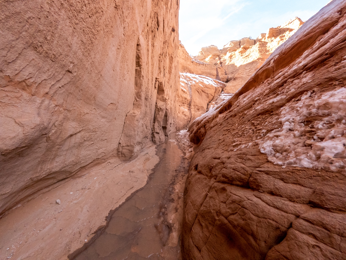
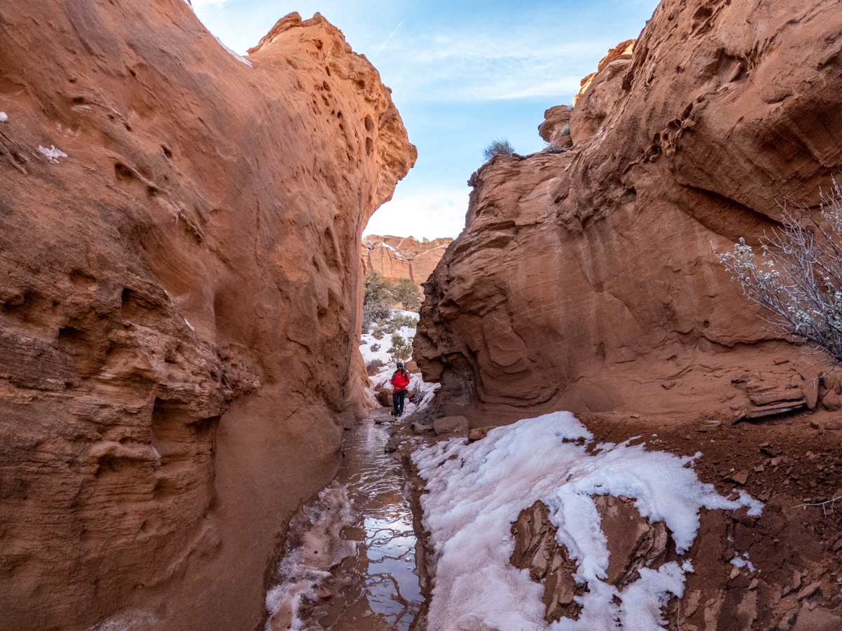
After leaving the Hat Shop, the trail follows along the base of the butte and then crosses over a few washes. It also passed by a short, about 7ft high spire. At 1.6 miles, we came to the intersection for a short detour to the Secret Passage Loop. This detour is very short, only about 0.3 miles, and then connects back to the main trail. This loop trail for Secret Passage curves toward the canyon wall and then crosses over a really interesting slickrock area with big rock formations that resemble an upside-down funnel. After the slickrock area, the trail also took us to a short slot canyon before joining back up with the main trail. Once the Secret Passage Loop meets up with the main Panorama Loop Trail, we turned right to keep going.
Going to Panorama Point
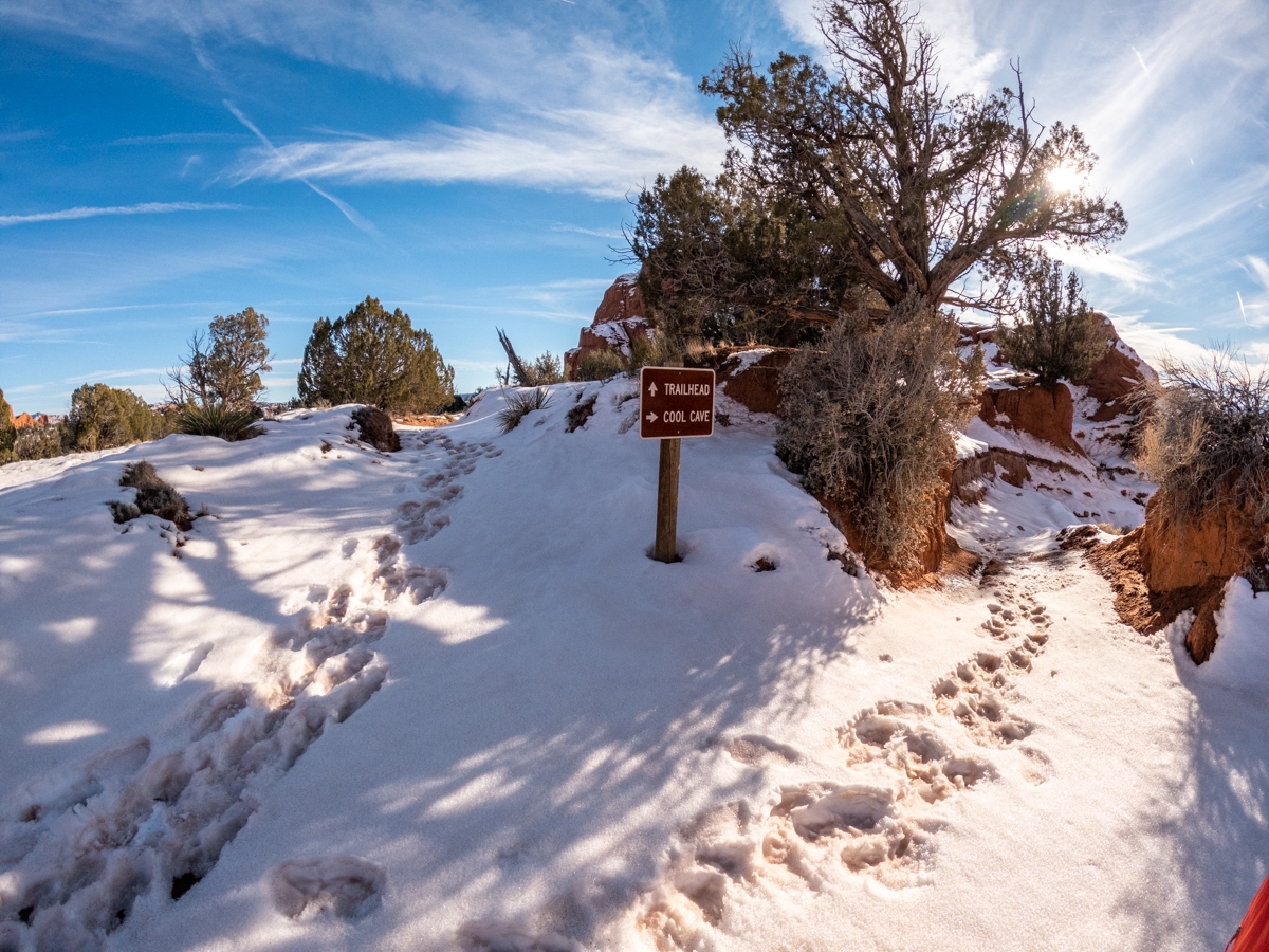
About a few hundred yards after the joining of the two trails, we came upon the junction to either make a shortcut toward the Panorama Point or continue to the Cool Cave. If you go right to go to Cool Cave, it is an additional 2.3 miles. Because the trail was full of mud and snow, we took a lot longer than we thought. Also, with how short the winter days are, we only have about 3 hours of daylight left to hike this trail. Since neither of us preferred the freezing temperature after the sun went down, we decided to skip Cool Cave and go through the shortcut to Panorama Point instead.
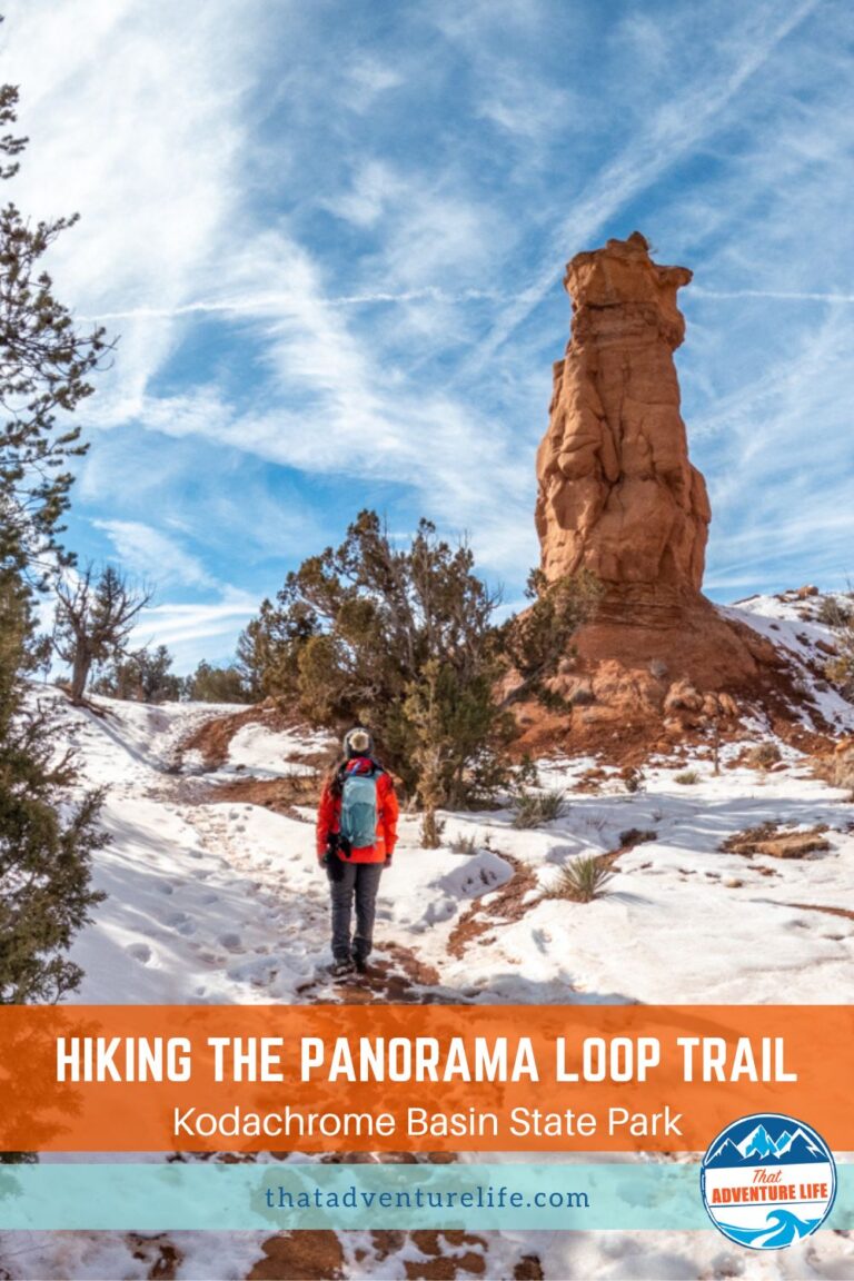
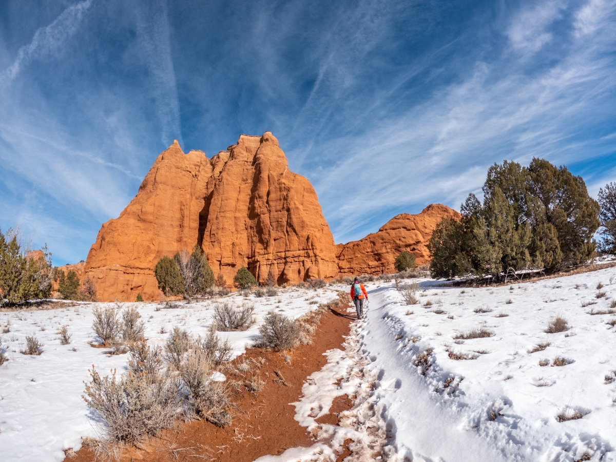
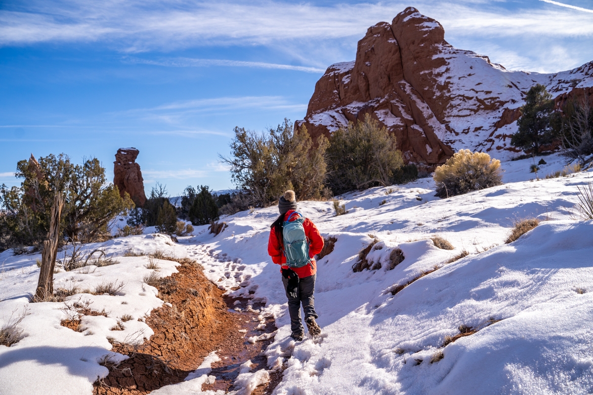
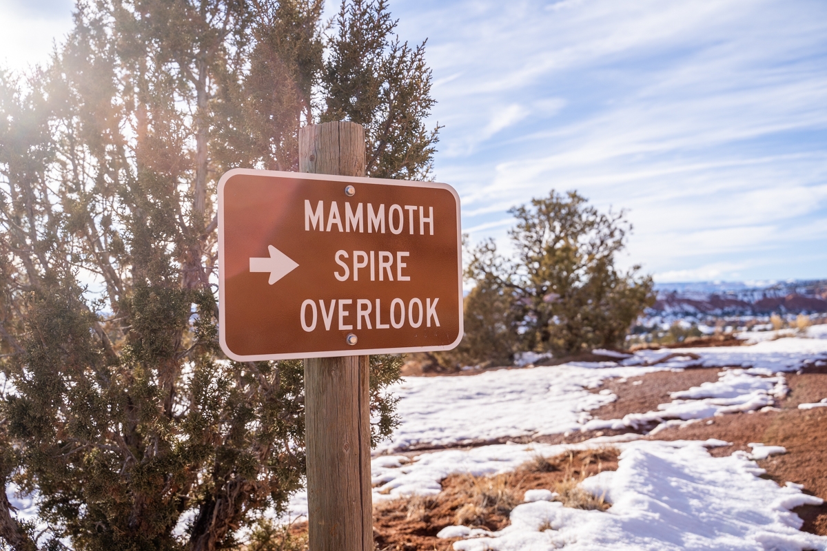
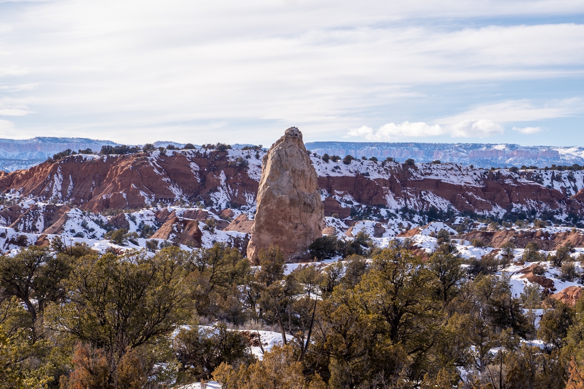
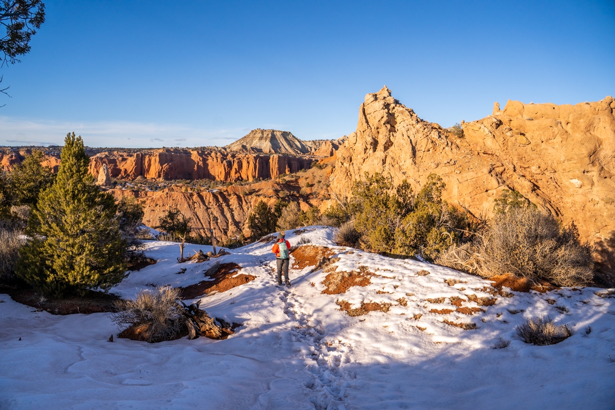
Once we made the left at the junction, we followed the trail across an open bench. This area probably would be sandy in the summer, but it was covered in thick snow. Along the way, we came across a few more interesting spires, one of which kind of looked like a poodle. After 0.3 miles from the Cool Cave junction, we came to the overlook for the Mammoth Spire. This Mammoth Spire is the largest spire in the park.
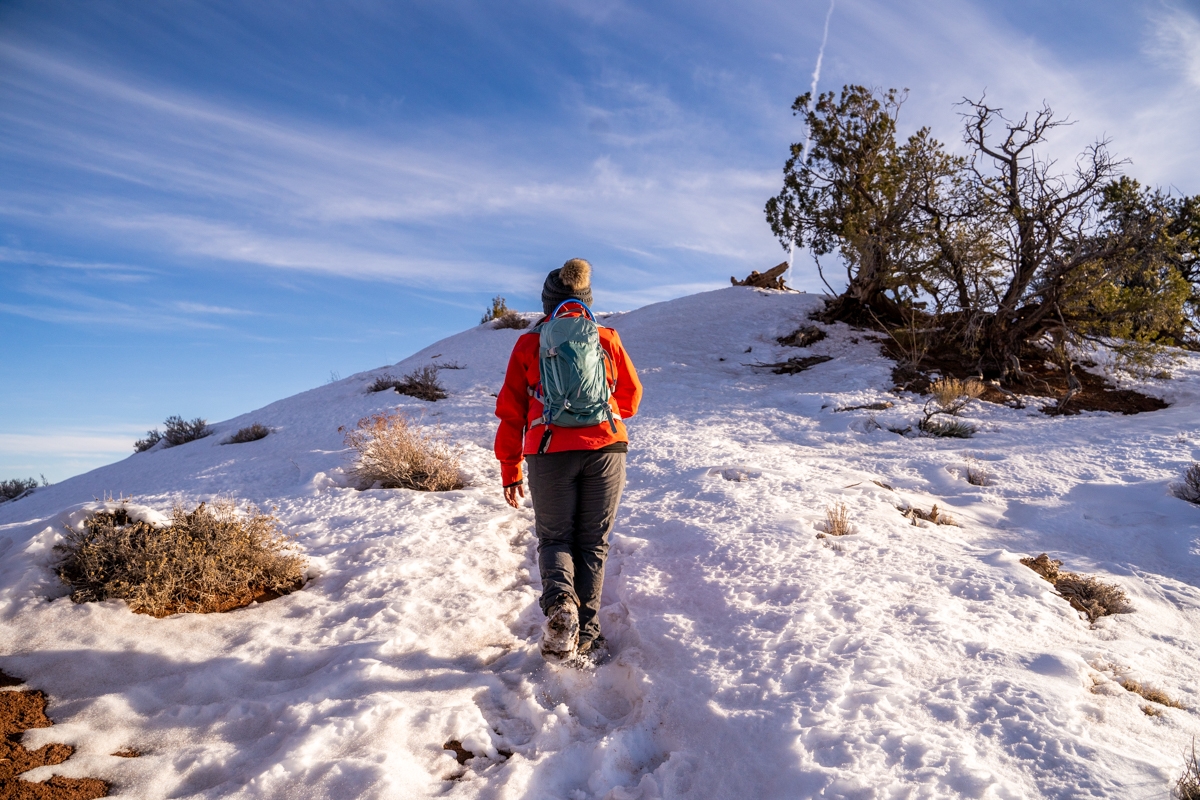
Climbing Up to Panorama Point
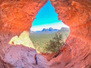
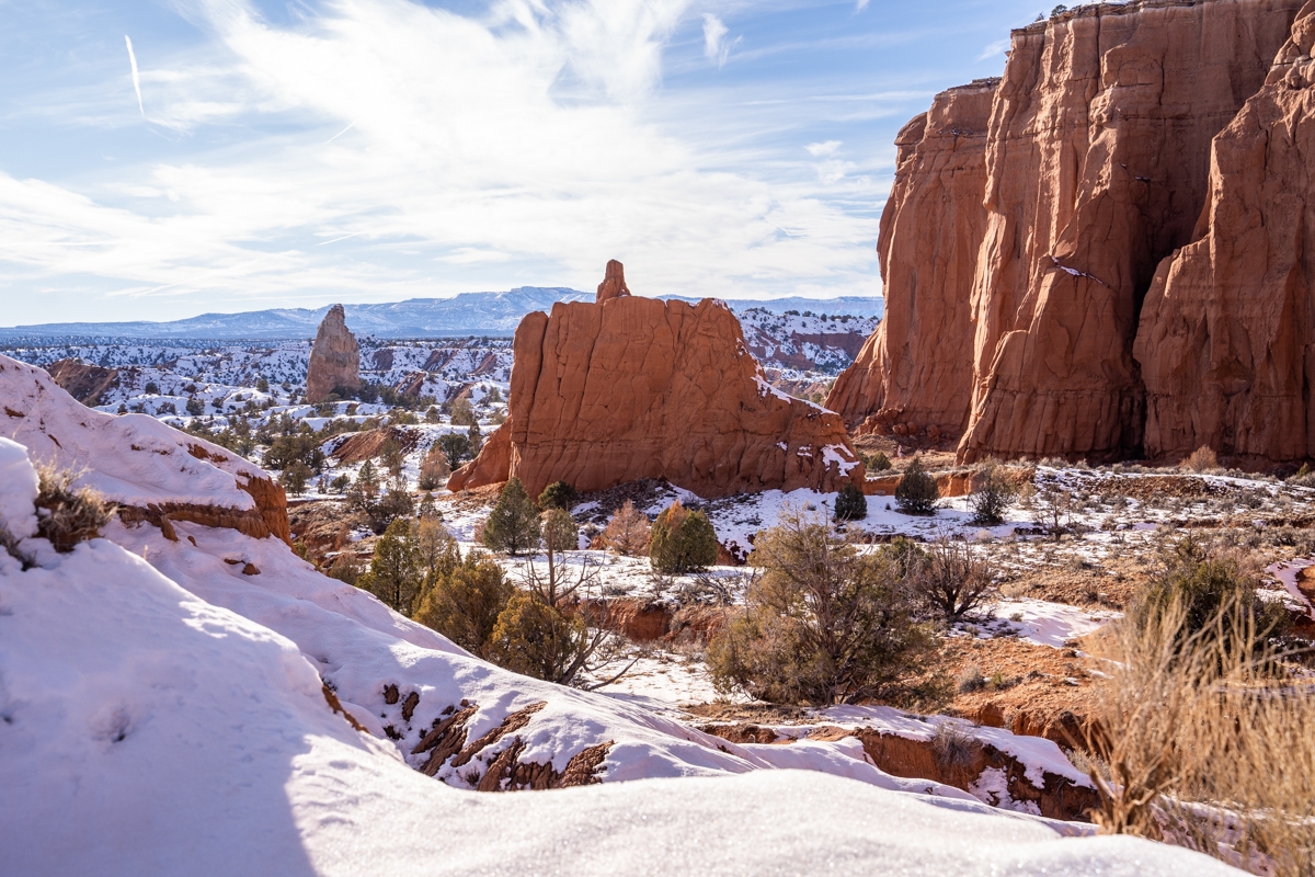
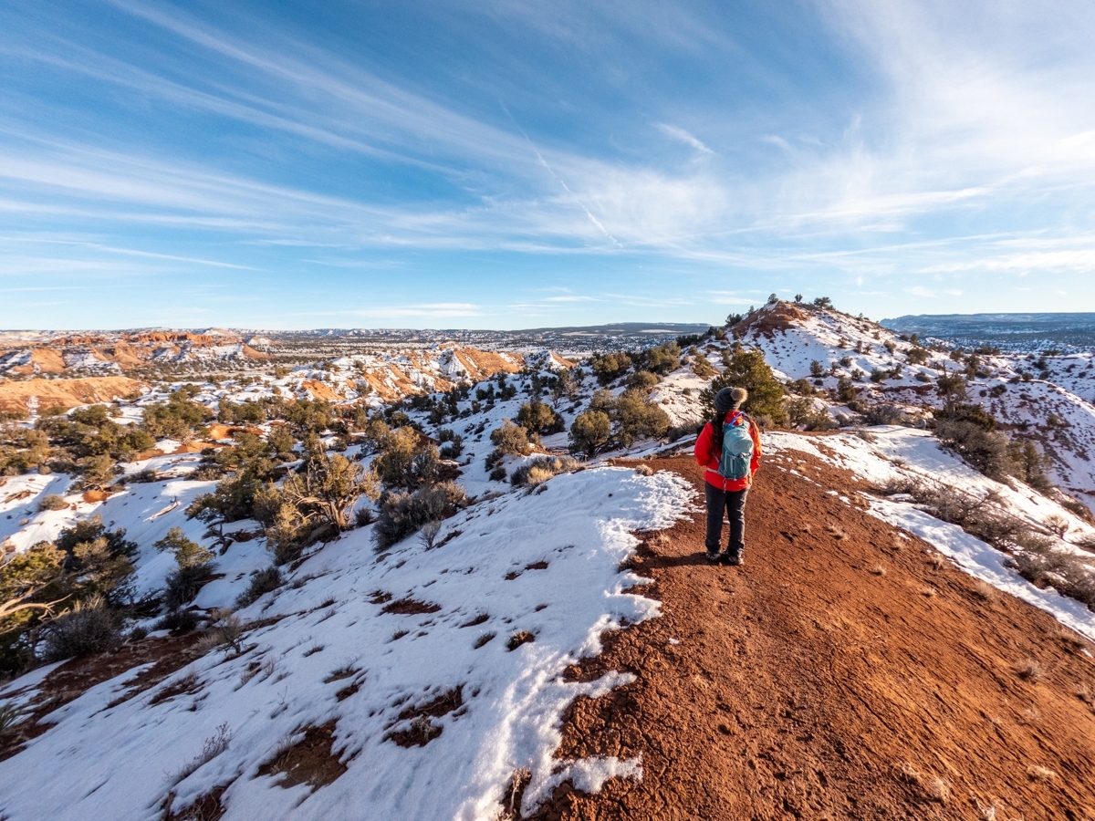
About 0.4 miles from the Mammoth Spire Overlook, we came to another insertion. This one is for the spur trail to go to Panorama Point and another trail that loops back to the trailhead. We proceed to follow the trail toward Panorama Point overlook. It is a steady uphill toward the overlook. Once the trail winds along on the top of a ridge, we could see the sweeping view from both sides. It then dips down and then climbs back up along the base of a sandstone outcropping. Then, there were a couple of short but steep climbs before we arrived at the Panorama Point.
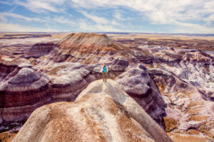
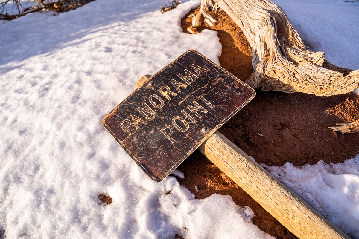
Panorama Point
From the Panorama Point, we have a 360° view of the entire area. We could see the colorful Bryce Canyon and the high Paunsaugunt Plateau across the western horizon, while the rolling terrain of the Skutumpah Terrace, cut by several canyons and topped by Mollie’s Nipple can be seen toward the south. While in the northeast, there are beautiful formations and tall spires of the Kodachrome Basin.
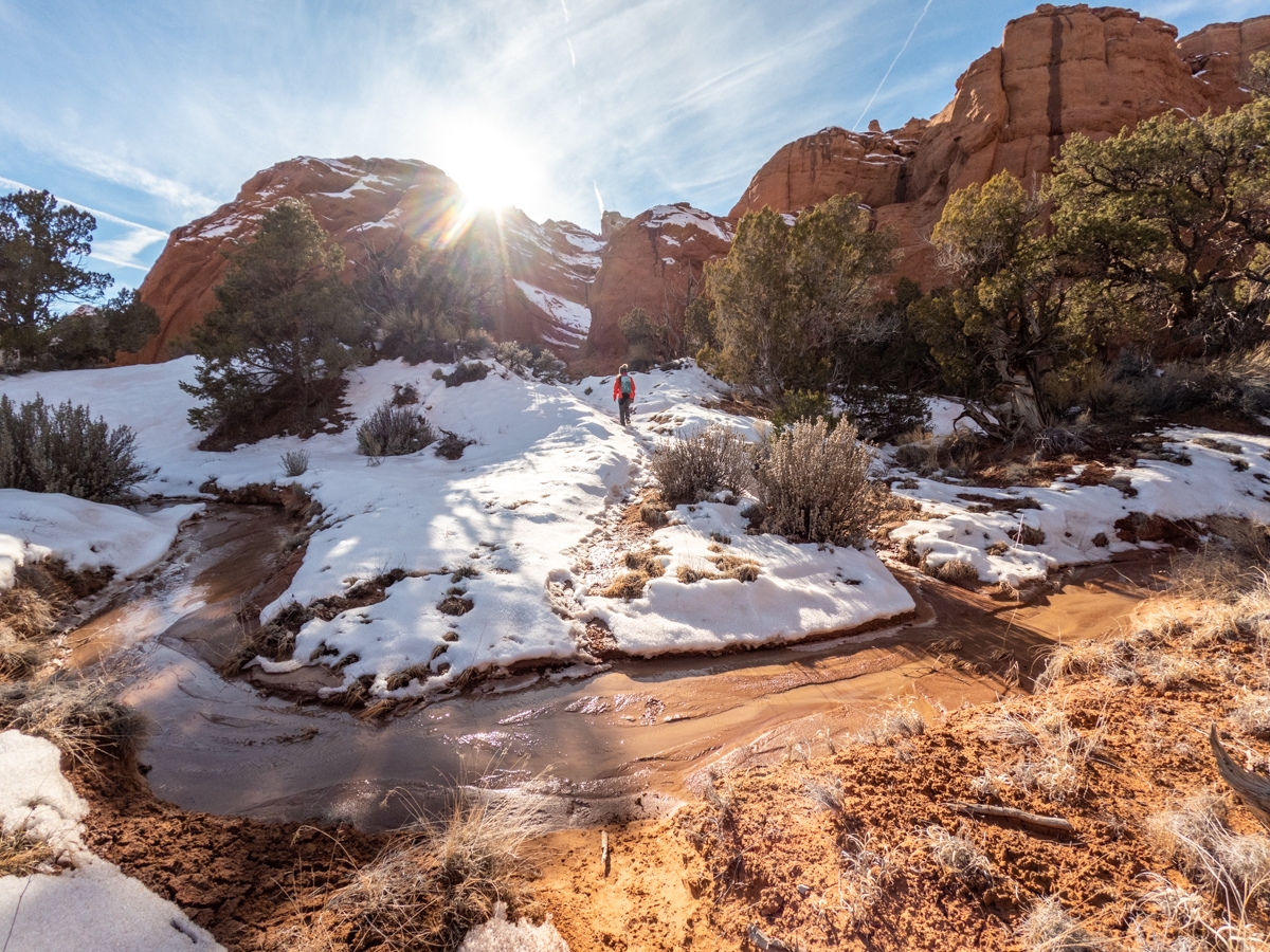
The Last Section of the Panorama Loop Trail
While we tried to enjoy this breathtaking view, we also realized that the sun started to set. So, both of us hustled to get back to our car before it gets dark. We headed back the same way we came up. After meeting back up to the main Panorama Loop Trail, we followed the last leg of our loop trail to get back to the trailhead. This part for some reason has deeper snow than the other sections. The trail crosses over a bench and then gently descends to a small stream. It then climbs up a long slope to the start of the big Panorama Loop. At this junction, we turned right to head back to the trailhead.
Overall, Panorama Loop Trail has many interesting and fun highlights to look at. This trail would be a lot easier to hike when there isn’t any snow or mud. The snow and mud make it extra challenging. However, it was also very beautiful. For a shorter, yet also breathtaking trail, you should do the Angels Palace Trail. If you have time, check out Bryce Canyon National Park. That place is super beautiful. Our favorite hike there is the Navajo Loop to Queens Canyon Loop. Another short but pretty hike there is Mossy Cave. You can also go cross-country skiing there as well.
These are the gear that we personally use and find them helpful for this particular adventure. Don’t forget to check out our Recommended Gear section as well.
adventure gear
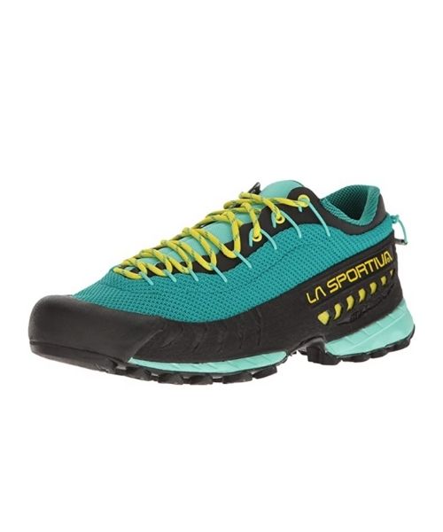
This is our favourite hiking shoes. We use them for canyoneering as well. Lots of traction. Vy’s version.

Dustin’s version for La Sportiva shoes

Make sure to use lots of sunscreens! We use eco-friendly, reef-safe sunscreen, Stream2Sea SPF 30.

Face sunscreen is also important. We love these tinted, organic All Good Organic Sunscreen Butter.
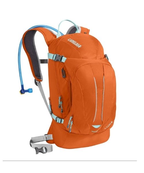
You should always bring plenty of water. Vy loves the Camelback L.U.X.E.
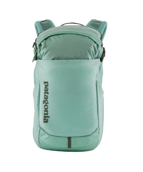
For shorter hikes, the Patagonia Women’s Nine Trails Pack 18L is perfect to hold water and your essentials.
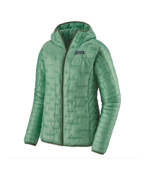
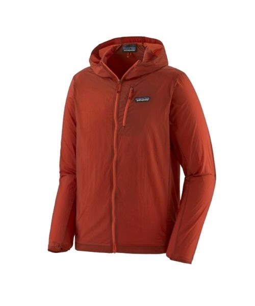
If you want something lighter, we love the packable Patagonia Women’s Houdini® Jacket and Patagonia Men’s Houdini® Jacket
other things to bring
If you’re visiting in the winter, we also recommend:
- Micro-spike or crampons: in the winter, the trails and even the parking lot can by icy. Make sure to bring micro-spike or crampon for added traction. You don’t need anything fancy. Just the simple one like this one would work.
- Warm waterproof jacket, pants and shoes, gloves: Vy actual use this jacket from R.E.I and she loves it. It’s lightweight, waterproof and perfect for layering.
- Neck gaiter – depending on the weather, it can be very cold, especially if there’s wind. We love these Smartwool Neck gaiter.
- Layering your clothes! This way, you can take them off or put them on as the temperature changes. We love our Smartwool baselayer. For pants, this is Vy’s version, and this is Dustin’s version. For top, here’s Vy’s and here’s Dustin’s.
- Always good to bring some snacks with you. For healthy and easy snacks, check out some of our recipes.
Always good to bring some snacks with you. For healthy and easy snacks, check out some of our recipes.
camera gear


Related Posts
Save your pins:

