
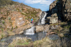
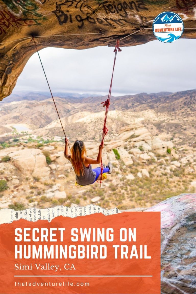
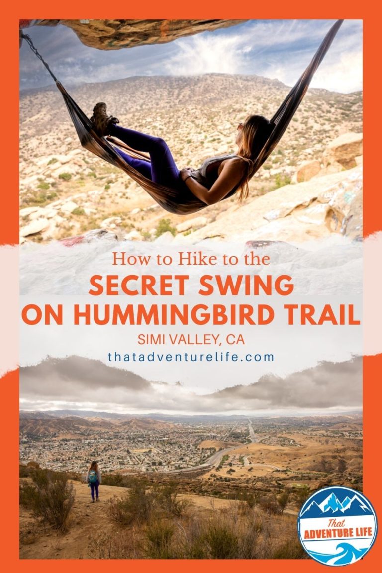
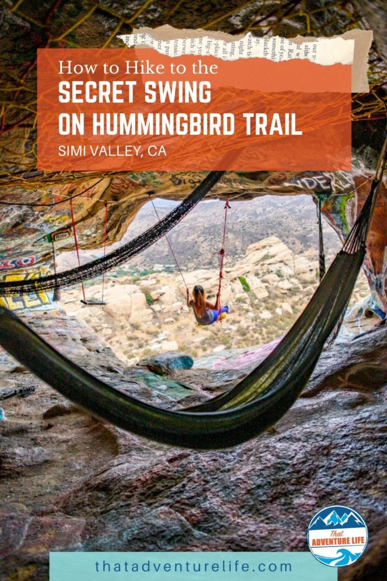
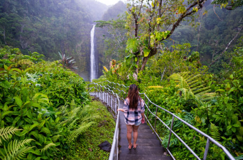
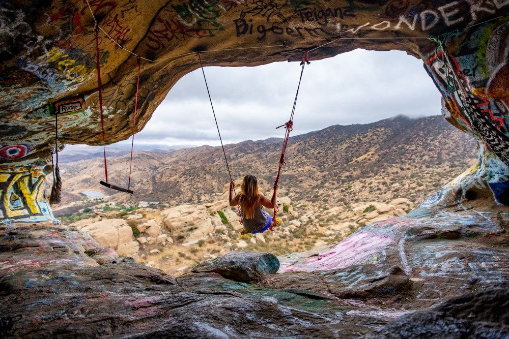
Hummingbird trail in Simi Valley, Los Angeles is one of those unassuming, difficult yet rewarding hikes. Rated difficult, this trail involves a relentless incline, rock scrambling, and requires good navigation skills. However, not only will you get spectacular views of the Simi Valley/Santa Susana Pass area, and fun little wind caves along the way, there’s also a secret cave with sweeping views of the mountains afar. Inside this secret cave, there are a few secret swings that are strategically placed for the best views of the area.
Note: We don’t condone graffiti in nature in any shape or form, but we do appreciate the effort of someone putting up these swings. If you’re attempting this hike and the cave, please don’t add any more graffiti. Also, make sure you practice LEAVE NO TRACE. Please pack out what you pack in, this includes your pet’s 💩. Thank you!
Stats
Where
Hummingbird Trail official trailhead:
2954-2980 Kuehner Dr, Simi Valley, CA 93063
34°16’55.5″N 118°39’37.7″W
Hummingbird Trail unofficial trailhead:
34°16’48.7″N 118°39’36.2″W
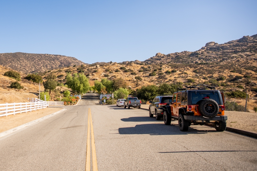
Parking
There is limited parking on the side of the road. However, please make sure to obey the no parking signs and make sure you only park where it is allowed.
There is also a small dirt lot that you can park off of Canyon Oak Drive. (34°16’48.7″N 118°39’36.2″W).
Restroom
There is no restroom
Fee
Free
Weather
Distance
- To the secret swing: 1.6 miles each way
- Hummingbird trail loop without going to the swing: 4 miles
- Hummingbird trail loop with a side trip to the swing: 5 miles
Elevation Gain
1545 ft
Level
Difficult
Time:
3 – 6 hours depends on what route you take.
Pet-friendly
You can bring dogs but they have to be on a leash. However, we do not recommend bringing your pup on this trail. There is a lot of rock scrambling that might be too dangerous for them and you.
If you bring your pup, please pick up after them like a responsible pet owner AND take their trash to the trash can! Don’t leave it along the trail.
Ideal Weather
Cooler days are best. There isn’t a lot of shade on this trail. October – May are the best months to go. Summer days would be too brutal.
Ideal Time
As early as you can in the morning for cooler temperatures and parking. This trail can get busy.
Video
The Adventure
Getting to Hummingbird Trail
Hummingbird trail’s official trailhead is located on Kuehner Drive in Simi Valley. You should be able to use your GPS to get to the trailhead. It is right next to the entrance of a gated community. Please make sure to obey all signage and traffic laws when parking.
There is also a small dirt lot just down the road. As soon as you get off CA-118 W onto Kuehner Drive, turn into Canyon Oak Drive. The coordinates above should be able to get you there. If you park here, you can start at this unofficial trailhead. Whether you start at the official or unofficial trailheads, both trails will meet up.
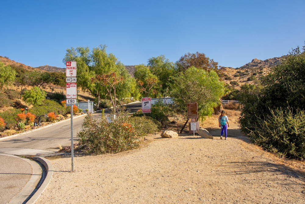
The Start
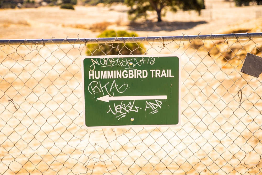
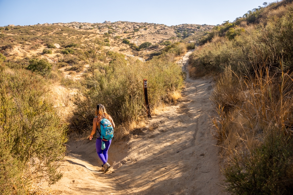
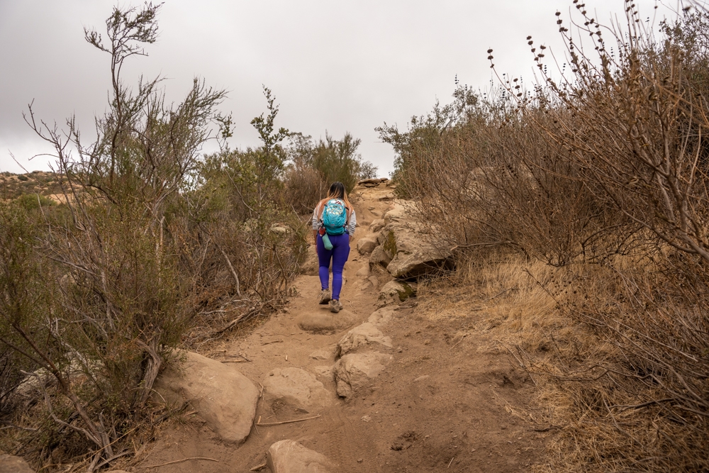
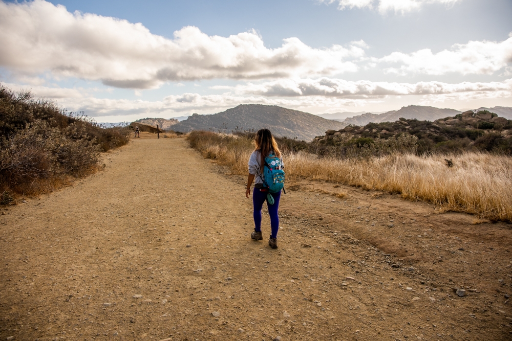
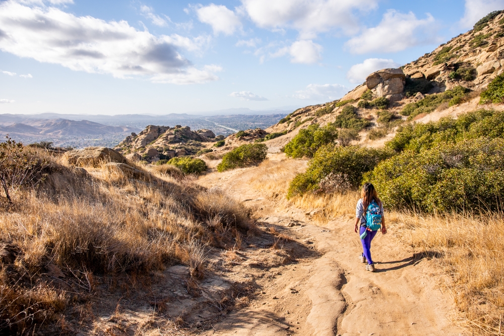
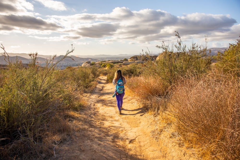
We pulled up to the trailhead of Hummingbird trail bright and early. Since this trail can get very warm, we wanted an early start. There is a sign on the fence pointing to the trailhead in case you don’t know where it is. Once you get to the trailhead, there is a sign there letting you know you’re on the right trail. Unfortunately, besides this one and a couple of other ones along the way, the hummingbird trail is not very well marked at all. You will need to rely on your navigation skills most of the way. Also, don’t forget to wear good hiking shoes with a lot of traction. You’ll need it!
In case you didn’t know, the hummingbird trail is a well-known mountain bike trail. Therefore, following the bike tracks is one way to make sure you are on the right path. This also means that you will need to keep your eyes peeled for mountain bikers as well. There are some pretty steep hills, and they can get going pretty fast.
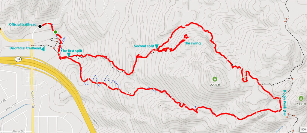
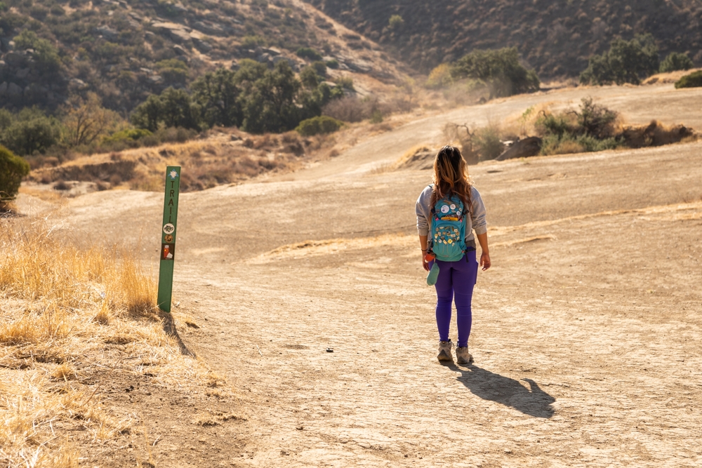
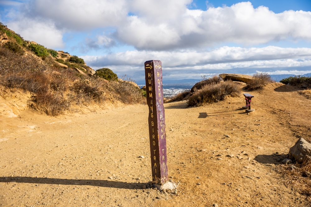
The trail is a bit confusing in the beginning. You will want to go across the open dirt field to the other side. There are a few green markers pointing the way. Once you cross over, follow the trail as it runs along the freeway. At about 0.4 miles, there is a split on the trail. There is a wooden marker here. This is the start of your loop. If you go straight (counter-clockwise) and follow the arrow on the marker, the secret swing will be near the end of your hike. If you go clockwise, you’ll reach the swing first. We found it is easier to find the swing if you go clockwise
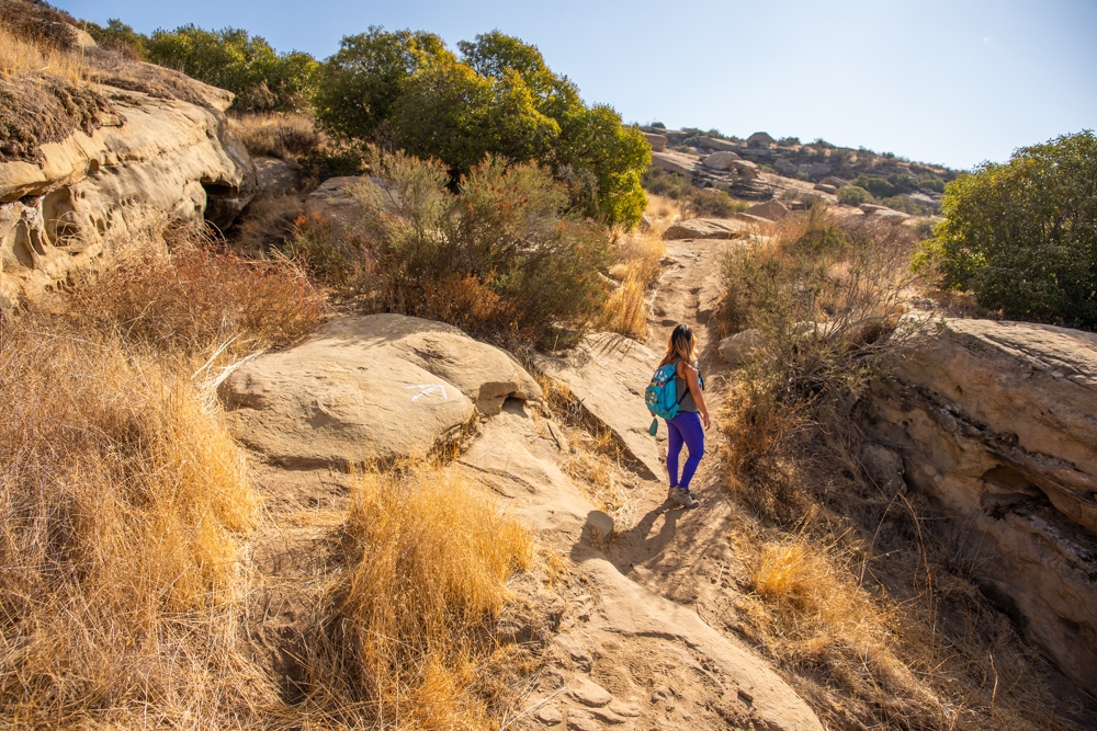
Hike to The Second Split
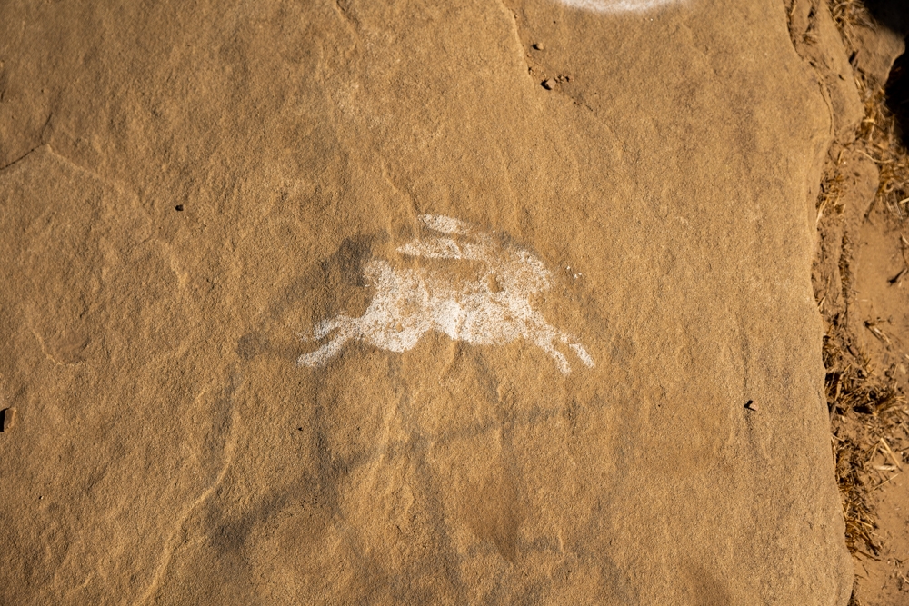
As soon as we took the left turn (clockwise), the trail seemed to immediately turn into a climb. It is quite steep. It is completely okay to stop and take a break as many times as you need. We definitely were dying on the way up. This area here can get confusing. The trail is not very defined. The best way is to follow the white rabbits that are painted along the way. In some areas, it seemed like they would disappear. However, if you look hard enough, you should be able to spot one further up the road. Don’t forget to look around you. The white rabbits are sometimes hiding in different areas.
I have to say, we have a blast finding these little white rabbits. It made us feel like we were Alice in Wonderland, following the white rabbit to a secret world.
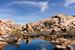
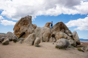
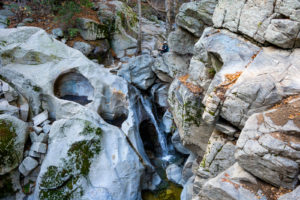
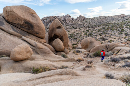
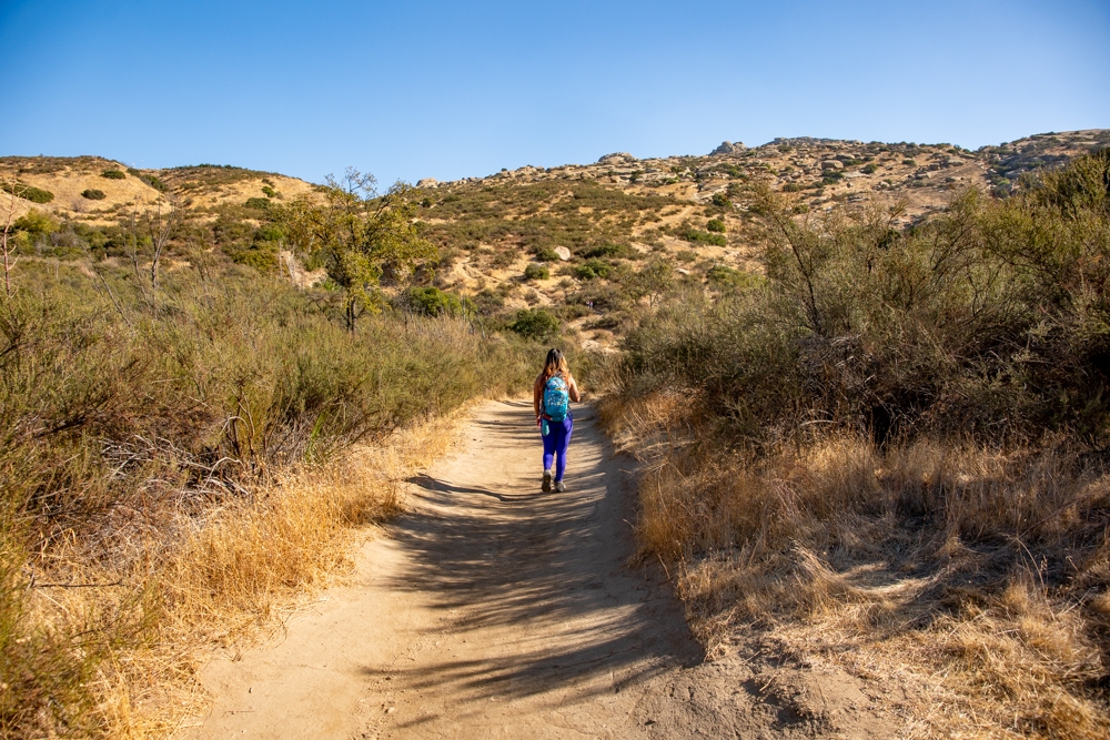
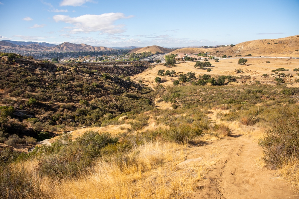
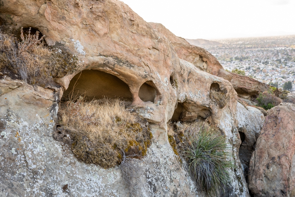
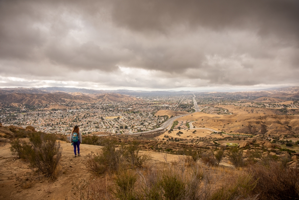
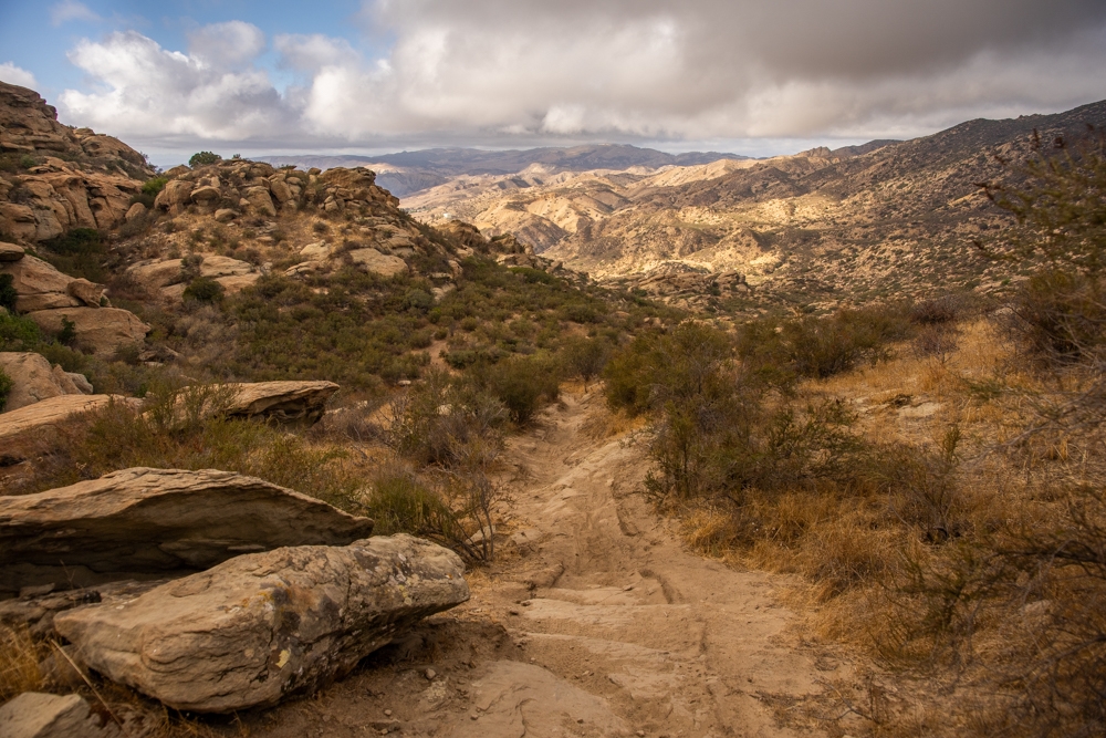
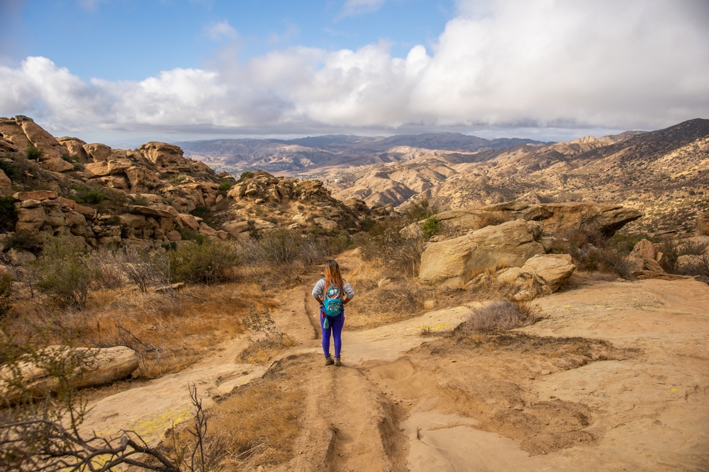
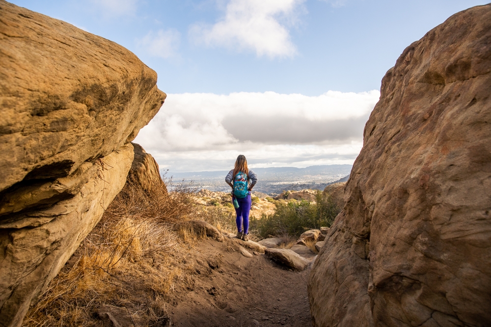
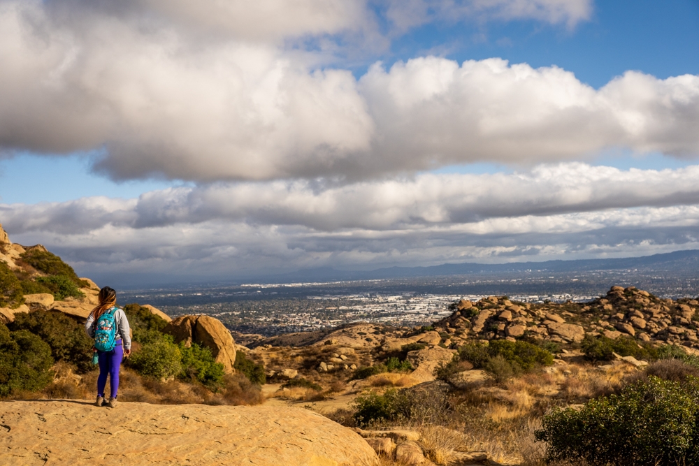
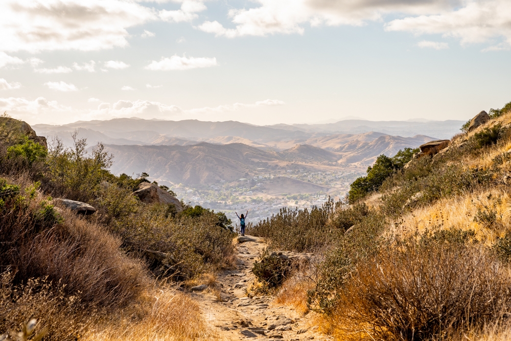
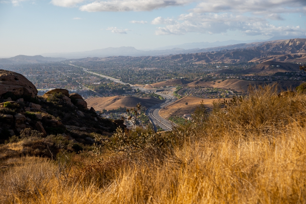
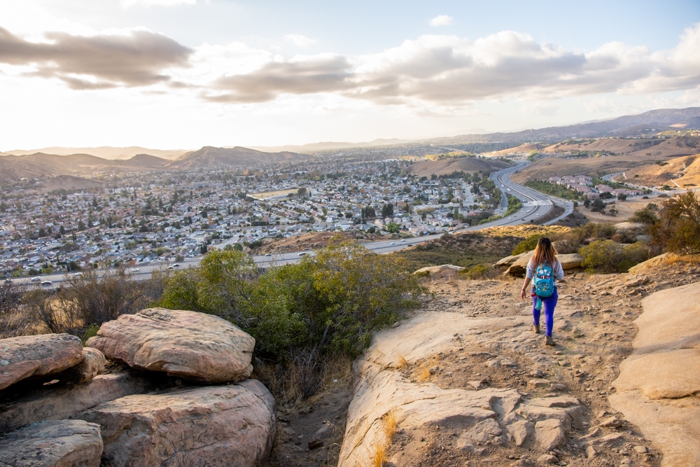
This part of the hummingbird trail is beautiful. Especially when you look back behind you. The view of Simi Valley and the surrounding areas is breathtaking. This trail also winds around interesting wind caves and geological features. I love looking at all the fascinating shaped boulders and cave formations.
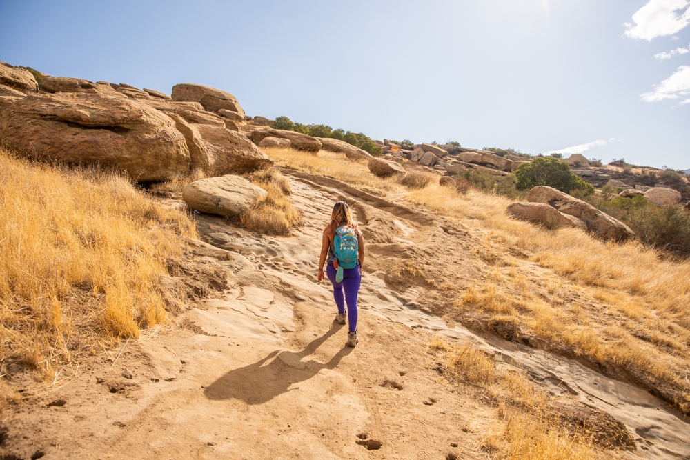
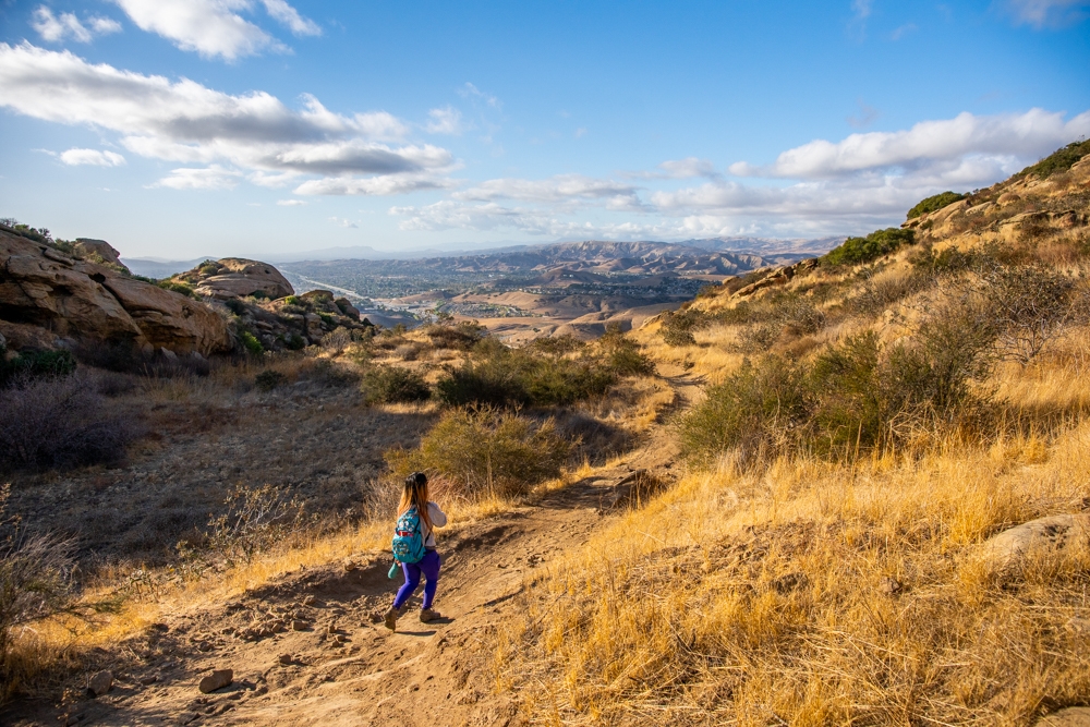
Eventually, you’ll come to your second split. It’s not really a defined intersection here. In fact, you won’t even know if you don’t pay attention. This is where the white rabbits and the bike tracks disappear. It is an open area with a big slab of rocks. At this point, to go to the swing, you’ll want to go up. To continue on the hummingbird trail, you’ll want to go to the left, around the corner. Look for the bike tracks.
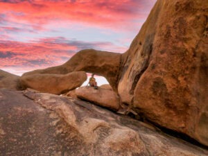
Getting to the secret cave and secret swings
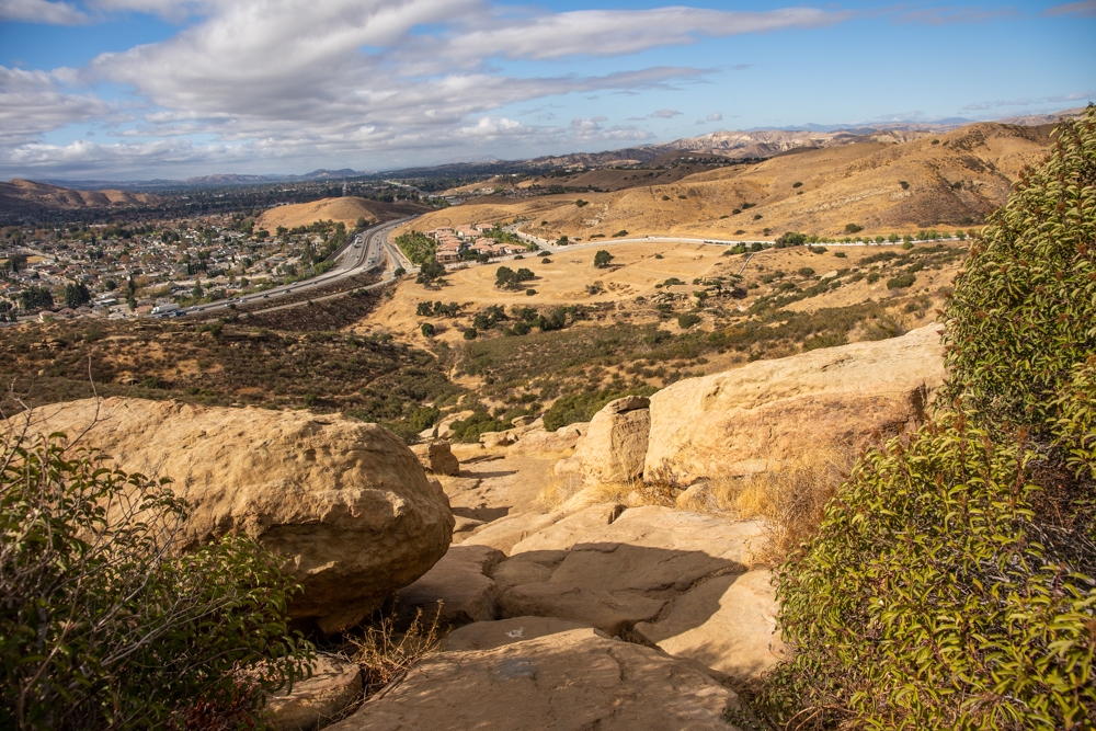
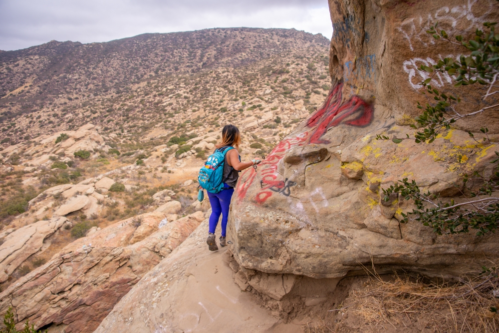
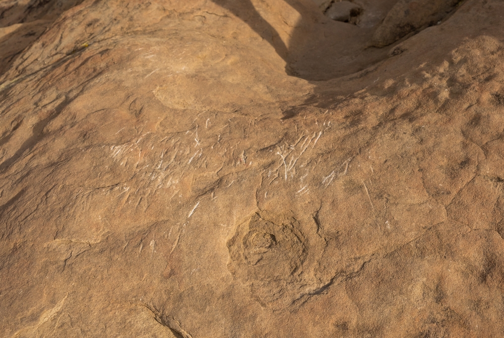
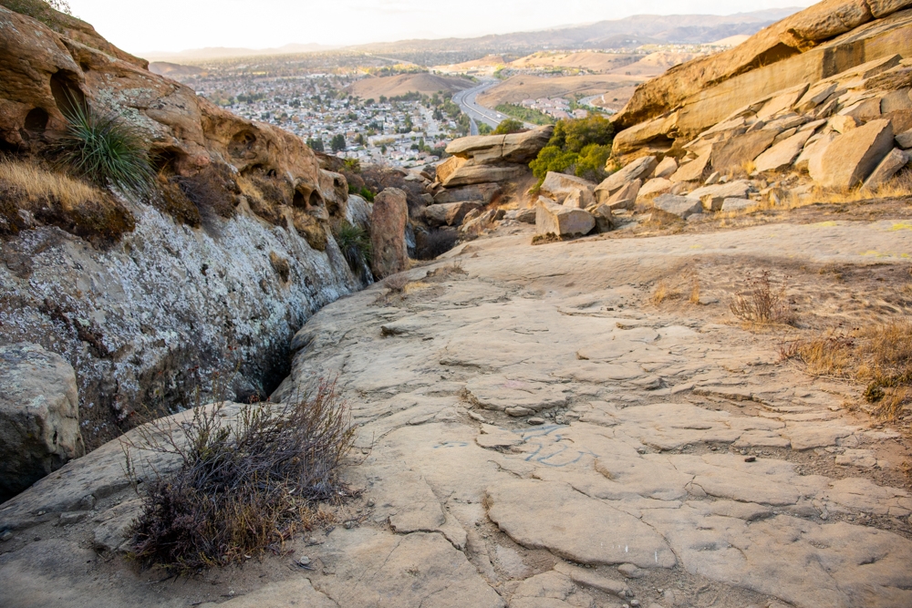
From the second split, you want to head up the big slab of rocks. The white rabbits turn into white arrows. Following the white arrows will lead you to an open area where there are tons of graffiti on the rocks at your feet. The view from here is also spectacular. When we went, there was a storm brewing. It made the landscape more dramatic. We got rained on for a bit but it was definitely worth it.
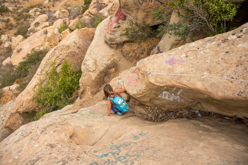
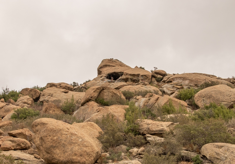
At this point, we were already dying from the elevation gain. So, it is a bit disheartening when we saw a message painted on the rock saying that the swing is 3 miles further. Obviously, this is not true. If you’re in this area, you’re almost there. Pay attention toward the cliffside on the left. If you look carefully, you will see a small cable bolted on the rock, leading down the cliffs. The helpful white rabbits appear again next to it.
To get down to the cave, you just have to climb down that rock ledge. It is not as bad going down but you will need the cable to climb back up. Once you get down, follow another cable to the cave on the righ
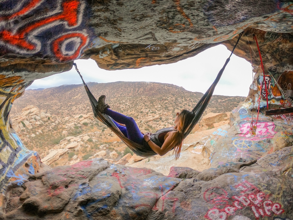
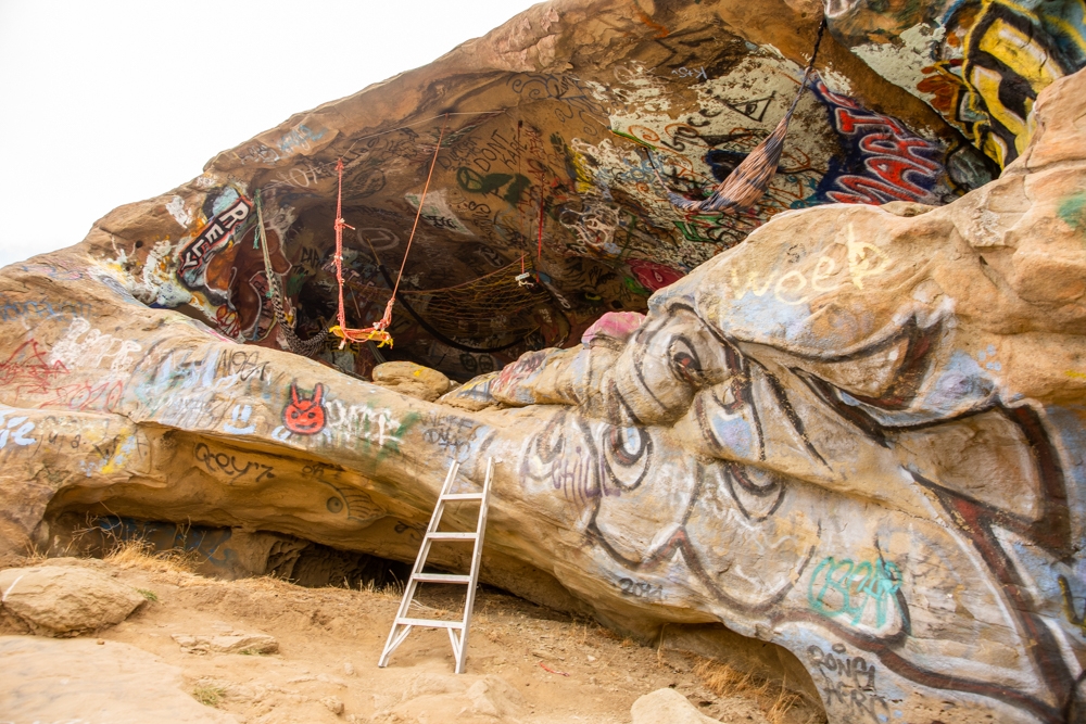
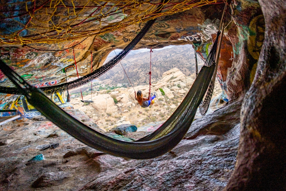
The secret cave and swings on Hummingbird Trail
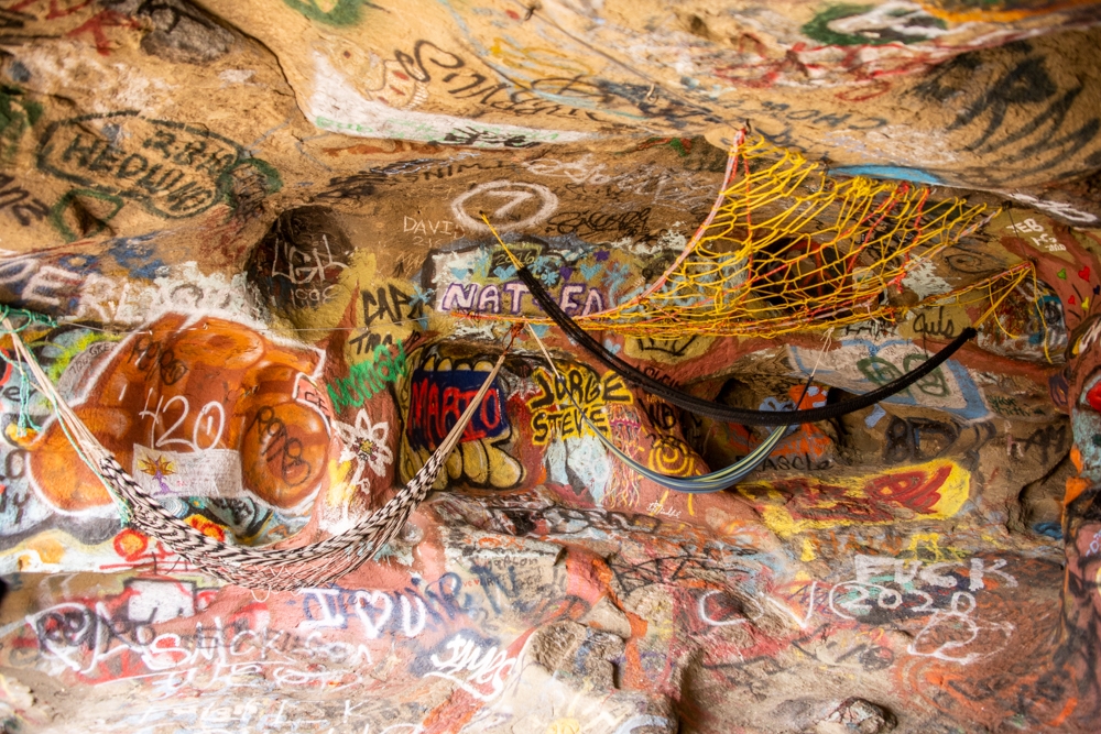
It is such a cool experience once you reach the cave. All we expected was one swing mounted in the cave. However, there are at least 3 or 4 sturdy swings hanging up in and outside the cave. Once we climbed up the small, rickety ladder to go inside the giant wind cave, imagine our surprise to see a network of cables, hammocks, nets, and swings inside this place. Someone put a lot of work into this. It was amazing.
We were lucky enough to have the whole place to ourselves. It was therapeutic to be able to sit on the swings and enjoying the storm unfolding before us. It was a perfect place for us to hide out as the rain was pouring down.
If you find this cave, please be respectful and do not litter. We want to help keep this amazing place alive for years to come.
Completing the loop: getting to Rocky Peak trail
Once the rain died down, we decided to continue on with our adventure. I half wanted to turn back to the car, but we decided to push on through. To complete the loop, you need to head back up the cable and go back to the second split. We attempted to climb down, hoping to avoid going around the long way. However, it is VERY sketchy and I’m not sure if it’s entirely possible to actually go this way. We ended up going back up the cable instead.
At the second split, we found the bike tracks toward the left side (if you going up) and followed the tracks. This part seems a little deceiving at first because it was flat for a minute. However, the incline kicks back in and you’ll get back to climbing. A bonus about this steady climb is that the views behind you get more beautiful as you get higher
At one point, we could actually see the cave from the trail. It was kind of cool to see it from the bottom up. Make sure to pay attention to mountain bikers and give them plenty of room to pass. This is a very difficult and dangerous trail for bikers. The good thing is, you won’t get lost if you follow the bike tracks on the dirt and petal strikes when there are rocks. It also helps that this part of the trail here is pretty straightforward as well.
Once you reach the third intersection, turn right to go onto an even dirt path. This is a small section of the Rocky Peak trail. It is also the end of your climb!! After a short distance, you’ll come to a wooden marker showing you how to get back on the hummingbird trail. Make a right here. If you want to take a quick break and enjoy the beautiful view, there is a bench here for you to rest your feet.
The way down Hummingbird Trail
From here, it’s downhill almost the entire way. This part of the hummingbird trail can get confusing again. There are multiple trails and tracks all over the place. Again, we followed the bike tracks and used our GPS tracker to get us down to the bottom. Don’t forget to enjoy that beautiful view of Simi Valley. For some reason, the views look more beautiful after you put in your sweat and tears to get here. Well, not tears, but you know what I mean. There is one area where the trail cuts through a rocky area. You know when you get there since there are a few neat huecos in the rock wall. The bike tracks disappear here but you can always once again follow the pedal strike marks in the rocks.
Keep in mind, there are some areas of this downhill climb that can get slippery. It is also as relentless downhill as it was uphill. If you have knee problems, make sure to take your time going down. Once you get down to the first split, follow the same trail back to your car.
As difficult as this trail was, we were happy that we completed the loop instead of just getting to the cave. We recommend finishing the whole loop. You’ll feel like a badass! A few other cool cave hikes near Los Angeles are the Cave of Munits or Vanalden Cave. If you don’t mind the drive, the Wind Caves in Anza Borrego are really neat. You can also check out what else to do while you’re in Anza Borrego too!
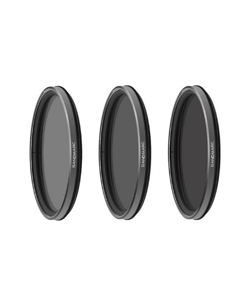
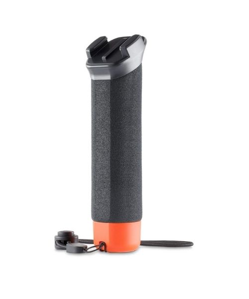
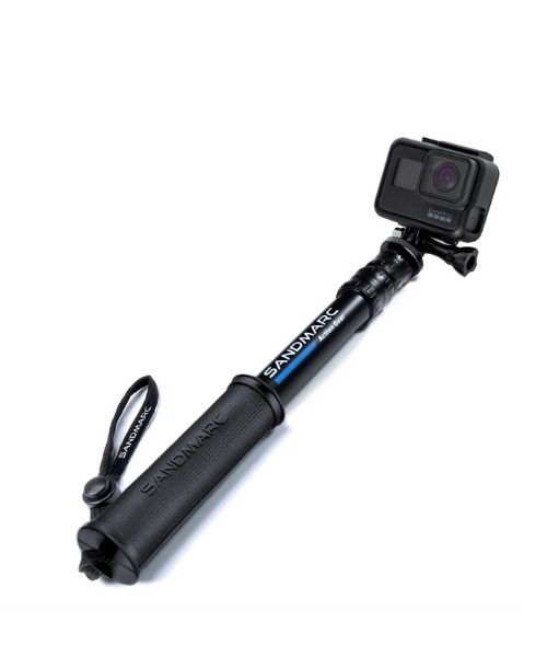
These are the gear that we personally use and find them helpful for this particular adventure. Don’t forget to check out our Recommended Gear section as well.
adventure gear
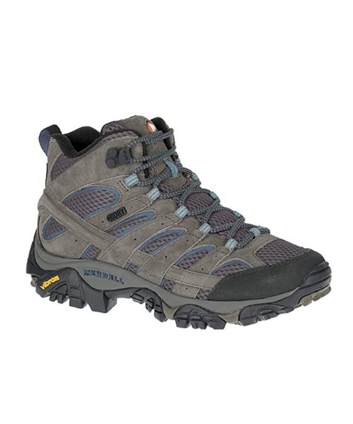
Good hiking shoes are recommended on these adventures. Vy uses the Merrell Women’s Moab 2 hiking boots

Dustin’s shoes are Targhee III Waterproof

There isn’t a lot of shade on this hike. Make sure to use lots of sunscreens! We use eco-friendly, reef-safe sunscreen, Stream2Sea SPF 30.

Face sunscreen is also important. We love these tinted, organic All Good Organic Sunscreen Butter.
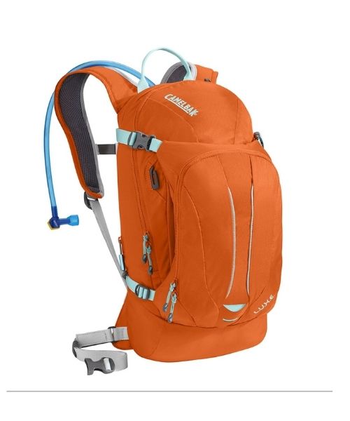
You should always bring plenty of water. Vy loves the Camelback L.U.X.E.
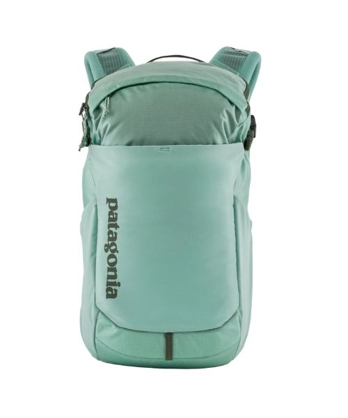
For shorter hikes, the Patagonia Women’s Nine Trails Pack 18L is perfect to hold water and your essentials.


If you want something lighter, we love the packable Patagonia Women’s Houdini® Jacket and Patagonia Men’s Houdini® Jacket
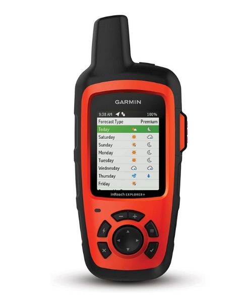
You’ll need a good GPS device to find your way here since there are no signages. We use Garmin inReach Explorer+,
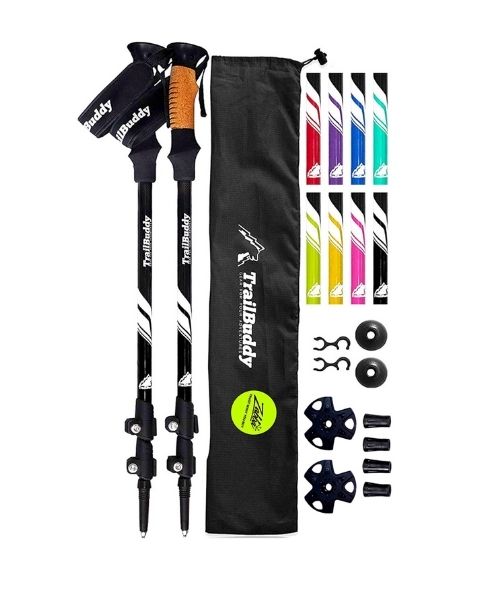
This is optional. We didn’t use them. However, they might help your knees with going downhill. We usually use TrailBuddy Lightweight Trekking Poles.
other things to bring
It can be a long hike if you complete the loop. It is a good idea to bring some snacks and/or lunch with you. For healthy and easy snacks, check out some of our recipes.
camera gear


Related Posts
Save your pins:


3 Comments
Sherri Trout
I really want to go see this cave. I am an artist and hiker but old. I am healthy and 74 but really want to see this cave. Let me know if you have anyone hiking it soon before it gets hot. Right now too slippery I am sure.
Jen
On one hand, I love the content of this post. On the other, I am very turned off by the basic location mistake. Simi Valley is not part of Los Angeles city or County. It is located in Ventura County.
Anthony
I can’t believe how popular this cave has become. It was a dream that I had for a long time to hang the benches and a net in the hidden cave and a few friends of mine in 2006 helped make it possible. I couldn’t of done it without them thanks to the original creators and thanks to everyone that loves respect this place. Please don’t add any graffiti and leave any trash