Upper Hot Spring Canyon: An Exciting Hike with Beautiful Waterfalls
Over the winter, we were looking into more interesting local hikes in Southern California. This was how the Upper Hot Spring Canyon trail came into our radar. Even though there isn’t a lot of info on it, the photos and reviews we came across piqued our interest. The next thing we know, Dustin and I packed our hiking bags and head out for a day of fun adventure. We have to say, the Upper Hot Spring Canyon trail in Cleveland National Forest surpassed our expectations. It was harder and a lot more exciting than we initially thought. And since we were there at the right time, after a few recent rainfalls, the waterfalls were flowing, which made this hike even more beautiful.
Note: Please make sure to respect this beautiful place and the surrounding areas. Always practice LEAVE NO TRACE. This means no loud music, no graffiti, no taking artifacts or fossilized items, and pack out what you pack in! Please help us protect this place for generations to come!
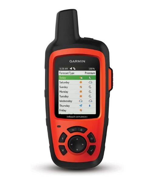
The trail is unmarked and also in a very remote area. There is zero cell reception there. Please make sure to bring a GPS tracker with you and plan ahead of time. Also, remember to download or print out any map or info that you will need before going.
Pet-friendly
You can bring your dogs, however, make sure your dogs are physically capable of challenging obstacles. There’s many spots where you’ll need to boulder-hopping, climbing up and down over sharp and slippery rocks.
Distance
About 3.7 miles R.T.
Elevation Gain
459 ft
Level
Moderate to strenuous depending on the water level. Also, some way-finding skill and rock scrambling are required.
Time:
3-4 hours
Ideal Time
Winters and Springs. The waterfalls will be flowing the best after a few good rains, however, it will make the trail more difficult as well. In the Springs, you can see beautiful wildflowers, as well as salamanders on the trail.
Weather
Video
The Adventure
Getting to Upper Hot Spring Canyon
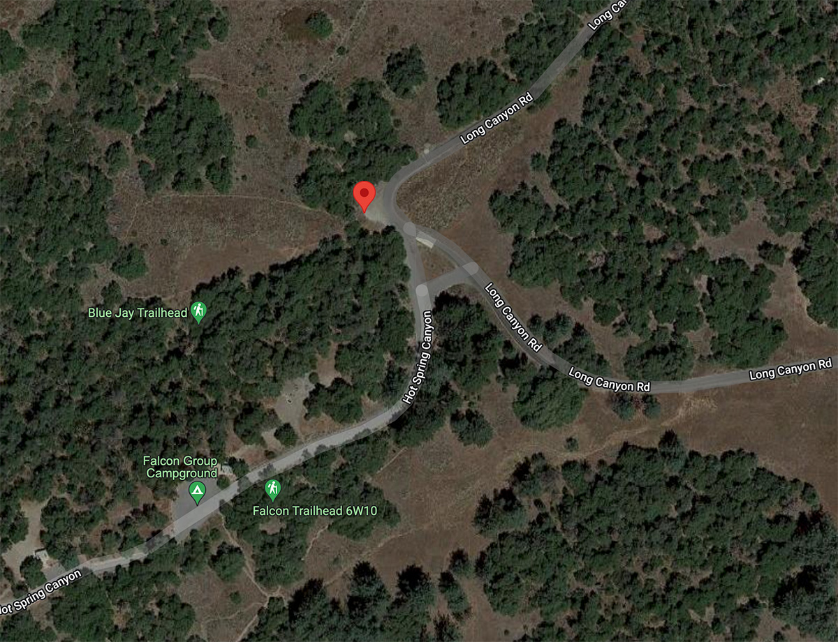
The trailhead for the Upper Hot Spring Canyon trail is located on Highway 74/Ortega Highway. It is near the Falcon Group Campground, inside the Cleveland National Forest. You can use Falcon Group Campground or the coordinates above to map your way there.
If you come from I-5, take Highway 74/Ortega Highway toward Lake Elsinore for about 25.8 miles. Then, turn left onto an unsigned Forest Rte 6S05/Main Divide Truck Trail, which then turns into Long Canyon Road. If you come from Lake Elsinore, drive about 6.5 miles on Highway 74/Ortega Highway before turning right onto Forest Rte 6S05/Main Divide Truck Trail.
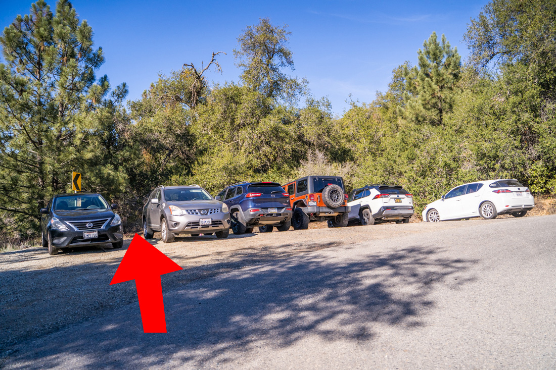
Follow Long Canyon Road to the entrance for Falcon Group Campground. Drive past the entrance and park in a turnout on the left side of the road. This is where the trailhead starts.
Previous
Next
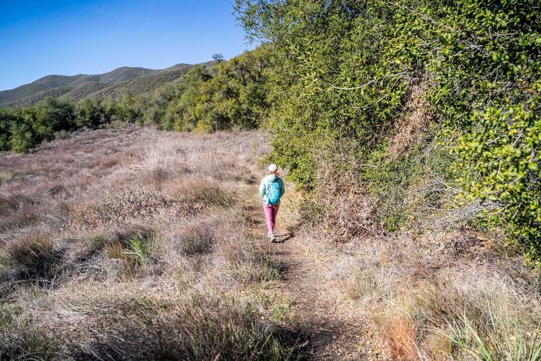
The Start of the Trail
The trailhead for Upper Hot Spring Canyon is unmarked. In fact, the whole trail is unmarked so it is a good idea to bring your GPS tracker with you. It is also in a very remote part of the Cleveland National Forest with zero cell reception, so make sure to download or print out any map or info that you will need ahead of time. The Upper Hot Spring Canyon trail starts at the turnout where you park your car. Make sure to use the trail on the left, the one between next to the yellow street sign, and NOT the one on the right. The trailhead is a little hidden, so just head through the trees. As soon as you pass through the trees, the trail will open up into a meadow.
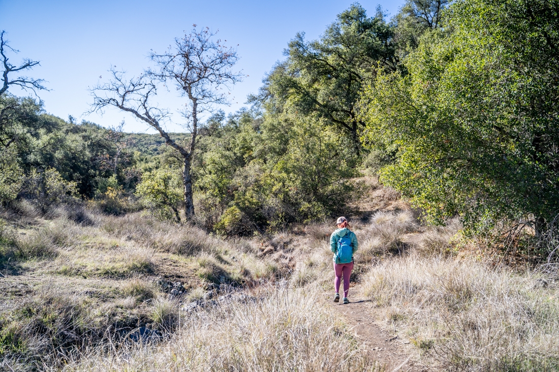
The beginning of the Upper Hot Spring Canyon trail can be a bit confusing. There are a few interconnecting trails that lead to campsites. About 0.1 miles hiking through the meadow, you’ll come up to the first junction. Go left here. The next junction is not too far from the first one. Also, keep left at the second junction, then make sure to stay straight. Soon after, you’ll come to a third junction, make sure to go straight. Going left here will take you to the campground.
Previous
Next
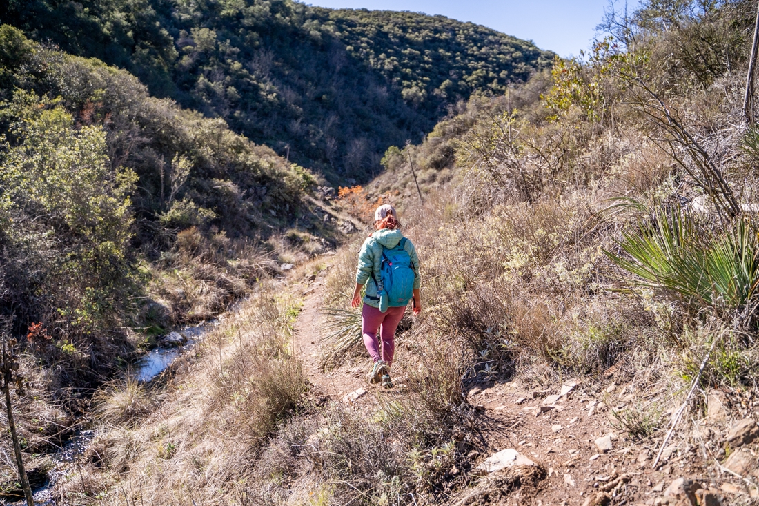
Following Hot Spring Creek
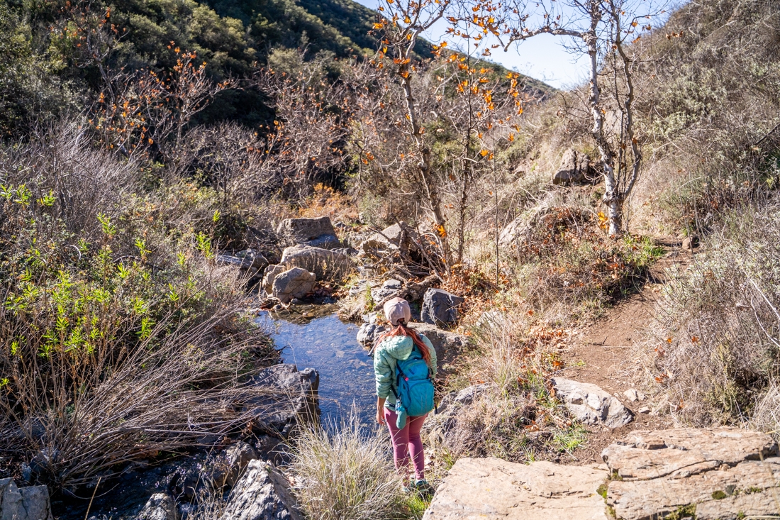
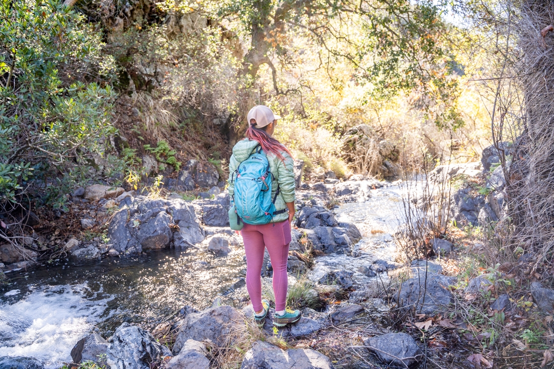
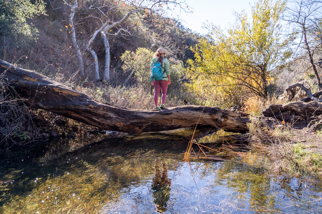
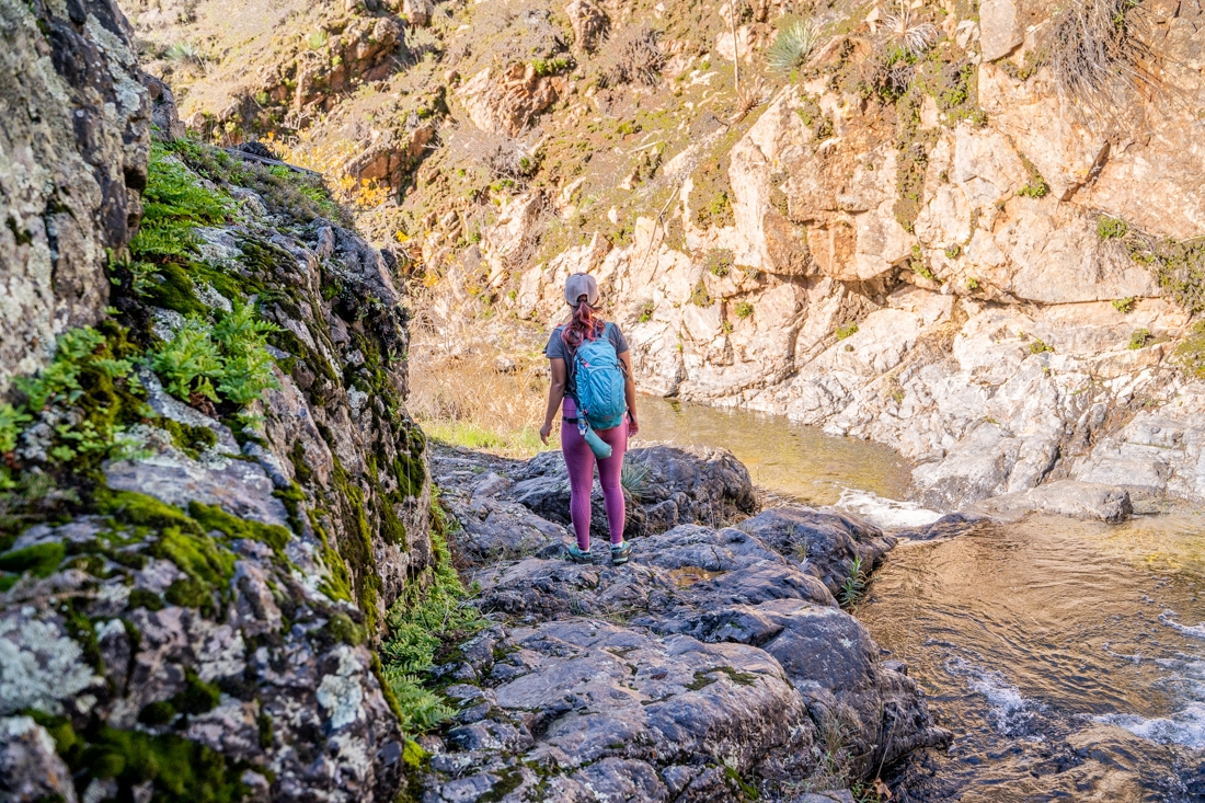
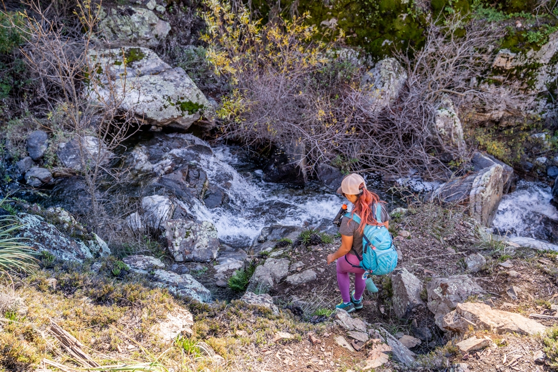
After passing all these junctions, you’ll come upon the side of Hot Spring Creek. From this point, the Upper Hot Spring Canyon trail will follow the creek all the way, which makes the wayfinding a lot easier. The worn trail runs along the running water, snake back and forth through the creek. On certain sections, you’ll have to do some minor rock scrambling on the side of the hills to avoid obstacles, while in other sections, you’ll need to stay in the creek. There are a few stream crossings along the way. The rocks can get slippery, so make sure to be careful. If the trail seems to disappear, make sure to look up to the sides. You’ll find it again once you climb the hill. Most of the time, the Upper Hot Spring Canyon trail follows the right side of the creek.
Previous
Next
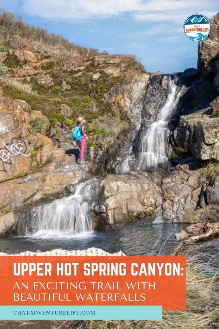
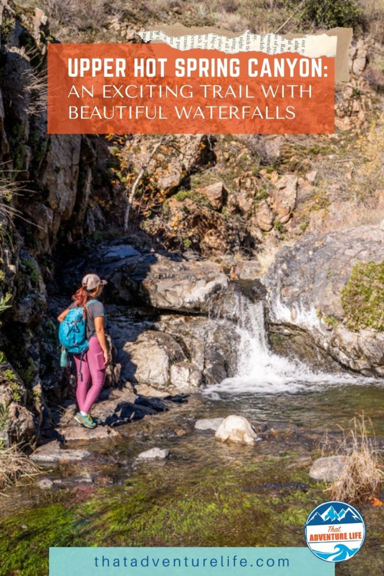
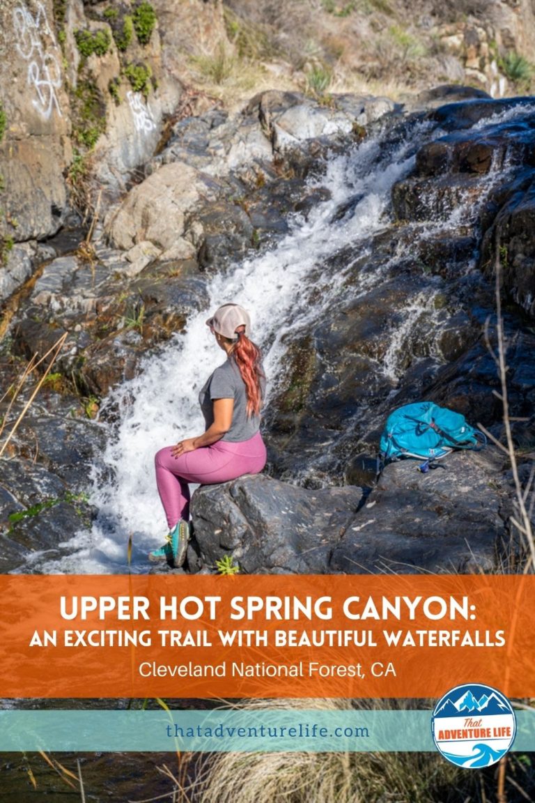
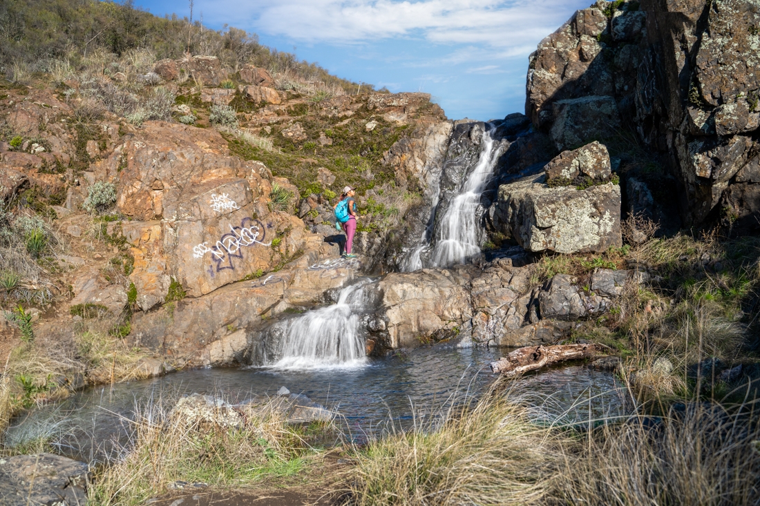
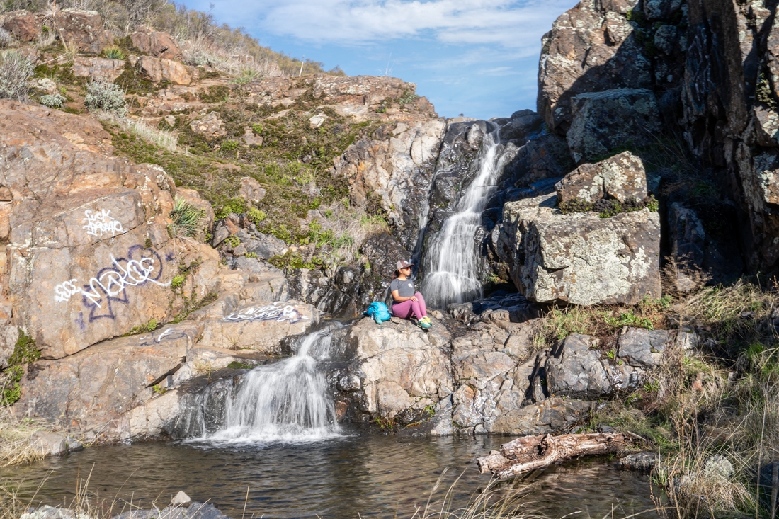
The First Waterfalls
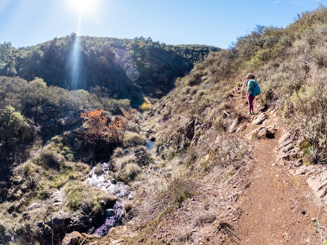
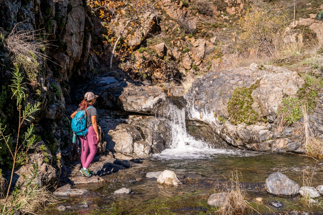
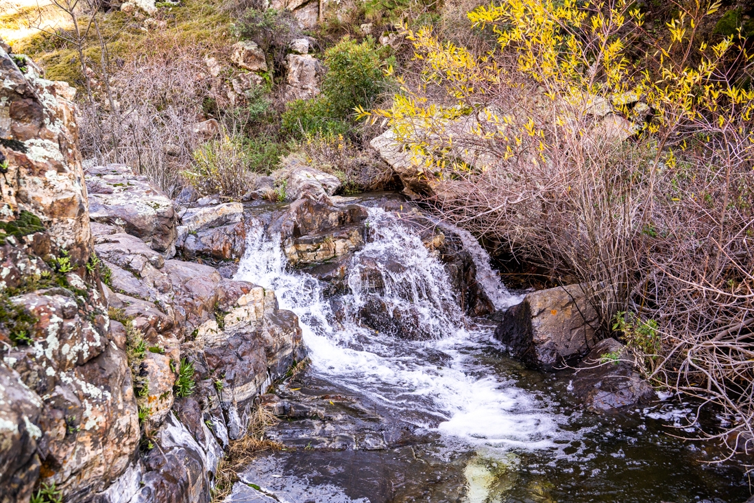
At about 1.2 miles, you’ll come up to a big flat area. This is the start of the first waterfalls. It is a beautiful two-tier fall, about 15-20ft tall. There are a couple of pools at the bottom. We didn’t go in or see anyone swim in the pools but the water was freezing cold. To go down to the bottom of these waterfalls, you’ll want to go down toward the right of it. After the first waterfall, the trail will become a lot more difficult, especially when there is tons of water. Many people turn back here so if you’re not up to the challenge, you can turn around here.
Previous
Next
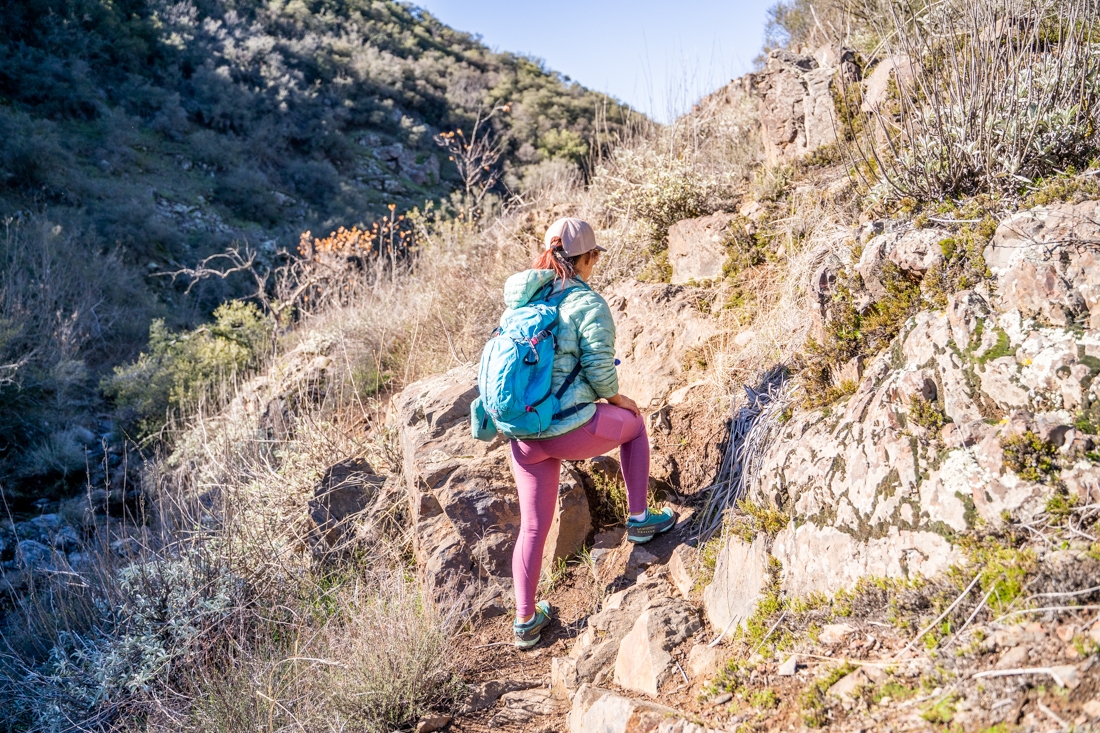
Going to the Second Big Waterfalls
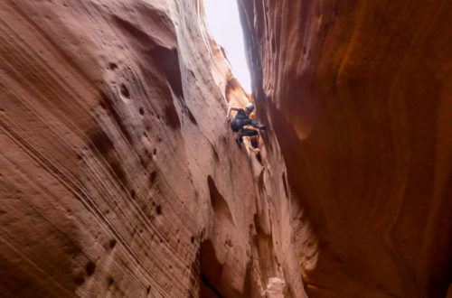
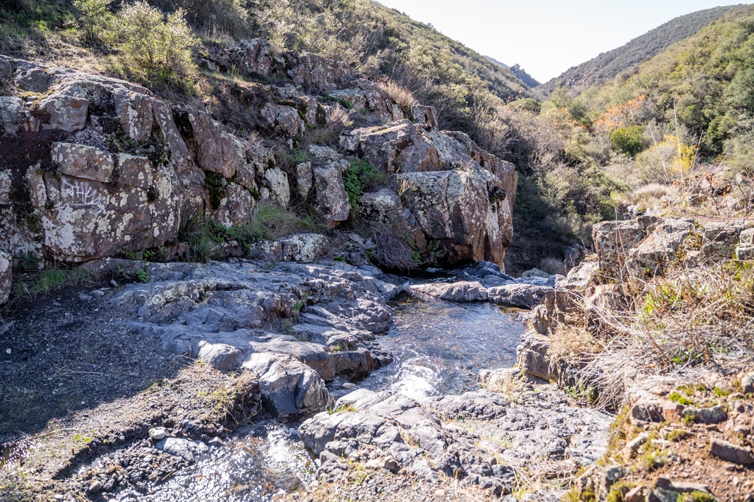
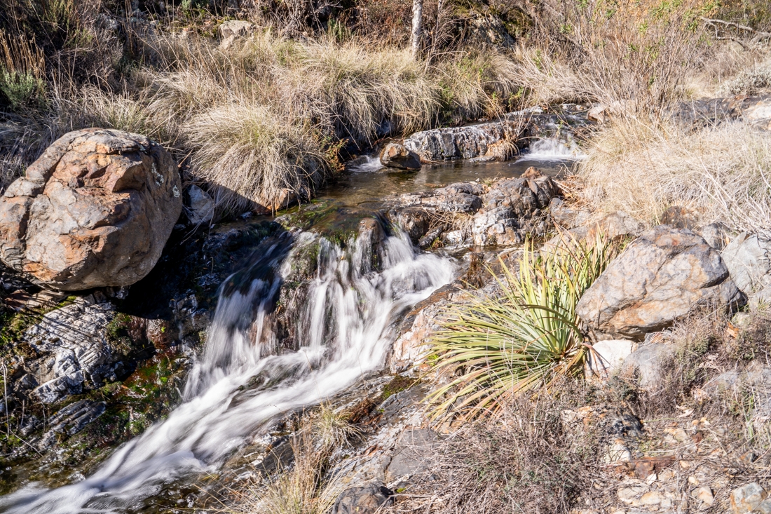
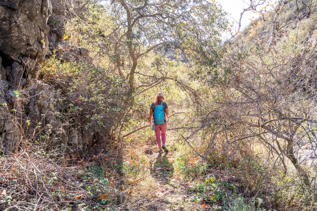
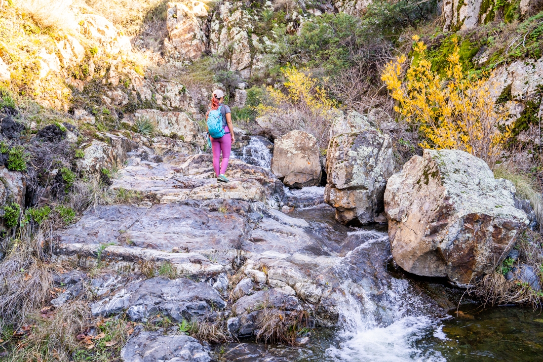
If you’re up to the challenge, continue downstream. From here out, there isn’t really a trail to follow. It’s more like a well-worn animal track. At certain parts, it is also overgrown so you have to squeeze your way through the bushes. There are also multiple creek crossings and rock scrambling. Depending on how high the water flow is, this section of the trail can be challenging. When you get to the big rock face, you’ll need to cross over to the right and continue down the other side. This part is very slippery so make sure to be extra careful. If the water is flowing good enough, you can find a small waterfall here. After passing this small waterfall, we crossed back over to the other side of the creek. From here, it is only a short distance to another small waterfall.
Previous
Next
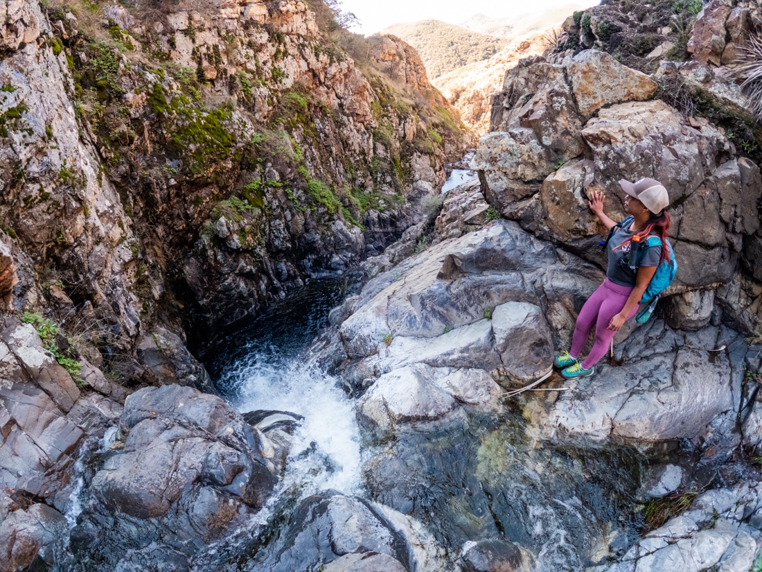
Second Big Waterfalls
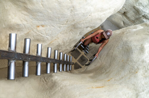
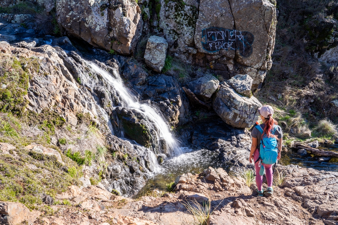
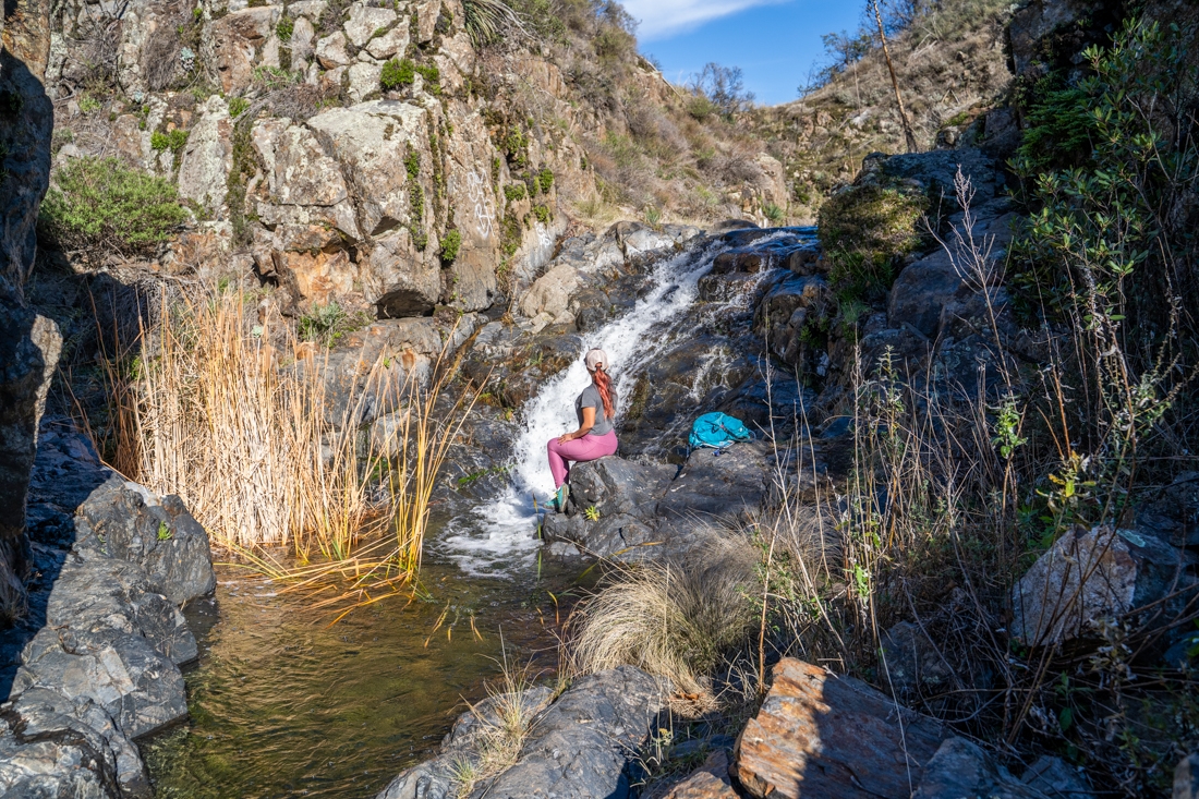
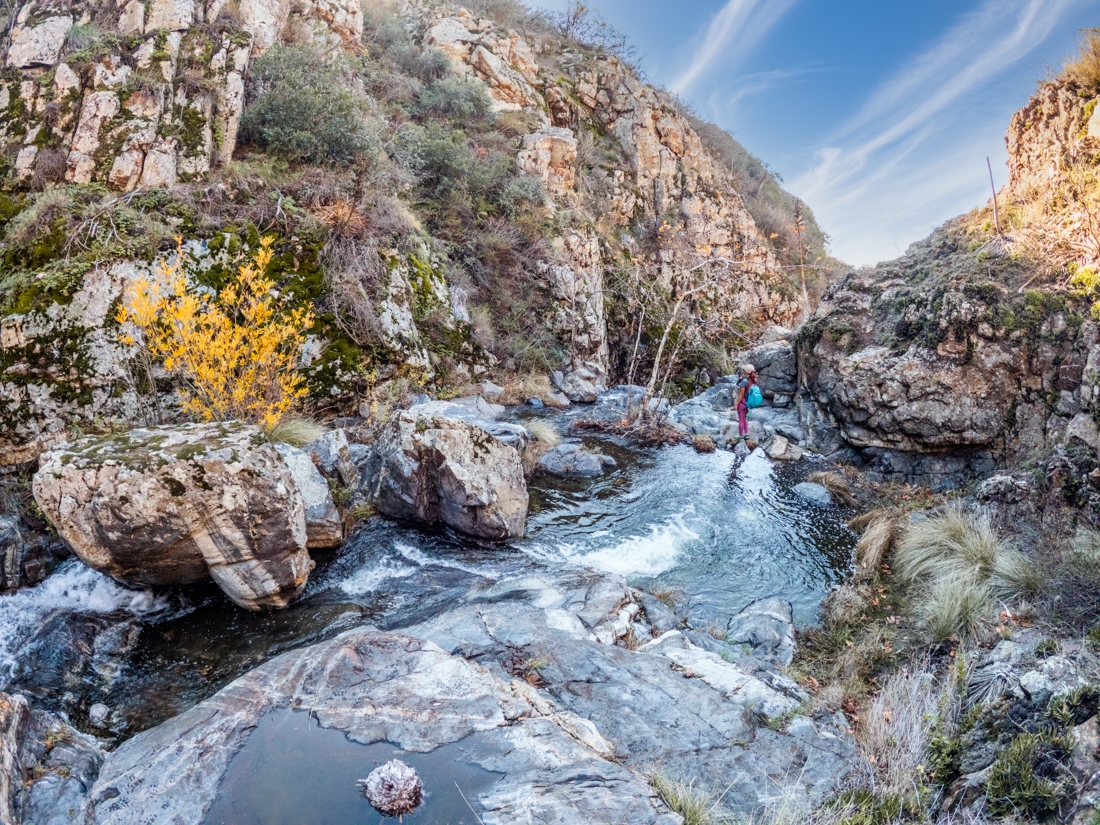
After about 1.6 miles from the trailhead, you’ll come upon the top of the second big waterfall. It is a sheer 25ft drop from the top of the fall to the bottom. Depending on the water level, it can be difficult and dangerous to get to the top of the fall. When we went, there was enough water to make it pretty but not too much to the point of being dangerous. Be careful if you’re climbing down, the rocks can be slippery here.
If you want to, you can use the small trail on the right to go up to a viewpoint. This trail will also continue into the Lower Hot Spring Canyon. However, we recommend turning back at the viewpoint. The trail descent into Lower Hot Spring Canyon is very dangerous and required proper technical skills and gears. In fact, it is a canyoneering route that is rated difficult (4B) and will take experienced canyoneers from 10-14 hours to complete.
Previous
Next
Upper Hot Spring Canyon is such a fun and beautiful hike, especially when the water is flowing. It is a great trail for anyone with a sense of adventure. We definitely would come back again, maybe for canyoneering the next time! If you’re up on Ortega Highway, don’t forget to check out Sitton Peak, it is one of the peaks in the 6 Packs of Peaks challenge. If you like fun, obstacle course-styled hikes, check out Rope Canyon trail and Ladder Canyon trail. Both of these are right next to each other near Palm Spring, CA.
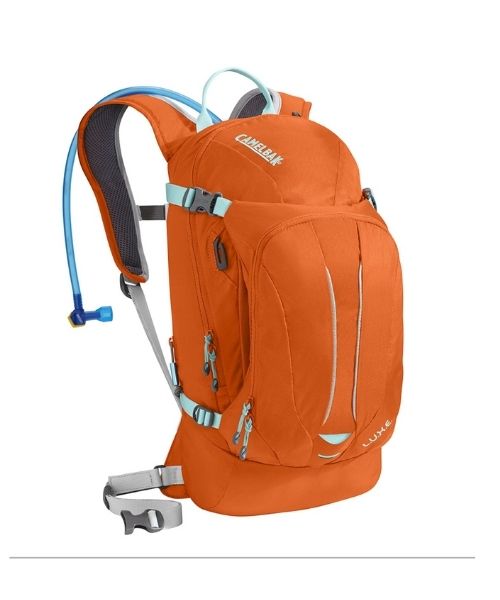
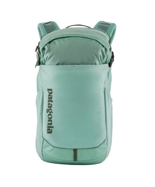
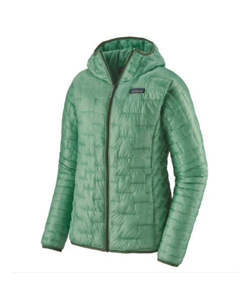
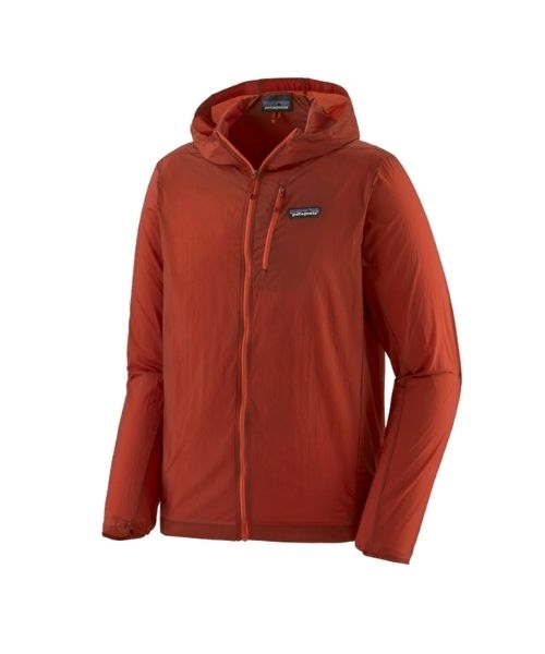
These are the gear that we personally use and find them helpful for this particular adventure. Don’t forget to check out our Recommended Gear section as well.
adventure gear
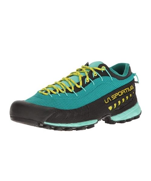
You need hiking shoes with good traction for this hike. These are our favorite hiking shoes. We use them for canyoneering as well. Lots of traction. Vy’s version.


