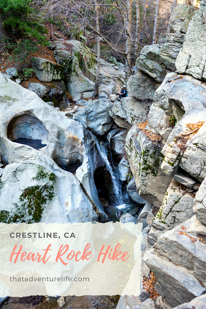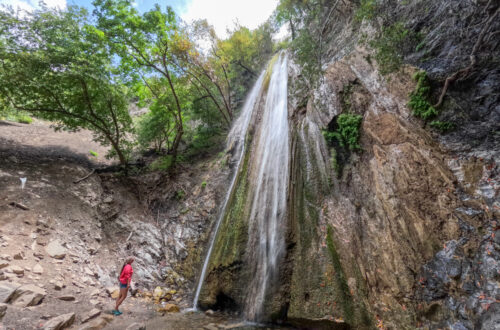
One of our favorite short hikes in the area is Heart Rock Trail. We love hikes that take us to something really cool. This is definitely one of them! Not only does it takes you to the infamous heart rock, but there’s also a 30ft tall waterfall right next to it.
STATS:
Where:
Heart Rock Trailhead – 250 CA-138, Crestline, CA 92325
Coordinates: 34.259912, -117.306006
Parking:
There is a dirt lot right in front of the trailhead. This trail can get very crowded. There is probably only room for about 8 to 10 cars. Make sure you get there early. You can also park toward the entrance or on the main road and walk-in.
Distance:
1.4 miles R.T.
Elevation Gain:
259 ft
Level:
Easy

Estimated Completion Time:
2 hours or less. We did it in 1.5 hours and we took a lot of time to take pictures and enjoy the scenery.
Ideal Weather:
Year-round. Winter can be a bit icy with snow on the trail. That could make things a little more tricky because the snow would cover up some of the rocks and tree roots that are on the trail.
Ideal Time:
Morning time will be less busy, however, it does get really cold in the winter.
Dog-friendly:
Yes. But please clean up after them.
GETTING THERE:
The trailhead is located right next to Camp Seely, in Crestline. You can find directions to the Heart Rock Trail on google maps by either looking up the trailhead itself or direction to Camp Seely. It’s located right off highway 138.
Once you see the sign for Camp Seely, turn to go toward the camp. There should be a sign there pointing toward Heart Rock Trail. This road will take you all the way to the trailhead. Be careful on this road. It gets quite narrow and there are blind corners. The road ends at the trailhead. There is a large gate blocking you from going any further. You can’t miss it!
THE ADVENTURE:
We got out of Butternut, the Adventure Jeep to a crisp, cool morning. It was about 45 degrees, but for some reason, it was not cold enough to require more than a t-shirt and shorts. (I don’t get cold very easily). Vy was fine with a light sweater. The trailhead is marked with a sign on a wooden post. For the most part, Heart Rock Trail is all downhill going there. However, the angle isn’t steep enough to make it challenging on the way back. It starts with a little turn off to the left. You will notice a big green fence on the right. That is private property, please avoid going towards this area. We would hate to have the landowner try to shut down this hike.
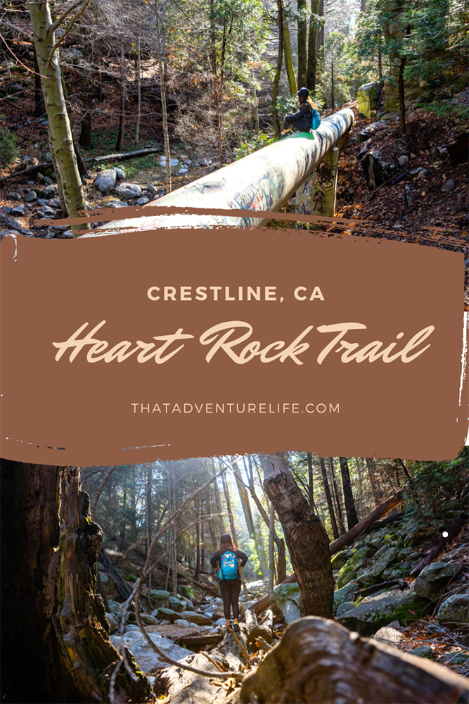
About 0.1 miles, you will come to your first neat point of interest. We have no idea what it does, but there is a large concrete pipe that comes out of the ground and travels along the hillside. For some reason, people have decided to spray paint all over it. While we never condone graffiti in nature, we thought it was kind of an interesting photo op.
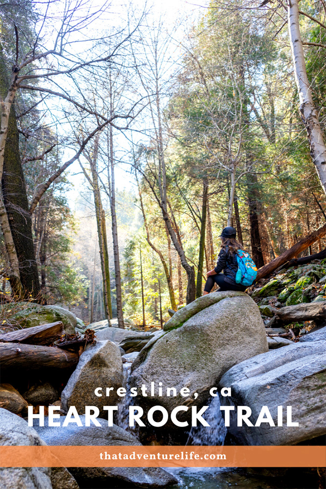
The next spot that we really fell in love with was about half a mile into the hike. It was just a small waterfall in the middle of the creek bed. It was only about 3 ft tall. However, there was something about the way the morning light was pouring these golden tones into the background that was just awe-inspiring! We spent about 20 minutes here, hopping from rock to rock in hopes of avoiding dipping our feet into the icy water, looking for that perfect angle. If you can find this spot, we highly recommend taking a second to take in its beauty.
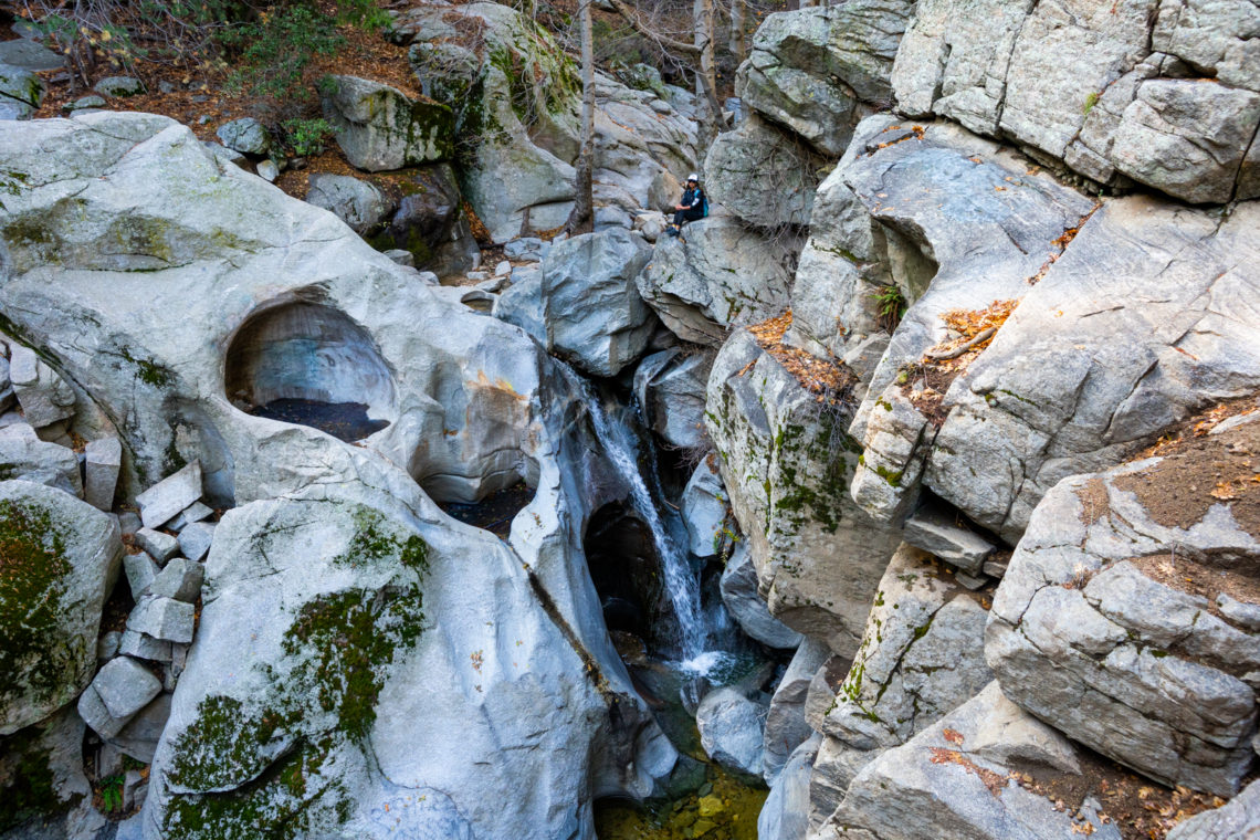
After the creek bed, it is just a short 0.2 miles to the Heart Rock. You will come to a section where the trail curves off to the right. There is a fork that goes left, but that isn’t the way to Heart Rock. This is the trickiest part of the trail and it isn’t that hard. You will find yourself at a series of rocky ledges that drop down about 18 ft. Once you reach the bottom, there is a large boulder that you can stand on.
Once you are there, look off to the right. There, you will find the waterfall and the Heart Rock. If you want other perspectives, there is a trail that goes off to the right (if you are facing the waterfall), This is the way to get into the heart during the drier months. Off to the left is the trail that will take you down to the bottom. You can’t see the heart from here, but it has a great view of the waterfall.
The trail seems to continue on after your stop at Heart Rock (toward the left). We usually just go to Heart Rock and back. To go back to your car, just follow the same way back.
If you’re into hiking near Crestline, don’t forget to check out the Big Horn Mine Hike in the Angeles National Forest
Happy Adventuring. Don’t forget to follow us on Instagram, subscribe to our Youtube channel, and sign up for our newsletter!
RECOMMEND GEAR:
Don’t forget to check out our Recommended Gear section as well.
• Sunscreen:
Always helpful with the Hawaiian sun
We use eco-friendly, reef-safe sunscreen. Alba Botanica Hawaiian Sunscreen.
• Comfortable hiking shoes
Even though it is a short hike, there is a lot to explore, including slippery rocks and exposed tree roots
Vy’s shoes are North Face HedgeHog GTX.
Dustin’s shoes are Coleman Tasman Hiking Shoe.
• Water
It is a short trail but you should always take water
Vy uses the Camelback L.U.X.E. Dustin uses the Clik Small pack (sadly Clik is no longer around).
• Lunch and snacks
It’s good to tame the hangry monster. The Heart Rock overlook is also a great spot for lunch.
CAMERA GEAR:
• Camera:
Sony a7 III
• Lenses:
Sony 24 -70mm f/2.8 Carl Zeiss Vario Sonnar T Zoom Lens