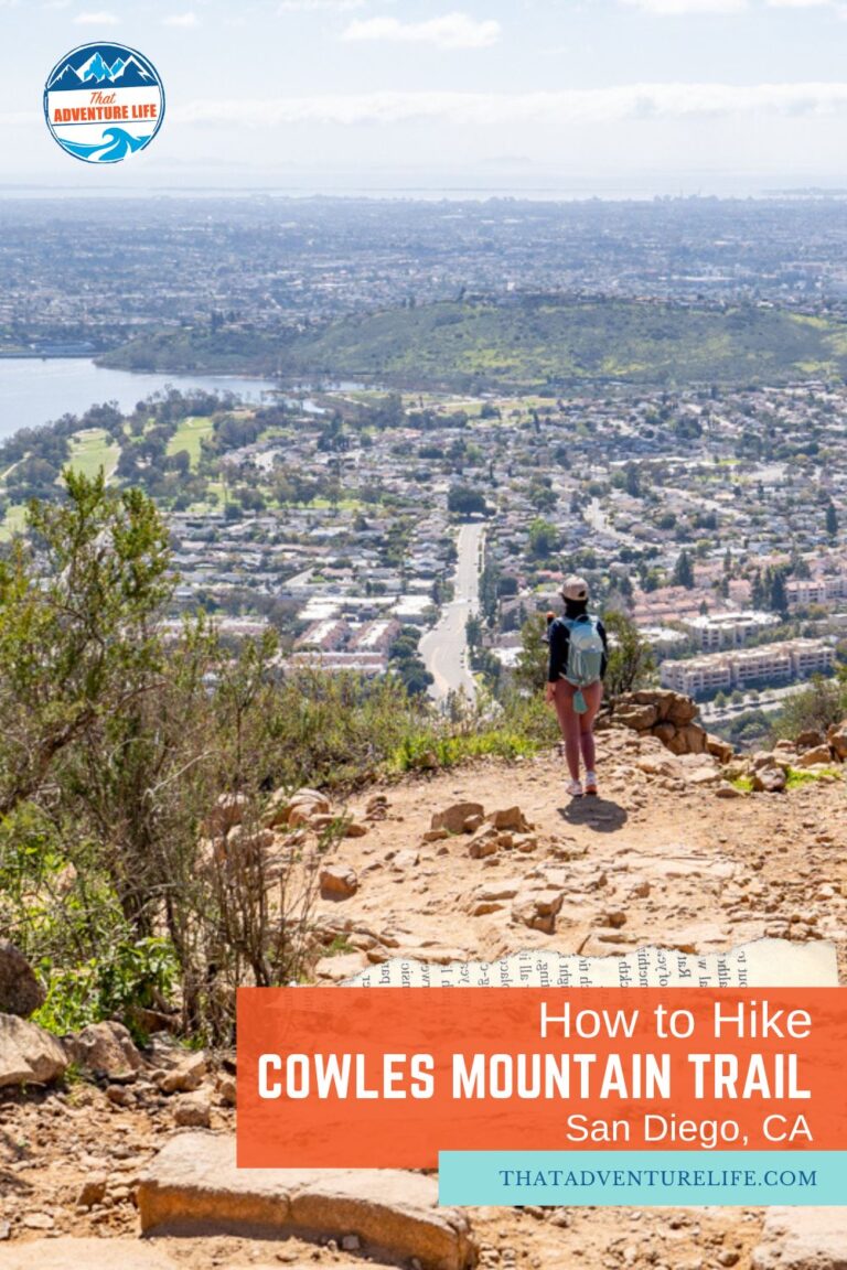
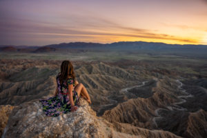
As a San Diego native, Cowles Mountain Trail was part of my weekend workout. It helped that the trail was pretty much in my backyard. Back then, Cowles Mountain Trail was a local thing. It wasn’t as popular as it is now. Now, this trail is easily one of the most popular trails in San Diego, on par with Iron Mountain Trail. And for good reasons. Cowles Mountain Trail is challenging enough to be a great workout, yet short enough for beginners to not feel too intimidated. This trail also offers wonderful, panoramic views of downtown San Diego, Mexico, North County, and Orange County.
Note:Please practice LEAVE NO TRACE when hiking this trail. It breaks our hearts to see the trail was covered in litter and people kept going off-trail. Please pick up after your dogs and yourself and don’t blast your music. DO NOT go off trail or cut switchbacks. Going off-trail causes the mountain to erode faster. It was crazy to see how much the trail had eroded since I first hiked it.
Very small parking lot in front of the trailhead. If the parking is full, you can park along the street. Please watch out for incoming traffic if you do.
Restroom
There is restroom at the trailhead.
Fee
Free
Distance
About 3 miles (4.8 km) R.T.
Elevation Gain
912 ft
Level
Moderate
Time:
2-3 hours
Pet-friendly
You can bring your pet, but they have to be on leash.
Ideal Time
You can hike this trail year-round, however, we recommend going early to avoid the heat and the crowd. There is not shade on this trail.
Weather
Video
Getting There
Getting to Cowles Mountain Trailhead is easy. You can use the address above to GPS your way there. The parking lot for this hike is tiny and it fills up quickly, especially on the weekend. Fortunately, there is plenty of free street parking. You just have to walk a bit further. If you park on the street, please make sure to pay attention to the street signs and oncoming traffic.
The Adventure
The Start of Cowles Mountain Trail
After parking along the street, we walked through the small parking lot to start our hike to Cowles Mountain. The hike follows a rocky dirt path and starts ascending from the very beginning. When we went, there were wildflowers lining both sides of the trail. It was quite beautiful. Because you’ll be gaining over 900ft in just 1.5 miles, the trail does climb consistently the entire time. But it’s not that bad, just make sure to take plenty of breaks! Another thing to pay attention to is your footwear. Due to the erosion, the trail is uneven, and rocky and can be very slippery after rain. Therefore, make sure to wear hiking shoes with good traction. I wore my gym shoes and I wished I had my La Sportiva, especially when going downhill.
Previous
Next
The Hike Up
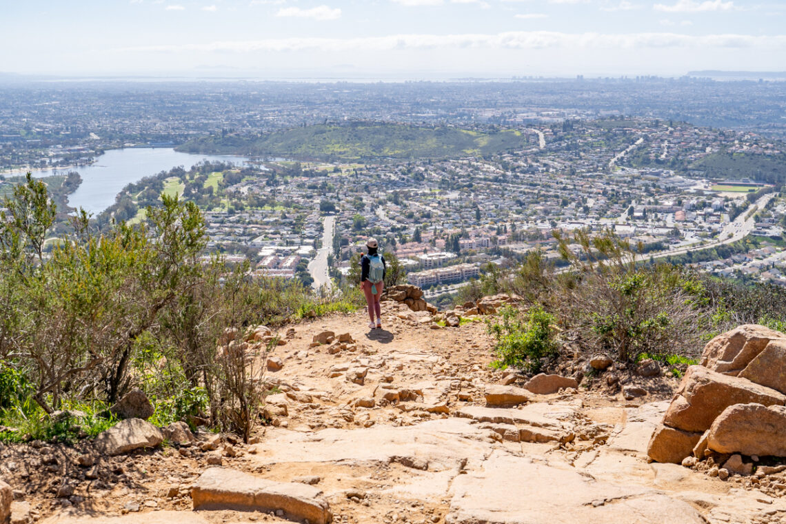
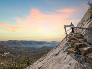
As we climbed our way higher along the trail, we were thankful for the wind and lower temperature. There is no shade on this trail so it can get very hot during a summer day. Make sure to bring plenty of water. Also, don’t forget to stop and enjoy the views. The views of the city below are quite beautiful.
About halfway, the trail turns into a series of switchbacks. You will have to climb up these switchbacks to reach the summit. Please make sure to stay on the trail, no shortcuts. This will help the mountain from eroding further. The trail also gets rocky in sections so make sure to watch where you going. As you continue your ascending, the views also get better and better until you reach the summit.
Previous
Next
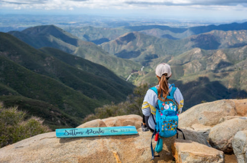
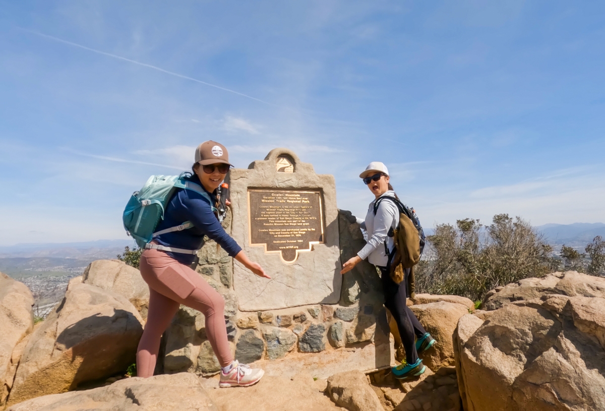
The Summit
The summit of Iron Mountain is a flat, spacious area. Since it is a popular hike, you won’t be alone up here. From up here, you’ll have panoramic views in every direction. You could see downtown San Diego, North County, and on a clear day, Mexico and Orange County as well. If you want that photo to commemorate all your efforts, there is also a summit plaque where you can picture with. If you want to explore, you can head down a small hill over to the antennas. There will be fewer people there too if you want to space alone. After you’re done here, head back the same way you came from.
As a short trail, we think Cowles Mountain Trail in San Diego offers a lot. It’s challenging enough as a great workout and has beautiful views of the city. We definitely recommend hiking this trail if you’re in the area. If you’re looking for something more challenging, check out Iron Mountain, Potato Chips Rock, or Eagle Rock. These ones are longer and more challenging. As for a short yet spicy trail, we recommend Ho Chi Minh Trail in La Jolla.
Previous
Next
These are the gear that we personally use and find them helpful for this particular adventure. Don’t forget to check out our Recommended Gear section as well.
adventure gear
This is our favourite hiking shoes. We use them for canyoneering as well. Lots of traction. Vy’s version.


