
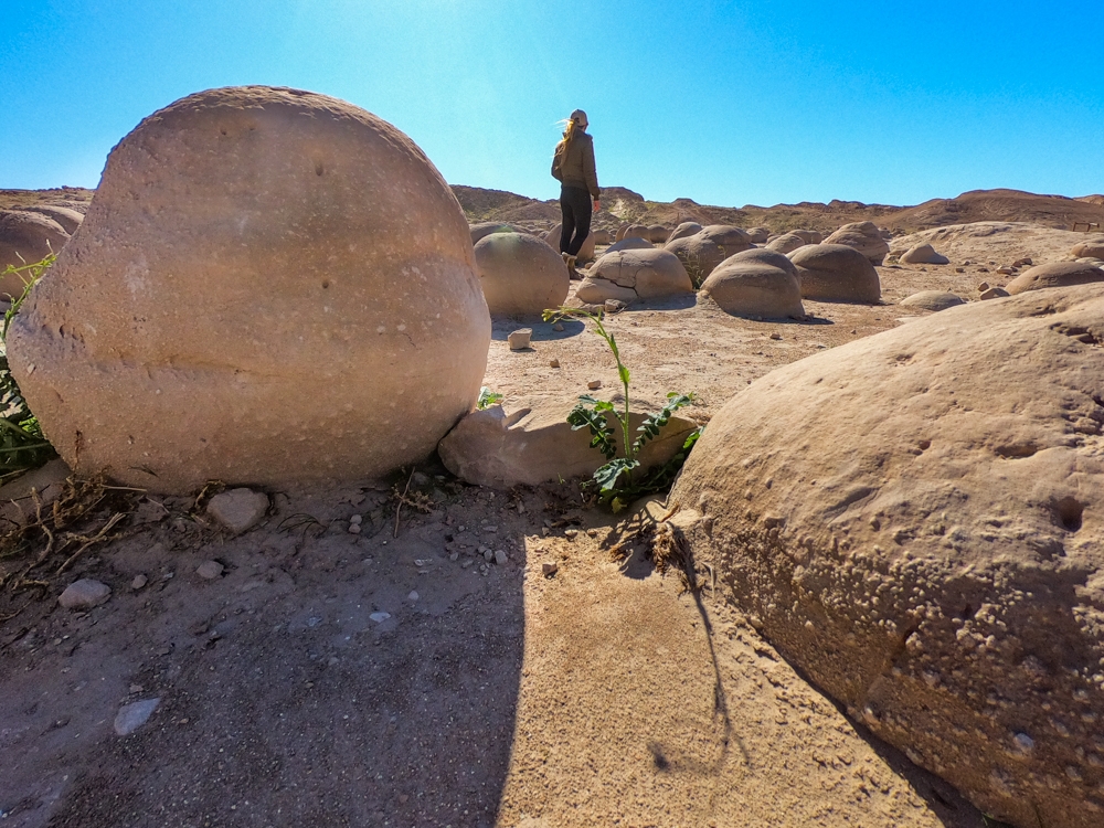
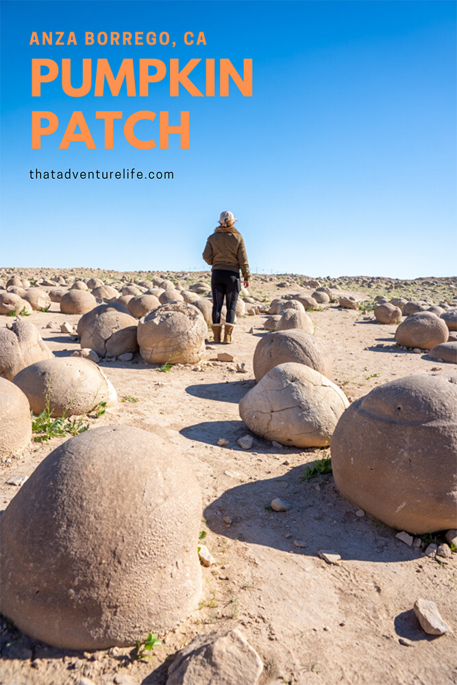
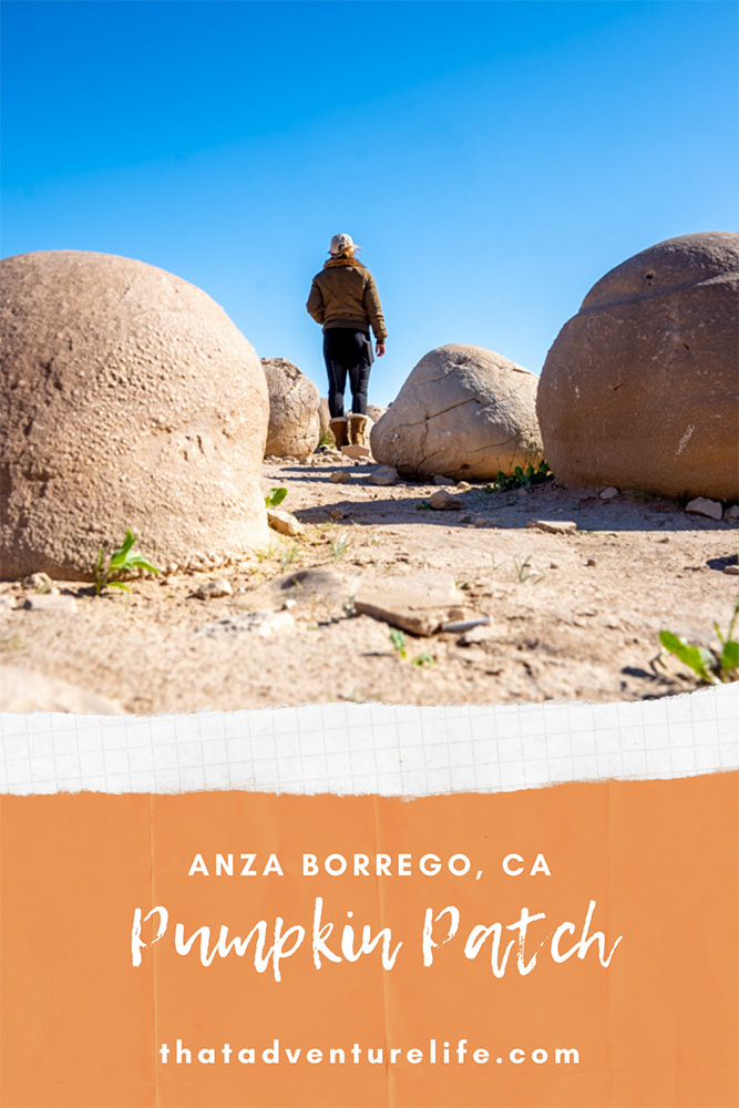
One of the hidden gems in Anza Borrego State Park is known as the Pumpkin Patch. The Pumpkin Patch is full of spherically-shaped rocks that are all the size of an average pumpkin, hence the name. It is a unique geologic phenomenon called concretions. Concretions are found all over the world, but they are not all formed in the same way. Even though it is not easy to get to (you need 4WD or depending on the route, at least high-clearance vehicles), it’s definitely worth a visit.
(Note: OHVs are NOT allowed in Anza Borrego Desert State Park. Don’t mistake dirt washes for OHV areas. You need to go to the neighboring Ocotillo Wells for OHV areas.)
STATS:
Where:
Pumpkin Patch Coordinates: 33°13’22.2″N 116°04’08.5″W
Pole Line Road Entrance: 33°07’32.6″N 115°58’38.7″W
Arroyo Salado Campground Entrance: 33°16’59.2″N 116°09’08.5″W
Truckhaven Trail Entrance: 33°16’51.3″N 116°05’46.8″W
Parking:
Dirt parking
Fees:
It’s free.
Restrooms:
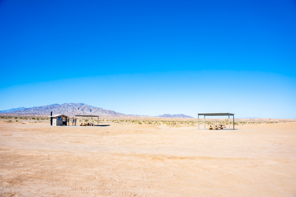
There are restrooms here with some picnic tables.
Distance:
Parking is right in front of the Pumpkin Patch.
Elevation: 0 ft
Level: Easy
Estimated Completion Time:
At least 1.5 hours to 4 hours depending on which routes you take.
Ideal Weather:
Winter and Spring are the best time to go since it is in the desert. Calmer days are better too. It can get VERY windy here.
Ideal Time:
Go there early morning or late afternoon, when the temperature is cooler. It is also better for photos.
Dog-friendly: YES
ABOUT PUMPKIN PATCH:
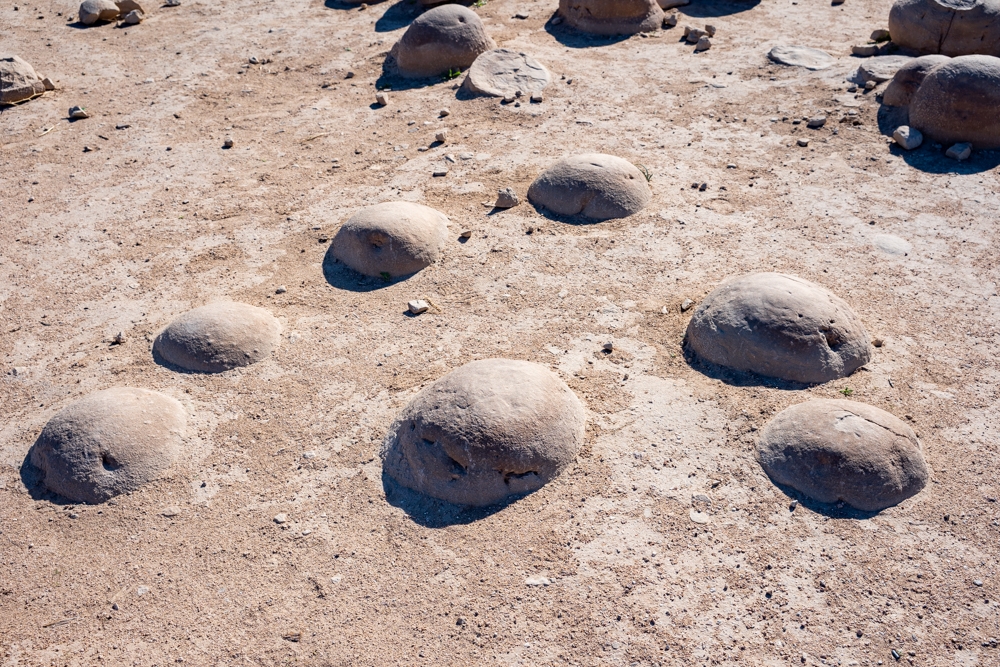
The pumpkin-shaped rocks at Pumpkin Patch are called “concretions”. They were formed similar to how a pearl forms. When loose sand is wet, it will naturally cement itself to a larger object such as a pebble, piece of shell or even an insect body. When the water evaporates, the sand becomes hardened around the object. Over time, more and more sand is added around the object, which slowly turns into the concretions. Concretions can become any shape or size.
The concretions at the Pumpkin Patch are particularly round due to its location. After several years of wind erosion, these pumpkins have gradually emerged from the sand. Because they are stationary, over the years, the wind slowly rounded them and turned them into what we have now. However, since they are exposed to the wind, they are slowly whittling away.
THE ADVENTURE:
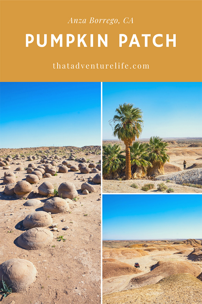
The Pumpkin Patch is located just east of Anza Borrego Desert State Park boundary, in the Ocotillo Wells SRVA. We’ve listed the coordinates for the actual Pumpkin Patch and 3 different entrances above. Don’t use the coordinates for the Pumpkin Patch on your GPS, it won’t be able to take you there. Our GPS took us to the backside of the Pumpkin Patch when we first went looking for it. However, the coordinates will give you a destination as you drive around in the sandy washes.
We will cover the 3 different routes to get to the Pumpkin Patch depending on how exciting you want your adventure to be. We’ve included the map below for better visualization (map is not to scale). Pole Line Road Route and Arroyo Salado Campground Route are the easier routes and are colored in orange. Truckhaven Trail Route is more advance and is colored in light blue.

Pole Line Road Route:
Pole Line Road (33°07’32.6″N 115°58’38.7″W) is the easiest way to get to the Pumpkin Patch. However, you’ll miss out on the 2 different palm oases that the other two routes will take you to. If you only have high-clearance vehicles but not 4WD, this might be the best way to go see the Pumpkin Patch.
You can access Pole Line Road through US – 78 in Ocotillo Wells. If you coming from Borrego Springs, make a left onto Pole Line Road. From here, you’ll follow Pole Line Road all the way to Tule Wash. Make sure to keep your eyes peeled. The signage around here is small. Turn left onto Tule Wash and go straight. You’ll see the Pumpkin Patch on the left-hand side.
Arroyo Salado Campground Route:
This route is a little trickier as far as navigation goes but it will take you through the two palms oases. As far as the actual drive, it is not that technical. Obviously, the drive will be better with 4WDs, however, it is doable in high-clearance vehicles. The Arroyo Salado Campground Entrance (33°16’59.2″N 116°09’08.5″W) is accessible through S-22, also known as the Borrego Salton Seaway. It is located in between miles 34 and 35. From Borrego Springs, you’ll turn right onto the wash once you reach the coordinates above. There is a very small sign in front of the wash that says “Arroyo Salado“. There are no other signs or indications so make sure you keep an eye out for it. It is very easy to miss.
Once you turn right onto the wash, you’ll pass through a primitive campground. If you decide to take the more advanced offroad trail, it will drop you off here in between Arroyo Campground and Seventeen Palms Oasis. You can follow the Arroyo Salado Wash for about 3.5 miles to your first split on the road. If you turn right, it will take you to a dead-end. This is where the Seventeen Palms Oasis resides. From here, it is a short walk to this little gem in the middle of the desert. Note: Dogs and pets are not allowed here in the oasis. Please keep them in the car if you bring them.
These palms at the Seventeen Palms Oasis are native California fan palms. Because they require a consistent water source but have shallow roots, they often located over fault lines where ground-water can come up through the fractures. Therefore, this oasis has been a desert watering stop for animals and humans alike for years. It also becomes a shelter for all sorts of wildlife. The second grove of palm trees has a post office barrel wedged between the trunks. Inside the barrel are notebooks with messages and notes from all the visitors throughout the year. It is a tradition since the earlier time in which travelers wrote helpful notes and left water bottles for those in need. There were several bottles tucked in the side of the barrel when we were there.
Once you’re done here, head back to the main wash and turn right to keep going. After about 0.2 miles, you’ll come up to another split. There is a small sign in front of the road to the right that says “5 Palms”. You want to make a right here to follow the road to 5 Palms. From far away, you can see a small group of palm trees peeking out from the top of the hill. This is another quick stop if you want to see more palm trees. To get here, take a right at the split and follow the palms. You’ll come to a dead-end with a dirt path leading to the palm trees. The view on the top is quite pretty. It gives you a bird’s eye view of the badlands you’ve been driving through.
If you don’t want to stop at 5 Palms, instead of turning right to go to it, keep following the road to the left. From here, you’ll pass through a couple splits on the road. Make sure to stay left and follow Tule Wash. It is about 3.3 miles from 5 Palms to the Pumpkin Patch. The Pumpkin Patch will be on your right-hand side. There is a restroom, along with a couple of picnic tables in front of it. Once you’re done admiring these wonders of nature, just head back the way you came from. Make sure to stay toward the right this time on Tule Wash, going to 5 Palms until you meet up with Arroyo Salado Wash.
Truckhaven Trail Route:
Truckhaven Trail (33°16’51.3″N 116°05’46.8″W) is a more exciting way to get to the Pumpkin Patch. It is not super technical but it requires 4WDs and offroad driving experience. The entrance to this route is located along S-22 (Borrego Salton Seaway). It is directly across the street from the start of the Calcite Mine Slot Canyon Trailhead. From S-22, you’ll want to make a right onto a small dirt road that is at a 30-degree angle. It is really hard to spot this road. We missed it the first time and only saw it once we made the U-turn. There is a concrete sign in front of it for “Doc’s Road” and a small metal sign that says “Truckhaven trail”. Truckhaven trail route is colored light blue on the map above.
The road is mostly straightforward. However, I recommend bringing a GPS with you so you’ll have any idea of which direction to follow. You’ll start off the route on a mostly flat dirt road. The dirt road soon turns into a rocky downhill that drops into the first wash. Once you go down to the wash, you’ll want to make a right here. It can be a bit confusing here because the open wash right next to the downhill road has a sign in front of it that says “no vehicles”. If you move up a bit, you can see another road with the arrow pointing to the right. This is the trail you want to follow. This road curves around for a bit and drops you off onto the second wash. Again, make a right here and follow this wash.
The view along this drive is really beautiful. It can be expansive once you’re on top of the valley or quite unique as you drive in between the canyon walls. The road can get very bumpy in certain sections. There are points where you need to straddle rocks or drive two wheels up the hillsides. You can keep following the second wash to the left until it drops you down to the third wash, the Arroyo Salado. Turn left onto Arroyo Salado. From here, it is about 1.7 miles to Seventeen Palms Oasis. You can follow the directions using the Arroyo Salado Campground Route for the rest of the way. I recommend heading back through that way as well instead of going back through Truckhaven Trail.
THE PUMPKIN PATCH:
This place is pretty cool to see. All the “pumpkins” are inside a big fenced area. It helps to protect them from offroad vehicles. There is a small entrance in the fence for you to go in. It is quite interesting to walk among these giant round rocks. They are quite smooth too. Some of them are broken due to the harsh elements. Some are still emerging from the sand. It was extremely windy on the day we went. We can see how the wind here can help shape and smooth these bowling balls.
Besides the Pumpkin Patch, there are so many things here to do in the Anza Borrego. Fonts Point, the best place for watching the sunset is right down the street on S-22. Wind Caves is another cool spot to check out. On the way there, don’t forget to stop by our favorite slot canyon hike. Before you leave, also make sure to explore the awesome giant metal creatures of Galleta Meadows. If you’re up for more adventure, you are just outside the Salton Sea, don’t forget to check out 10 things to do in Salton Sea, Salvation Mountain or Slab City Adventure.
Happy Adventuring. Don’t forget to follow us on Instagram, subscribe to our Youtube channel, and sign up for our newsletter!
RECOMMEND GEAR:
Don’t forget to check out our Recommended Gear section as well.
• Snacks/Lunch
You will be in the badlands so bring food and snacks with you, just in case.
• Water
Again, you’ll be exploring the desert so bring lots of water.
• Sunscreen:
It’s the desert. The sun is brutal here. We use All Good Organic Sunscreen Butter – Zinc Oxide – Coral Reef Safe and All Good Sport Sunscreen Lotion – Coral Reef Safe (3 oz)(2-Pack) or Stream2Sea SPF 30 Reef Safe Sport Tinted Sunscreen.
• GPS
It will help you tons in case you get lost. All these washes look the same.
• Gas
Make sure to fill up your tank in town. You won’t need it. However, you never know.
CAMERA GEAR:
• Camera:
Sony a7 III
Gopro Hero 7 Black
• Lenses:
Sony 24 -70mm f/2.8 Carl Zeiss Vario Sonnar T Zoom Lens


3 Comments
S
Thank you! Great tips and the video gave me a good sense of the terrain
Vy
Thank you! We’re glad it helps. 😊
Kelly
This post is AWESOME!!! I thoroughly enjoyed the information-especially the bit about the barrel with letters/journals and water bottles! I’ve never seen anything like that before! Thanks for sharing!